Rain and thunderstorms tonight; Drier and warmer midweek
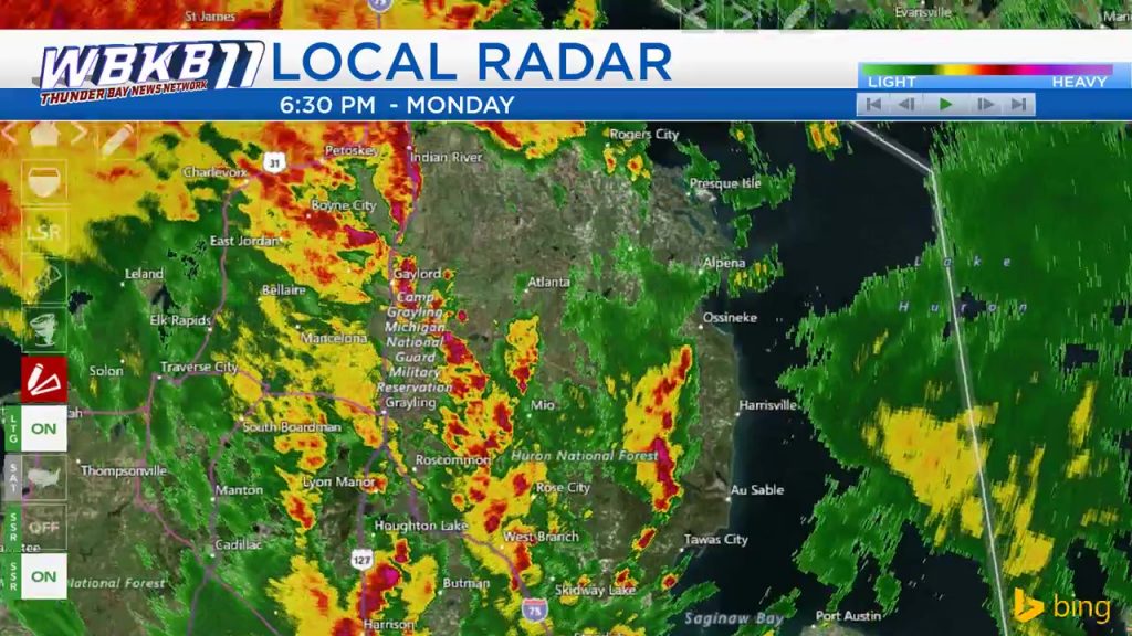
Pockets of heavy showers are moving from southwest to northeast across the area as a warmer and more unstable air mass arrives. These occasionally heavy showers will continue for much of this evening-overnight.
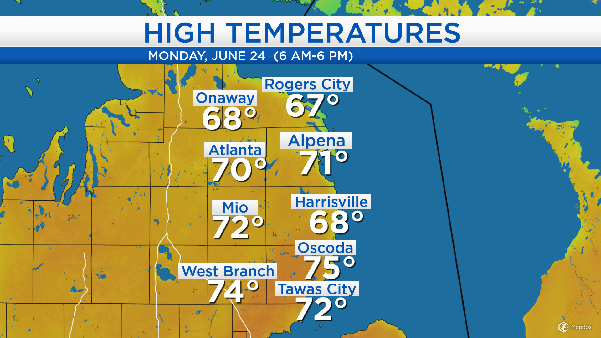
High temperatures today got close to 70 degrees, although temperatures south of Alpena reached the middle 70s. Warmer temperatures will move into our area over the next couple of days.
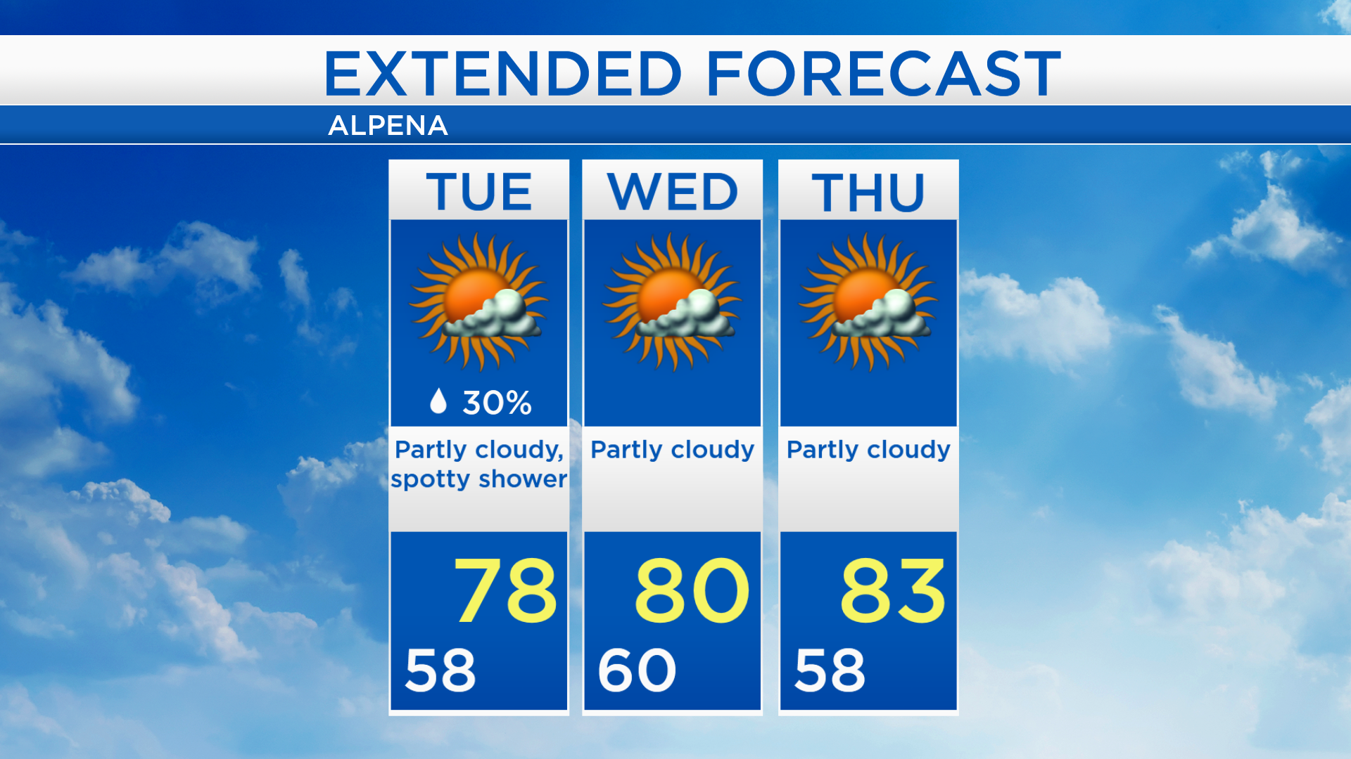
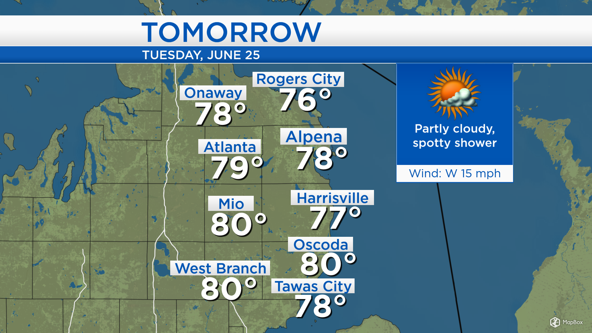
Unsettled weather extends across Minnesota, so we will see a chance of isolated showers tomorrow. Many dry periods are expected, but passing showers are possible at almost any time morning until evening. Drier air will move in on Wednesday.
Low temperatures tonight will remain mild, in the upper 50s. By the mid-morning, temperatures will reach the middle 60s with a slight chance of showers but otherwise mostly dry skies. High temperatures tomorrow afternoon will reach the upper 70s as a small chance of showers continues.
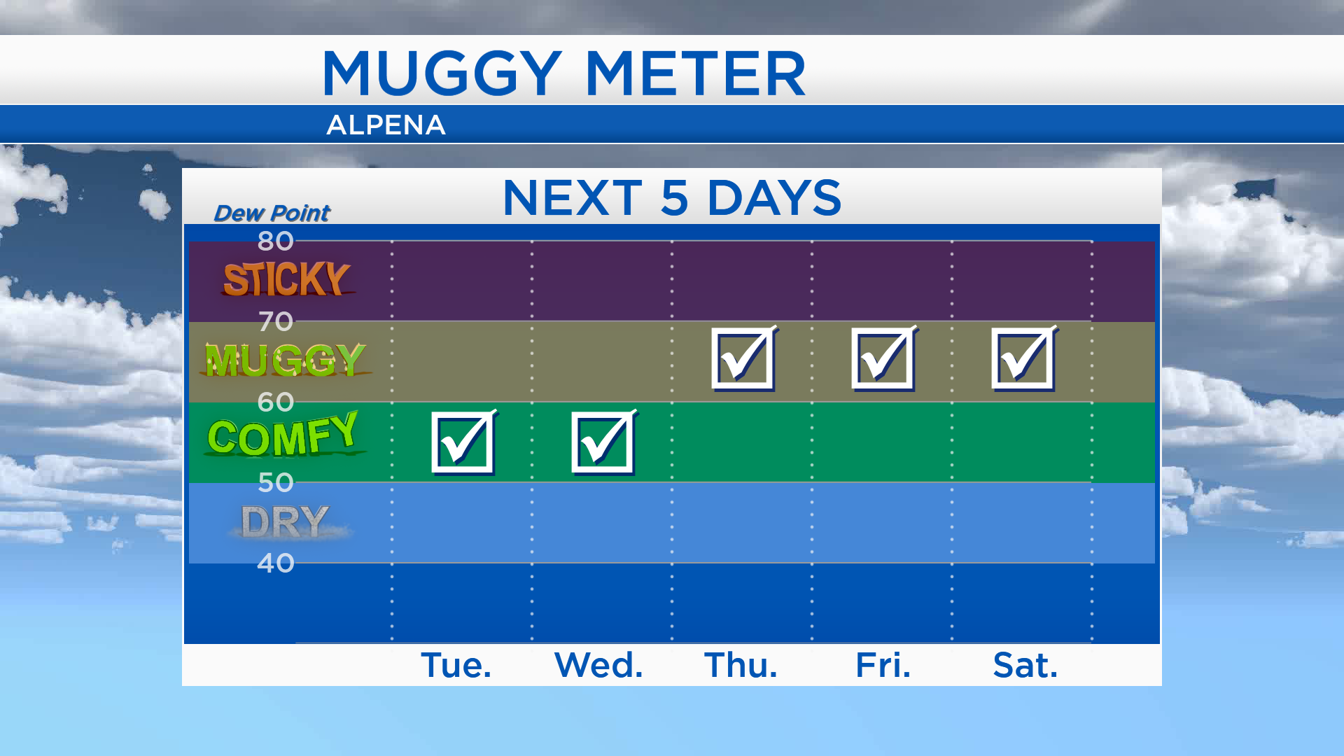
The muggy meter will climb later this week, as dew point values increase. The dew point is a measure of how humid the air mass is. Dew point values in the 50s indicate a comfortable air mass which is what we will have for Tuesday and Wednesday. It will feel muggy later this week, when dew point values climb into the 60s for Thursday, Friday and Saturday.
High temperatures will reach the upper 70s tomorrow, then near 80 degrees on Wednesday. Partly cloudy skies and dry days are expected Wednesday and Thursday. Winds out of the southwest combined with a generally warm air mass are ideal for producing warm temperatures which is what we will get on Thursday — when the high temperature is forecast to reach 83 degrees. A few showers are possible Friday with high temperatures close to 80 degrees. For the rest of Northeast Michigan’s weather forecast, watch the latest weather video by clicking the weather tab at the top of the page.