Michigan DNR adds interactive map for exploring shipwrecks
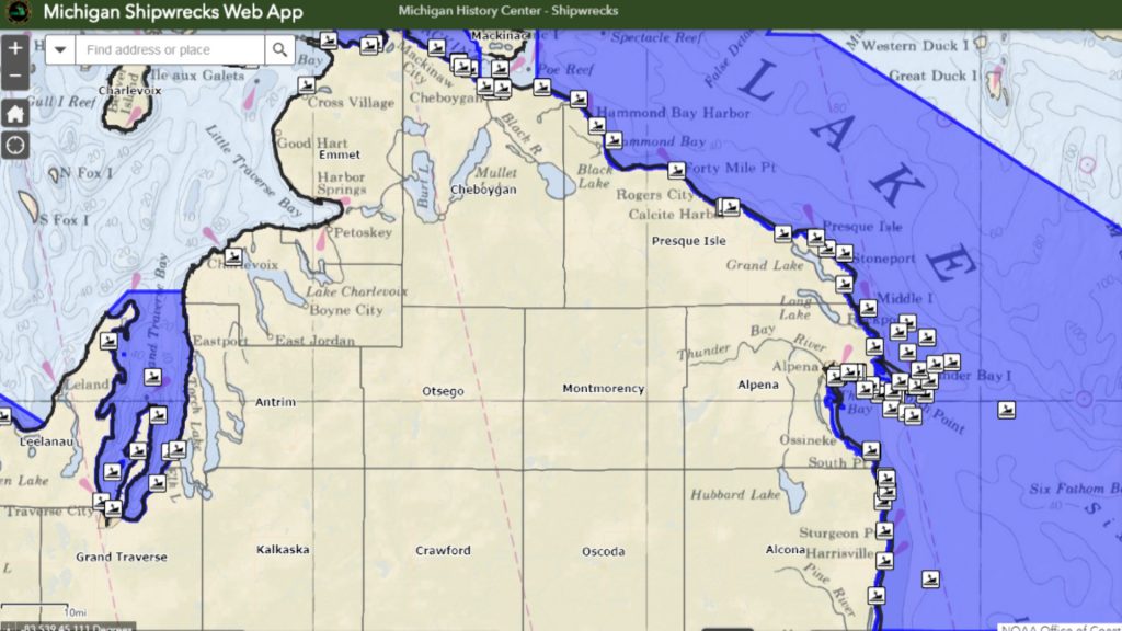
ALPENA, Mich. — With about 1,500 shipwrecks in Michigan waters, this new interactive map makes it simple to explore them. It offers information on each wreck including: the level of difficulty for diving to the wreck, whether or not you can canoe or kayak to it’s location, how it sank, and a description of the ship. For instance, the ship name “The Montana,” was just outside Thunder Bay when it caught fire and sank in September of 1914. It now lays 66 feet below the water.
When exploring the map, its easy to notice there are large number of shipwrecks in the Alpena area. Maritime Archaeologist, Phil Hartmeyer, explains why this particular location has so many. “Alpena is positioned, geographically, in a very unique place as it relates to commercial shipping,” he said. “As vessels in the commercial period, and still to this day, are going up to Lake Superior, over to Lake Michigan, they have to round the peninsula around Presque Isle and around Thunder Bay, so it was a real popular place.”
One ship, named “The Benjamin Franklin, sank all the way in 1850, and it’s easy to understand why ships like that had a harder time making their way through the water. “Back to a day without any radar, without any gps, you got the fog banks everywhere, storms,” said Hartmeyer. “There’s all kinds of reasons why even just being on the lake was dangerous, and populate that with thousands of schooners that were sailing the lakes, and steamers alike, it was a pretty easy spot for human error and certainly lots of collisions out there.”
To check out these shipwrecks in Alpena and the rest of the Great Lakes, you can find the new interactive map by searching for Michigan Shipwrecks Web App or by clicking here.