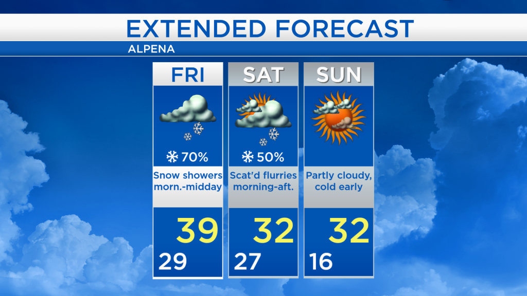
Light snow continues through tomorrow morning; Cooler this weekend with dry weather on Sunday

A low pressure system over Indiana is pushing snow into Northeast Michigan, and periods of snow will continue until midday Friday. A gap of dry weather currently over Wisconsin and Iowa will move into Northeast Michigan tomorrow afternoon. A separate, weaker system is bringing light snow showers to the Upper Peninsula an northern Minnesota, which will weaken as it enters our area on Saturday.
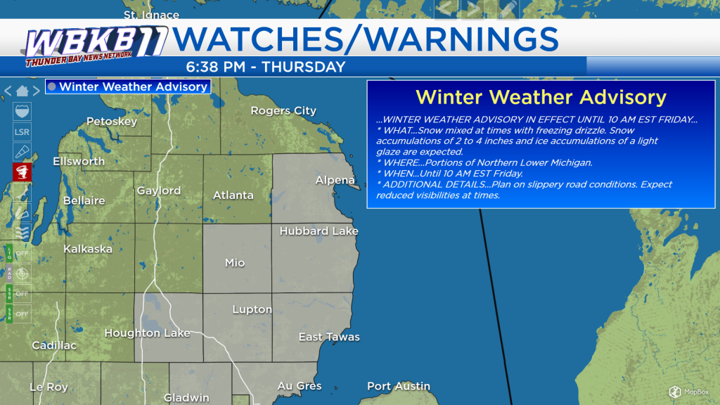
The National Weather Service has issued a Winter Weather Advisory for most of Northeast Michigan, including Alpena, Harrisville, Mio, Oscoda and Tawas — where 2 to 4 inches of snow are possible overnight through tomorrow morning.
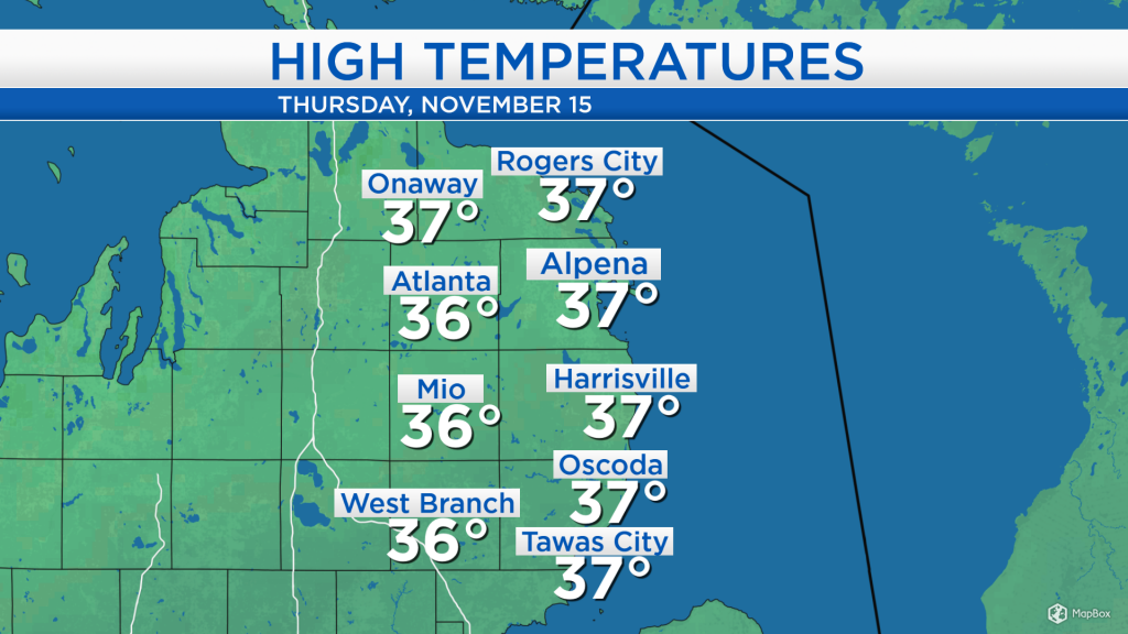
Today, high temperatures reached the middle and upper 30s as cloud cover increased during the afternoon combined with a light breeze out of the southeast at 5-10 mph. Similar temperatures are expected tomorrow, before cooler temperatures arrive this weekend.
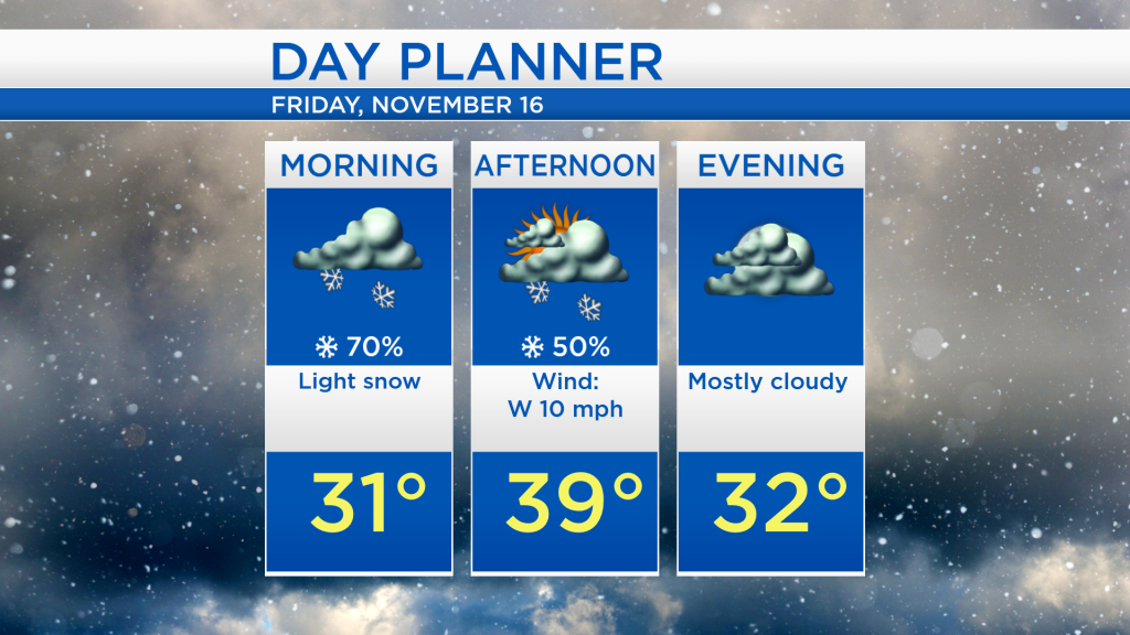
For tomorrow, the steadiest snow will fall in the morning, then the snowfall will then begin to taper in the afternoon. Morning temperatures will start around 30 degrees, then afternoon highs will reach the upper 30s as briefly drier weather begins to move in.
After periods of snow tomorrow morning, dry weather will last for several hours tomorrow evening. After that, a round of some light flurries is possible Saturday morning and afternoon with cooler temperatures, reaching the lower 30s in the afternoon. Dry weather is expected all day on Sunday with highs in the lower 30s, then temperatures are forecast to cool even further by Monday. For the rest of Northeast Michigan’s weather forecast, watch the latest weather video by clicking the weather tab at the top of the page.