It’s so cold — you’ll have to thaw your turkey
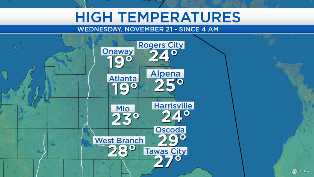
High temperatures today were reached in the predawn hours, and since then, temperatures have fallen into the teens. Winds out of the northwest about 15 mph have brought colder air into our area, after the cold front that passed through last night.
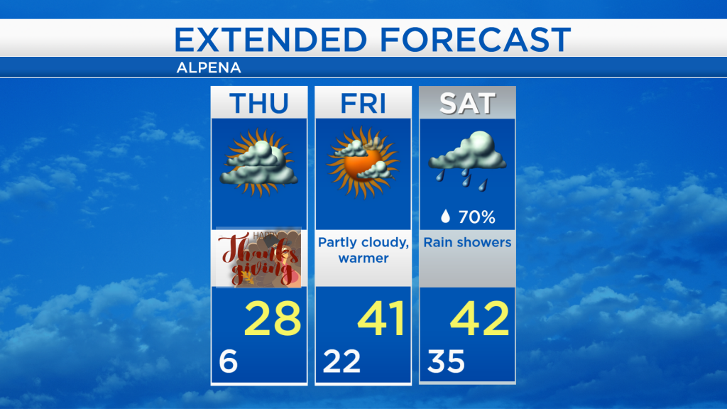
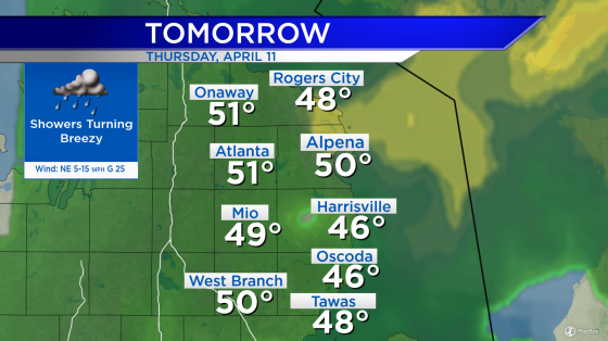
Until the weekend, no organized storm systems will travel through the Midwest. Mostly cloudy skies are expected tomorrow, then a partly cloudy skies on Friday. A weak boundary is producing some scattered areas of snow to our west, and any scattered precipitation is forecast to remain confined to our west and southwest, staying out of Northeast Michigan.
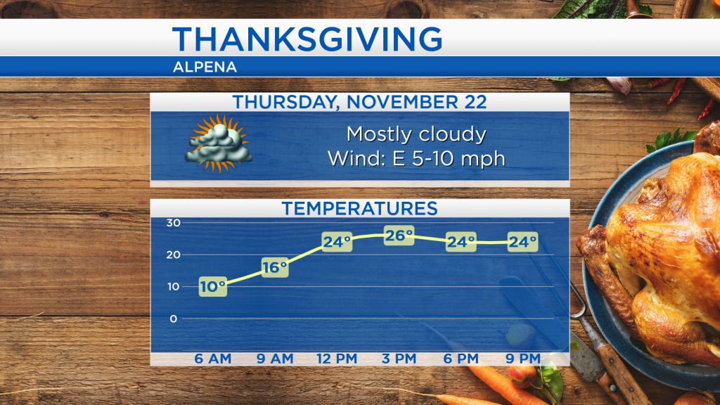
Overnight, low temperatures will drop to around 6 degrees, then slowly rise tomorrow morning. For Thanksgiving day, early-morning temperatures close to 10 degrees are expected, then highs will reach the upper 20s in the afternoon. The temperature drop-off tomorrow evening will not be as sharp, as low temperatures settle in the lower 20s predawn Friday.
The next two days are forecast to remain dry. Then, a storm system brewing in the southwestern states will move toward the Great Lakes region, spreading rain into our area on Saturday. Saturday will be the wettest day of the weekend, and warmer temperatures starting on Friday will continue through the end of the weekend.
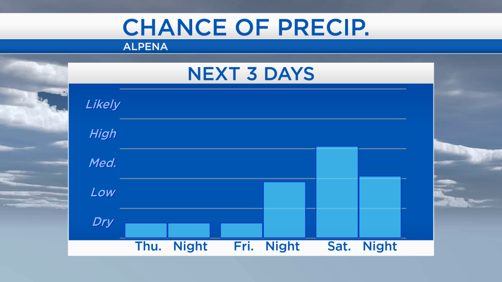
Cold temperatures will last one more day, as highs reach the upper 20s on Thanksgiving. Warmer air will arrive Friday as afternoon temperatures warm into the lower 40s. Saturday will become wetter with rain showers and highs in the lower 40s. Most of Sunday should remain dry up until the evening, then a wintry mix of snow combined with rain may affect our area Sunday evening through Monday midday. For the rest of Northeast Michigan’s weather forecast, watch the latest weather video by clicking the weather tab at the top of the page.