Dry weather tonight; Cold front brings snow showers late Thursday then much colder Friday
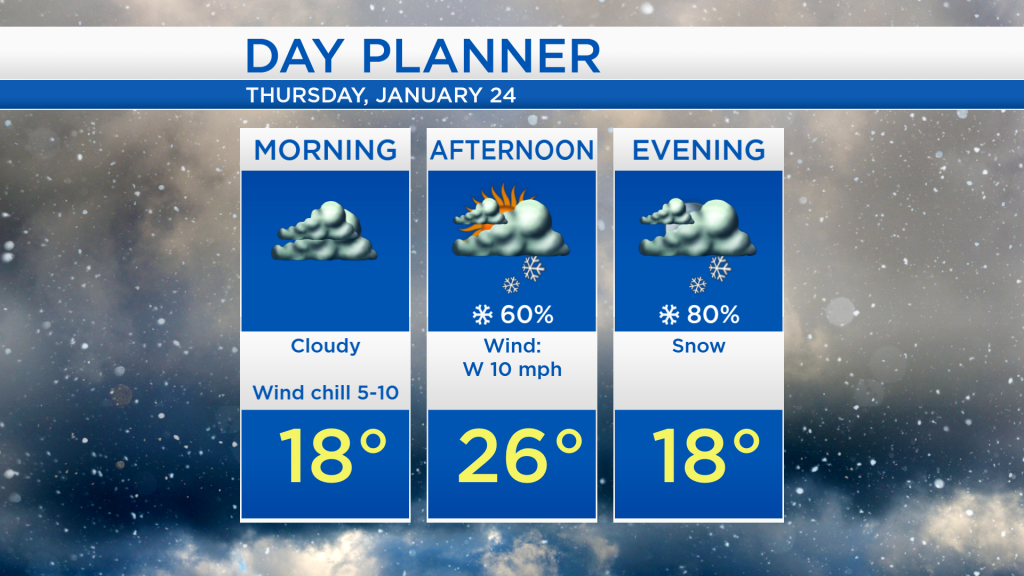
The steady snow that accumulated during the morning and afternoon is finally leaving to the northeast of our area. We will see dry weather moving in from Wisconsin tonight through tomorrow morning. After that, some snow showers just north of the Canadian border will drop into our area beginning tomorrow afternoon.
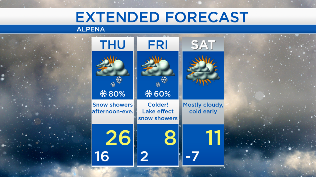
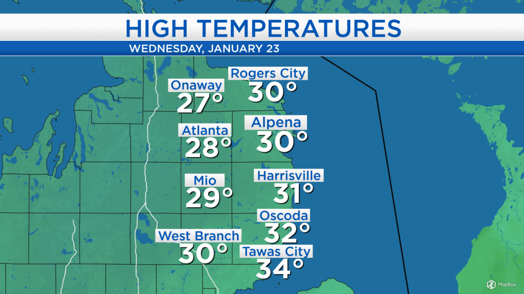
High temperatures today reached about 30 degrees. Seasonable air will continue tomorrow as highs reach the mid-20s. Colder air out of central Canada will expand southward into the Midwest for Friday and the weekend.
Overnight lows will drop to about 16 degrees under mostly cloudy skies and winds out of the northwest at 10 mph. Tomorrow will start with dry weather in the morning, then snow showers will move in during the afternoon and evening. 1-3 inches of snow are expected Thursday afternoon-Thursday night, with the upper end of that range (2-3 inches) possible in Presque Isle in Montmorency counties, and likely up to 2-inch amounts elsewhere.
Snow showers will move into our area late-day tomorrow as a cold front travels from the Upper Plains through Michigan, and highs will reach around 26 degrees tomorrow. Much colder air will arrive Friday with temperatures reaching only 8 degrees in the afternoon. On Friday, some lake effect snow showers off of Lake Michigan could reach our area, but periods of dry weather are also expected. Bitter cold air will arrive Friday night-early Saturday with low temperatures well below 0 degrees. For the rest of Northeast Michigan’s weather forecast, watch the latest weather video by clicking the weather tab at the top of the page.