Dry weather moving in; Cooler Wednesday
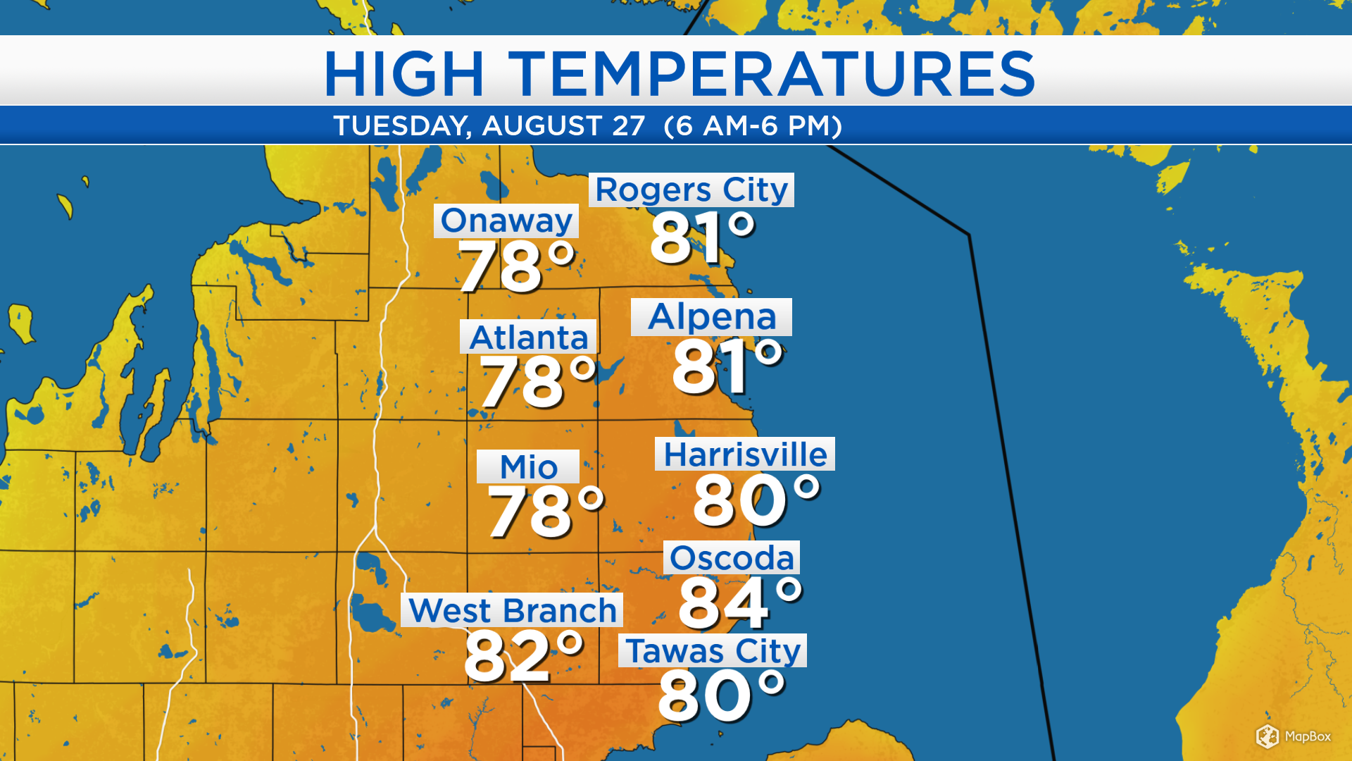
High temperatures today warmed to the lower 80s near the Lake Huron shoreline. Winds from the southwest about 15 mph and gusting to 25 mph helped bring warmer temperatures, combined with plenty of afternoon sunshine.
Unsettled, showery weather in Minnesota and North Dakota will likely stay to our north, although it may bring some extra cloud cover tomorrow afternoon. Temperatures will get cooler tomorrow, and rebound on Thursday. The forecast through the next few days is looking mostly dry … with one minor exception Thursday night.
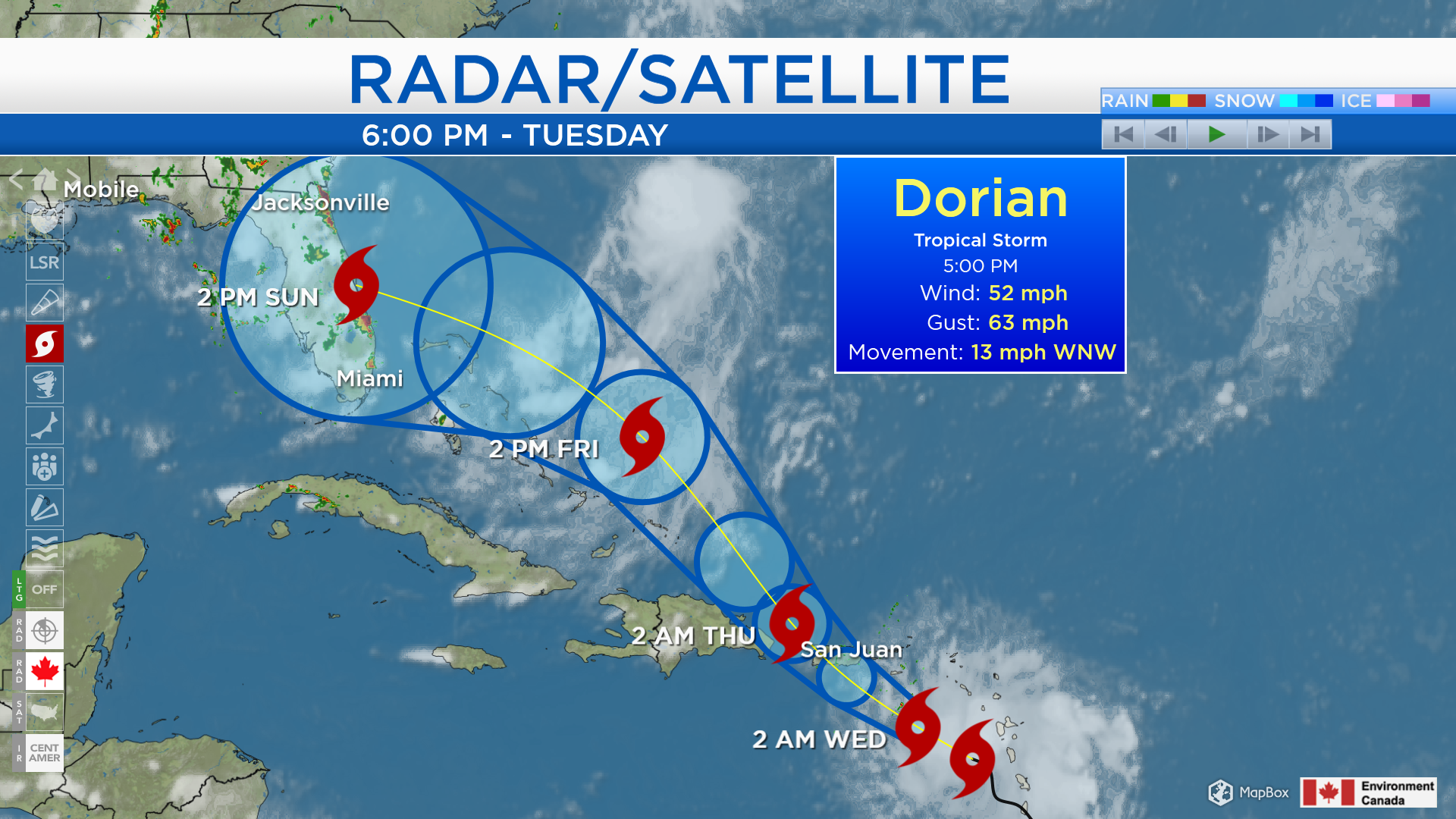
Tropical Storm Dorian continues to travel toward the northwest, currently located near the Windward Islands. Its sustained winds are slightly more than 50 mph, a little weaker than yesterday. The official forecast from the National Hurricane Center no longer brings it up to hurricane strength later this week, Dorian will most likely remain a tropical storm, although briefly attaining category 1 hurricane strength is possible. (A tropical storm has wind speeds of 39-73 mph while a category 1 hurricane has winds speeds of 74-95 mph.) The forecast cone represents possibilities for the center of the center of the storm, although impacts from rain, wind and high waves may extend outward from its center. Dorian is forecast to travel near Puerto Rico and the Dominican Republic Wednesday-Thursday, then make landfall somewhere in Florida on Sunday.
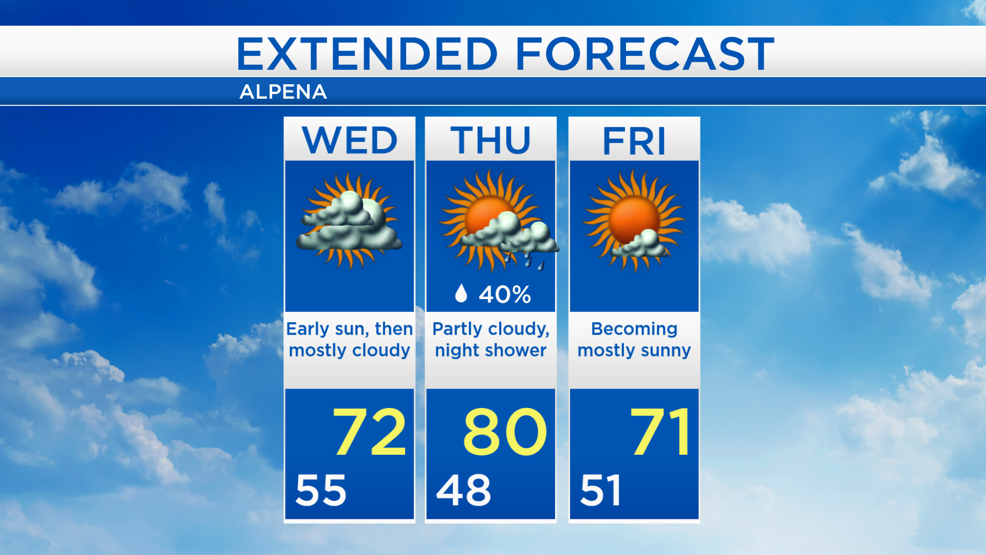
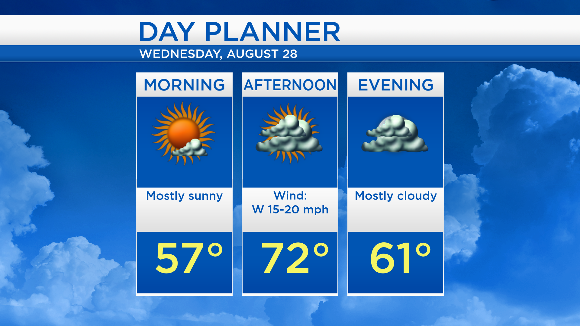
Closer to home, mostly clear skies will last through tonight and tomorrow morning, and low temperatures will fall close to 55 degrees. More cloud cover will likely move in tomorrow afternoon and high temperatures will reach about 72 degrees. Winds from the west will be noticeably brisk at 15-20 mph.
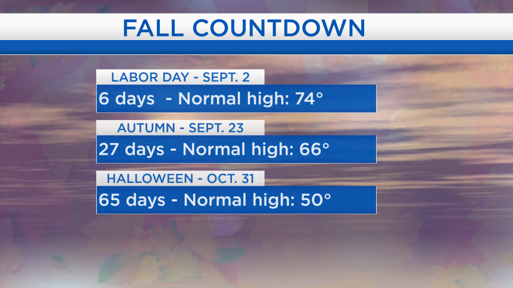
Looking ahead, normal high temperatures in late-August reach the middle 70s. Labor Day is six days from now and the normal high temperature then is 74 degrees. Autumn starts in 27 days, by which time normal high temperatures fall to the middle 60s. As temperatures continue to cool throughout the fall, the normal high on Halloween is 50 degrees.

Skies will become mostly cloudy tomorrow with high temperatures in the lower 70s. Partly cloudy skies are expected Thursday while more sunshine and southwest winds will help bump up temperatures to the 80 degree mark. High temperatures will cool again to the lower 70s on Friday with mostly sunny skies and a breeze from the northwest. Dry weather is forecast to last into Labor Day weekend. For the rest of Northeast Michigan’s weather forecast, watch the latest weather video by clicking the weather tab at the top of the page.