Dry most of the long weekend; Warmer Labor Day
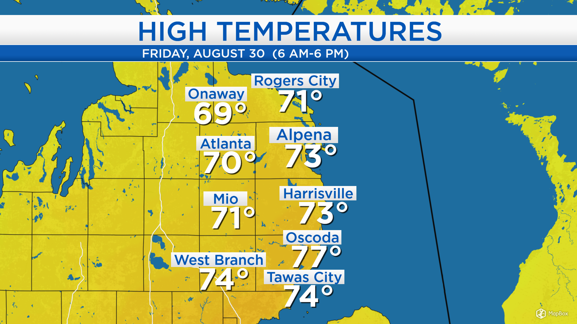
High temperatures today reached the middle 70s near the Lake Huron shoreline and lower 70s farther west. High pressure over the Upper Plains is bringing plenty of blue sky to our area today but winds from the northwest have helped supply cooler temperatures.
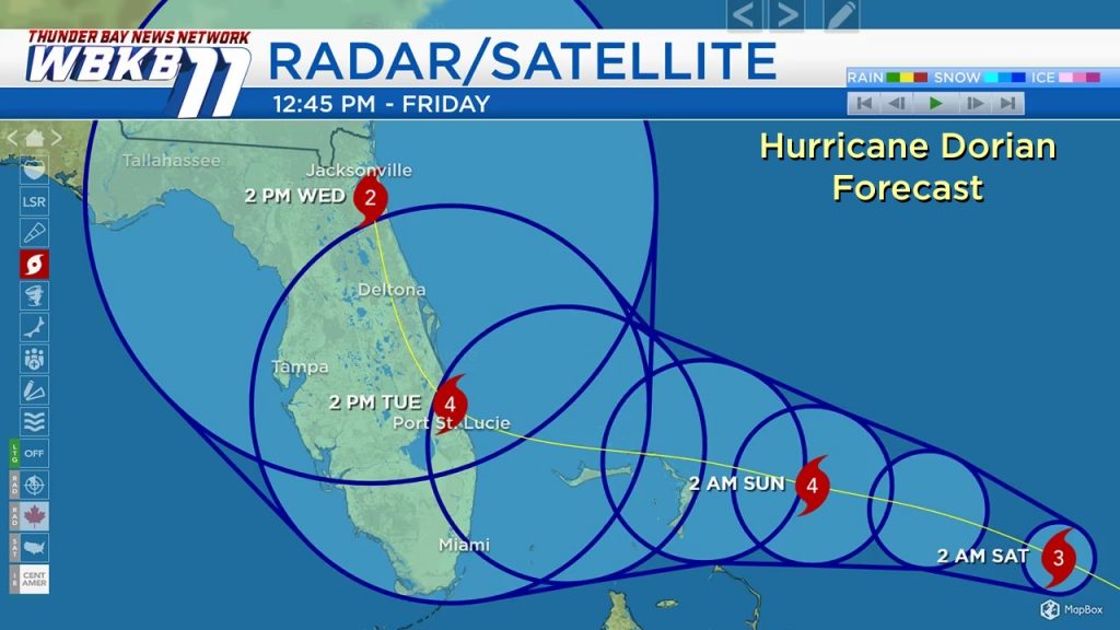
A few clusters of showers/thunderstorms scattered across the Plains will remain to our south. The big story nationally remains Hurricane Dorian. Today, Dorian strengthened to category 3, producing winds at 115 mph in the strongest part of the storm. It will be heading west toward the Atlantic Coast of Florida. Dorian is expected to strengthen further, reaching category 4 status tomorrow. The forecast is now looking slower, anticipating landfall early Tuesday on the Florida coast. This will bring winds over 110 mph in the strongest part of the hurricane to the Florida coast, rainfall over 6 inches in some cases, and very high storm surge.
Overnight low temperatures will cool to the lower and middle 40s with mostly clear skies. Cloud cover will increase slightly in the afternoon and high temperatures will reach about 72 degrees. Temperatures will cool into the lower 60s tomorrow evening with partly cloudy skies.
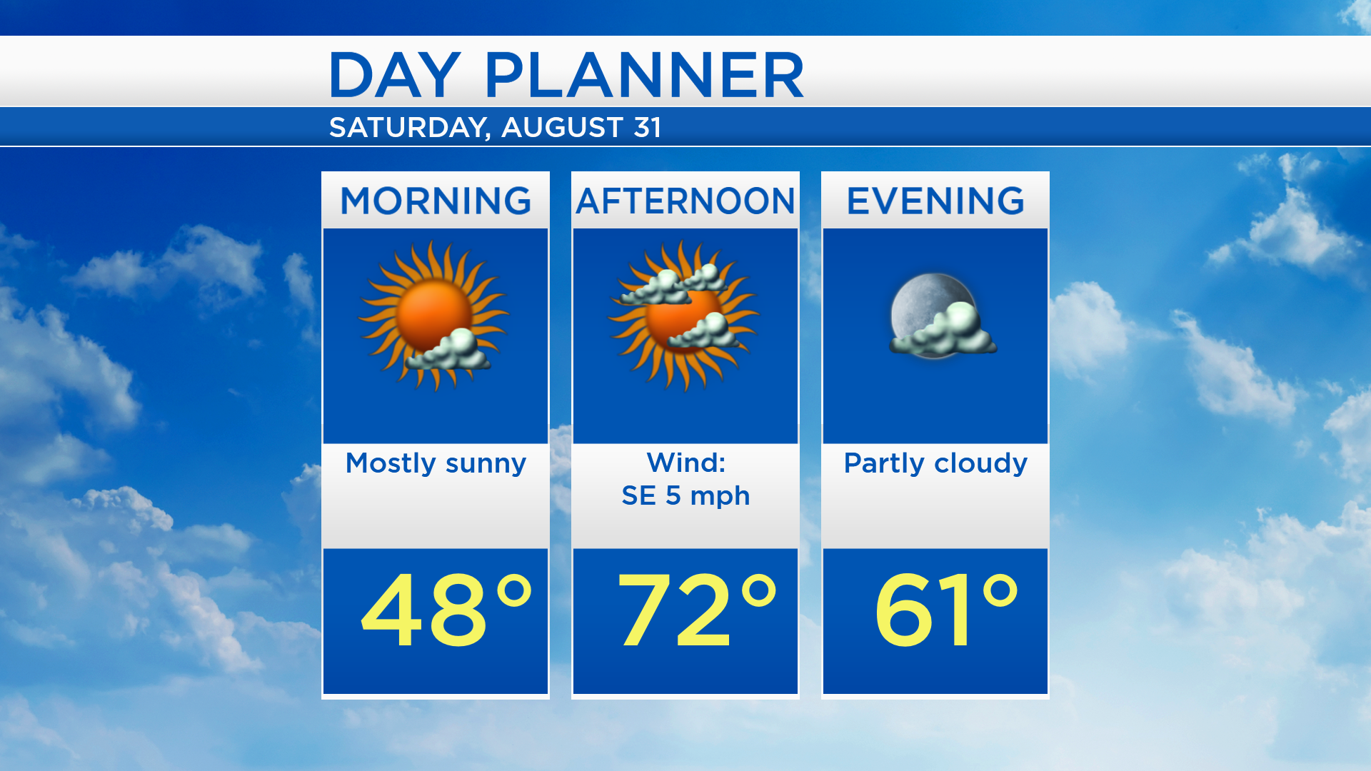
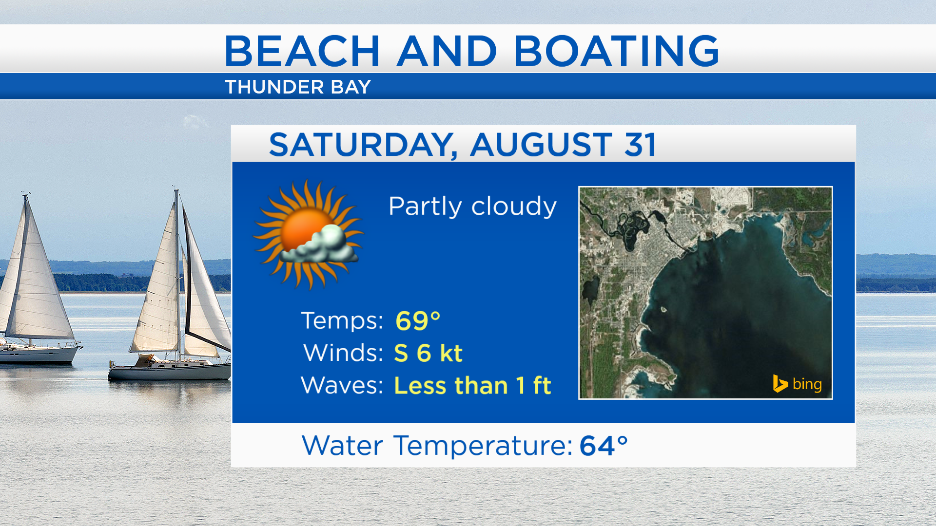
For any activities at the lakefront, partly cloudy skies are expected. High temperatures will reach the upper 60s at the shoreline. Winds will calm to about 6 knots tomorrow, and waves will settle down to less than 1 foot.
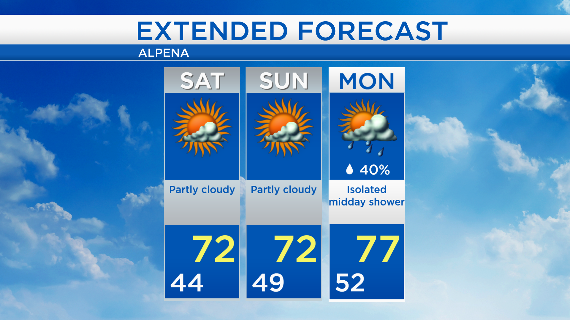
Some extra cloud cover is possible tomorrow afternoon and high temperatures will get to the lower 70s. High temperatures will also reach the lower 70s on Sunday with partly cloudy skies. Isolated showers are possible midday Labor Day, but most of Monday should remain dry. A more substantial chance of rain will arrive Tuesday. For the rest of Northeast Michigan’s weather forecast, watch the latest weather video by clicking the weather tab at the top of the page.