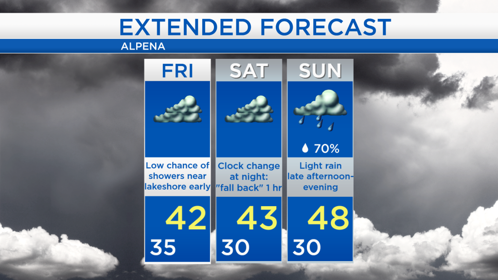
Colder temperatures lasting through Saturday; Wet Sunday-Monday
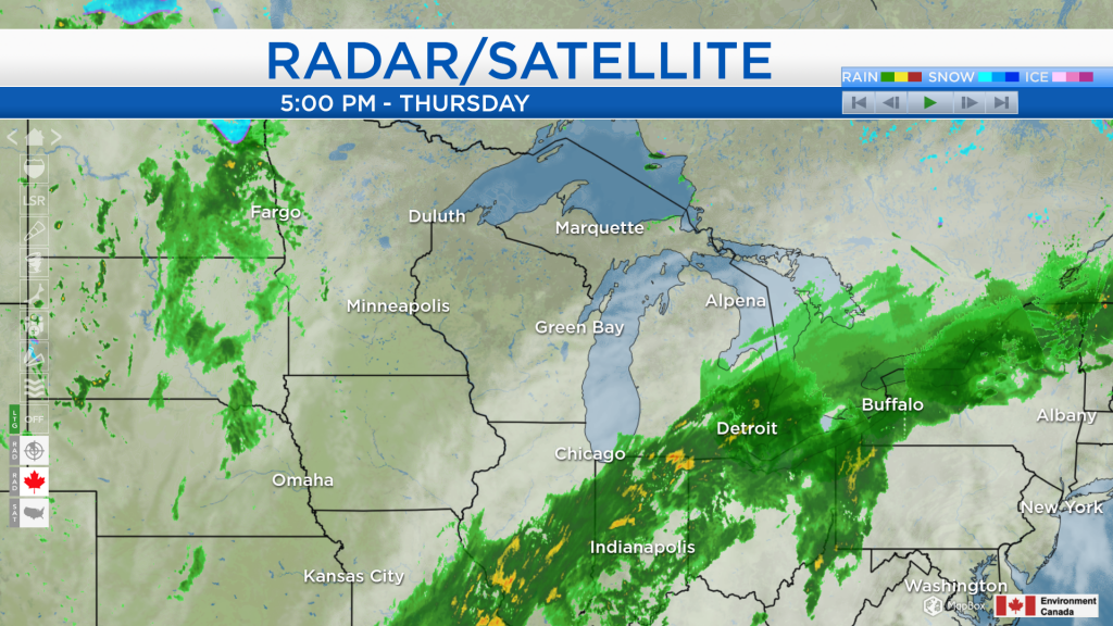
A storm system located in the Ohio Valley is bringing a blanket of cloud cover to northern Michigan, and steady rain to southeastern areas of the state. This system will narrowly miss our area as it moves into the Northeast U.S. Cloudy skies will persist over our area for the next few days.
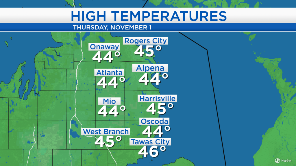
High temperatures today reached the middle 40s under overcast skies and light winds out of the north about 5-10 mph. Similar high temperatures are expected tomorrow.
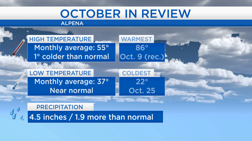
Looking at a review of the temperatures throughout October, it was the first month since April that we have seen temperatures colder than normal. The average of all the daily high temperatures was 46 degrees, six degrees colder than normal. The average of all the low temperatures throughout the month was near normal. On October 9, a daily record high of 86 degrees was set. The month also saw rainfall totals close to 2 inches more than normal.
Overnight, low temperatures will drop to the mid-30s. In the morning, there is a small chance of a patchy shower for locations close to the shoreline in southern Alcona and Iosco counties. Cloudy skies are expected all day tomorrow with highs reaching only the lower 40s.
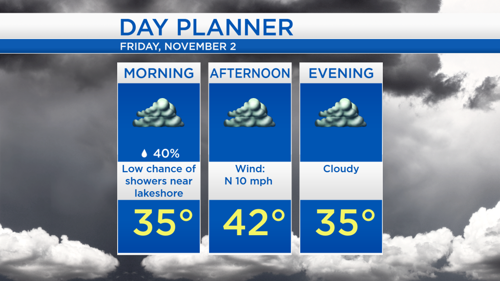
Gray weather will continue tomorrow with afternoon temperatures around 42 degrees. Similar daytime highs are expected on Saturday, and late Saturday night remember to set your clocks back 1 hour as Daylight Saving Time comes to an end. Periods of light rain will become likely Sunday, especially late in the day. Showers will continue into Monday, at least milder temperatures will enter Northeast Michigan. For the rest of Northeast Michigan’s weather forecast, watch the latest weather video by clicking the weather tab at the top of the page.