Cold, snow and gusty winds as the calendar turns to December
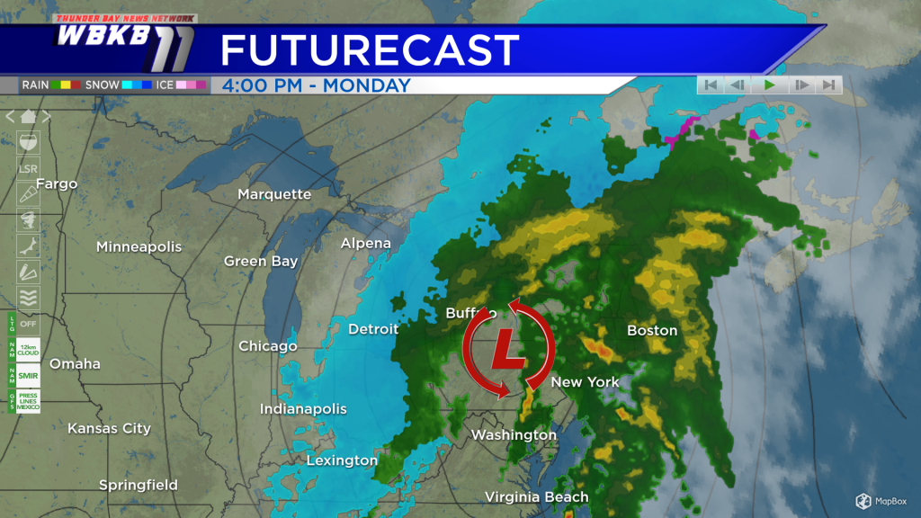
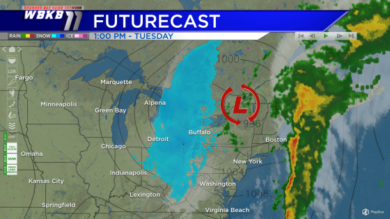
A big pattern change is on the way, leading to more winter-like conditions in Northeast Michigan. Much colder temperatures, stronger winds and chances of snow are all in the forecast for Monday and Tuesday. A storm system moving northward from the Gulf Coast will affect most of the eastern U.S., including parts of the Great Lakes region.

Northeast Michigan will be on the back edge of this storm system. Monday, a few snow showers could result in some light amounts.
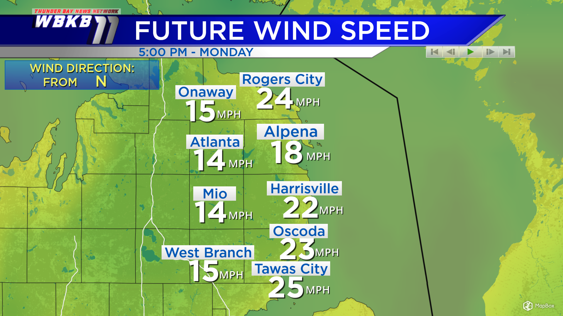
Strong, gusty winds from the north will bring much colder air into our area Monday. Highs will be in the lower to middle 30s Monday afternoon, but wind chills will be in the lower 20s, so it will feel much colder.
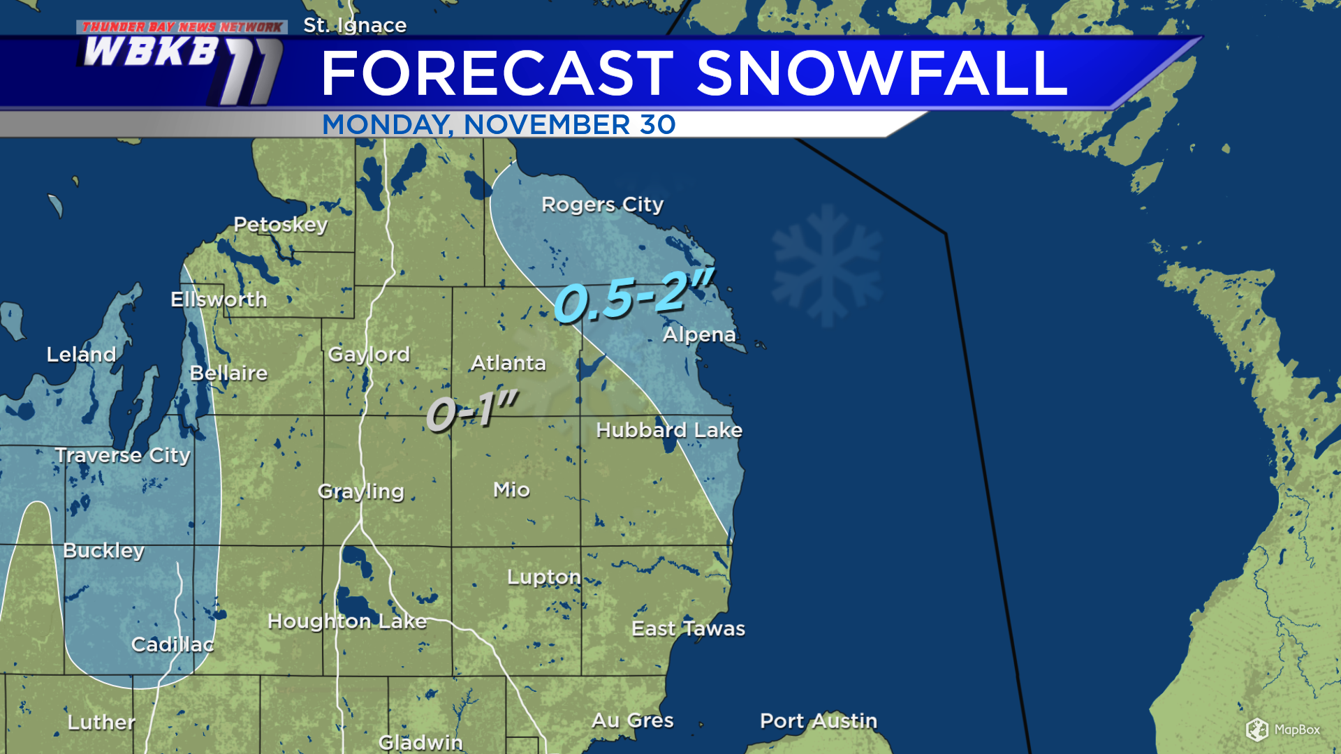
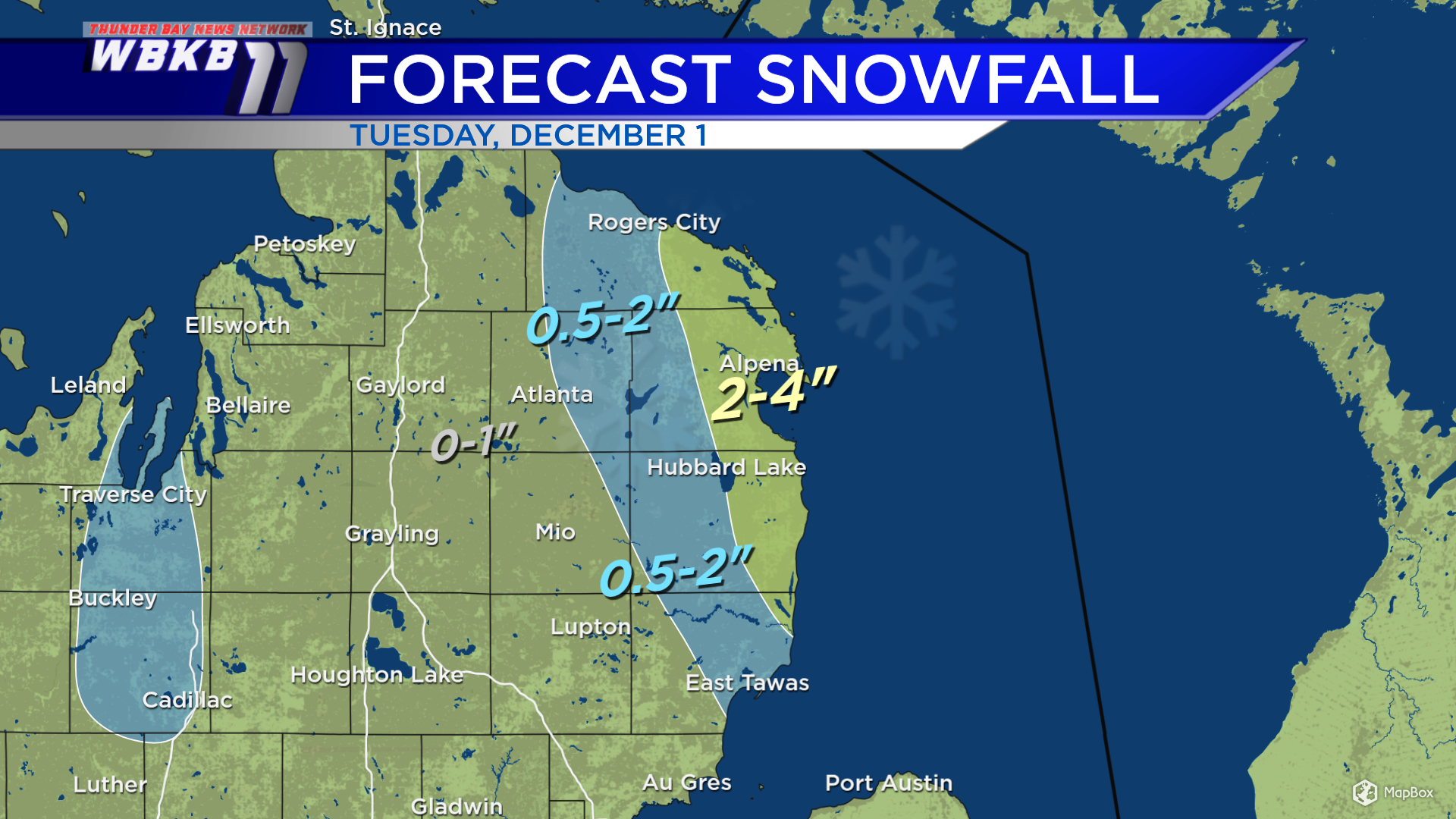
Tuesday, a disturbance attached to this large storm system will move into Northern Michigan. The steadiest snow will fall in the late-morning through afternoon.
This disturbance plus some enhancement off Lake Huron results in higher forecast snowfall — most notably for eastern Presque Isle County, eastern Alpena County and eastern Alcona County. Impacts to road conditions will be greatest for the areas shaded in yellow, where the most snow is forecast.
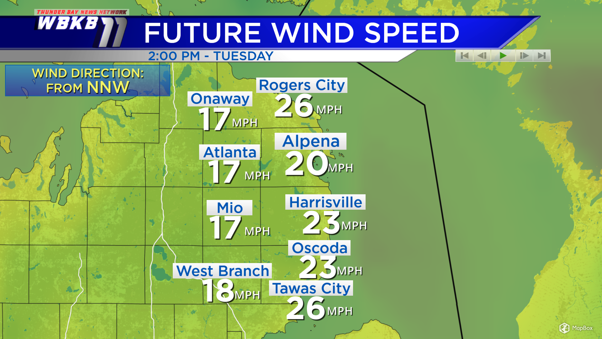
Winds will remain blustery Tuesday, from the NNW. Tuesday will feel pretty similar with highs in the lower to middle 30s and afternoon wind chills in the 20s.