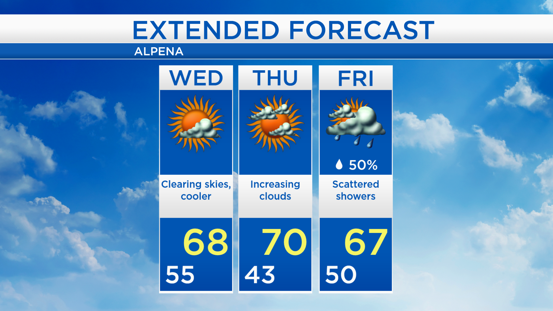
Clearing skies Wednesday; Chilly start early Thursday
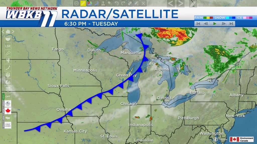
A cold front moving through our area brought pouring rain this morning and midday. Scattered showers and thunderstorms periodically moved through our area this afternoon. Cloudy skies will persist tonight, then clearing skies from the west will spread into our area tomorrow.
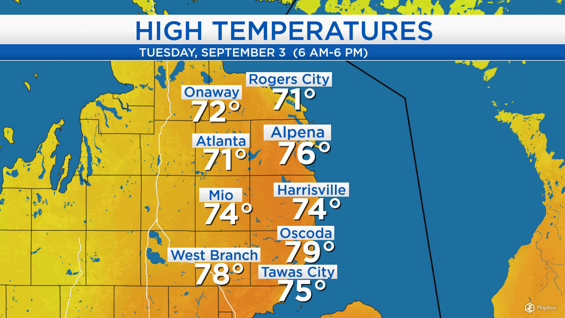
Before the cold front moves through, winds from the south have brought high temperatures in the middle 70s to most of Northeast Michigan. After the cold front passes to our east, temperatures will get cooler tomorrow with a breeze from the northwest.
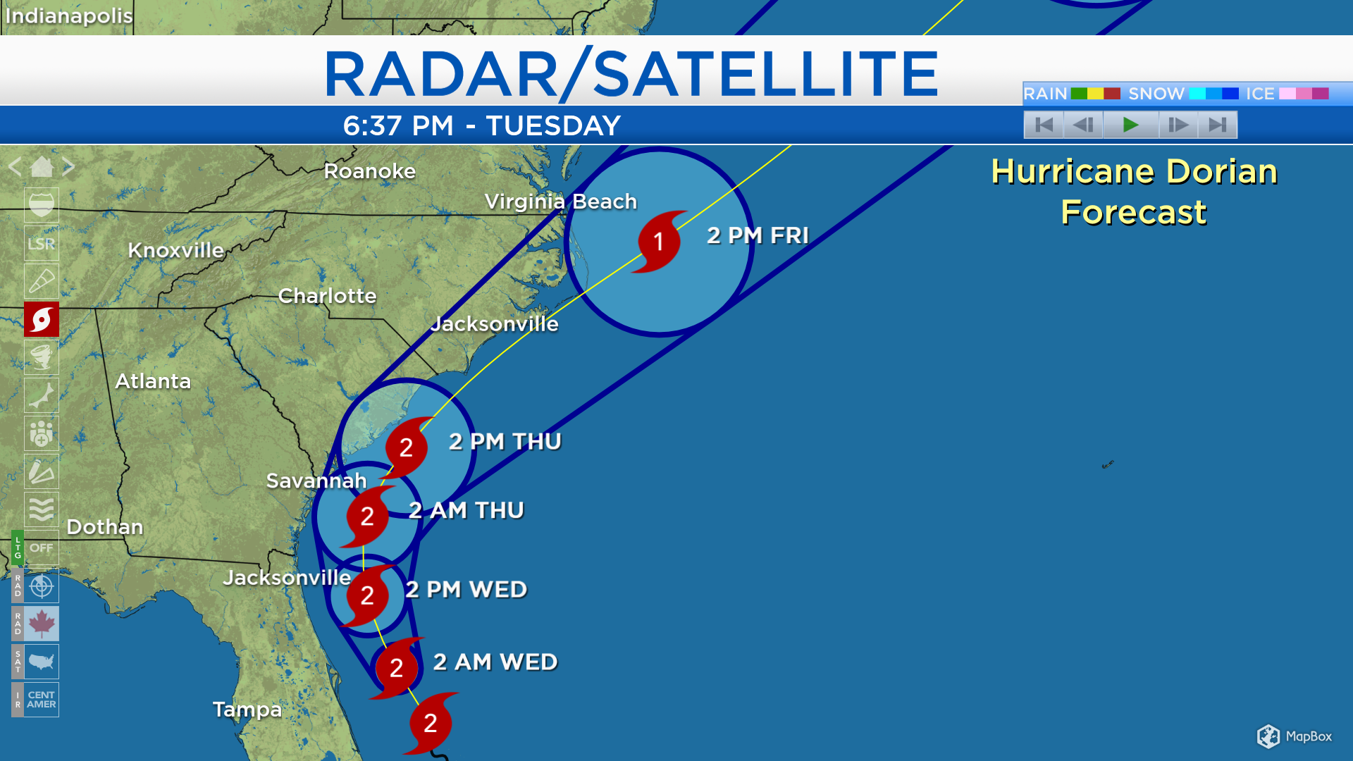
Hurricane Dorian has weakened to a category 2 storm. It is producing wind speeds about 110 mph, bringing heavy rain and hurricane force gusts to coastal Florida. Storm surge will continue to be an issue, water 4-7 feet high off the Atlantic will inundate the coastline on the northern side of the hurricane. Hurricane Warnings (light purple) extend from the Florida coastline to the South Carolina coast. Tropical Storm Warnings (light blue) include northeastern Florida, coastal Georgia, and eastern South Carolina. Hurricane Watches (dark purple) include coastal South Carolina and eastern North Carolina. Tropical Storm Watches (dark blue) extend from eastern South Carolina to coastal Virginia.
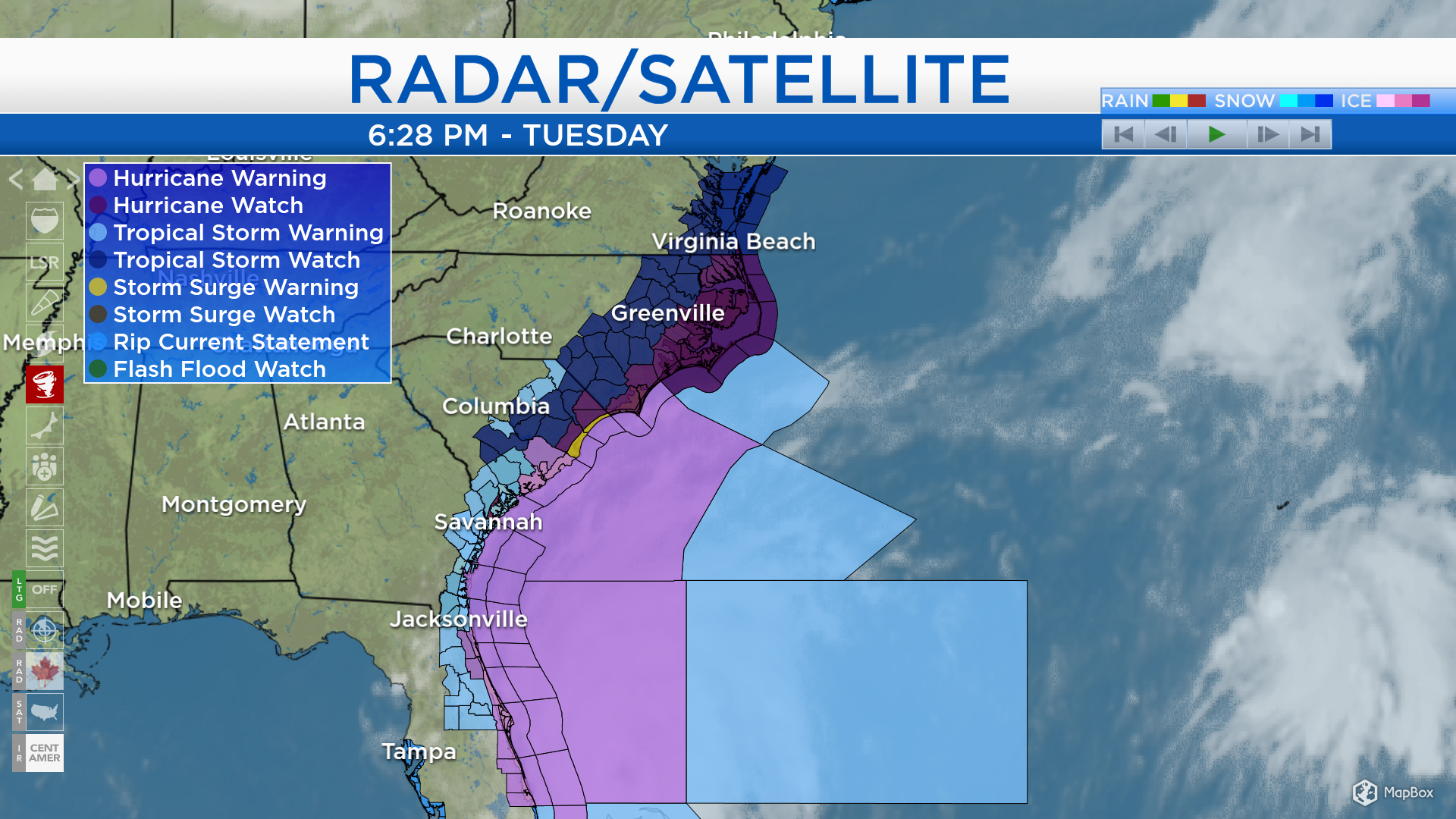
Hurricane Dorian will slowly move northward, then curve to the northeast. It is expected to remain at category 2 strength until Thursday. It will move northward, still off the coast of Florida tomorrow. By Thursday afternoon/evening, it will travel very near the coast of South Carolina. Early Friday, the potential for landfall over coastal North Carolina will have to be monitored.
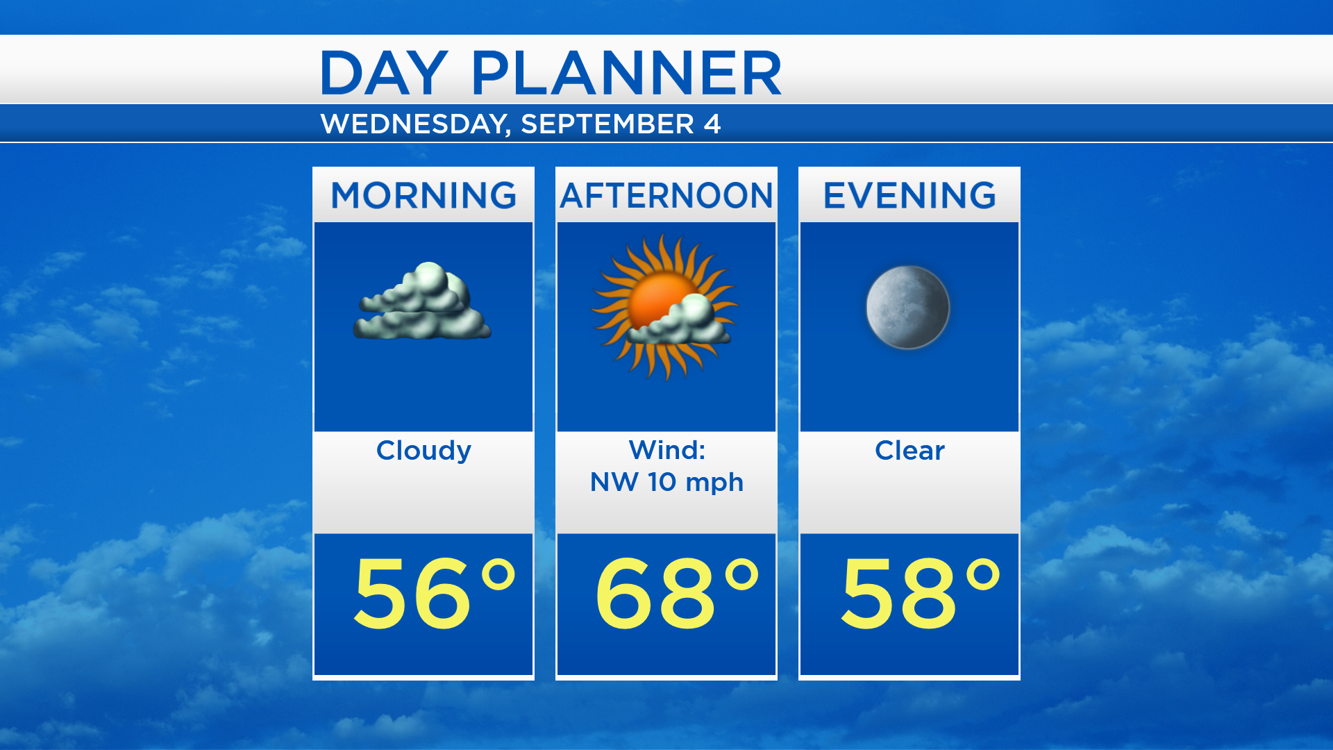
Low temperatures tonight will cool to the middle 50s with cloudy skies. Tomorrow will start cloudy, then increasing sunshine is expected. High temperatures will reach near 68 degrees, provided by a cool breeze from the northwest. Skies will become clear late tomorrow skies with evening temperatures in the upper 50s.
Clearing skies will take place tomorrow with cool temperatures, getting only to the upper 60s. Low temperatures early Thursday will start in the lower 40s. More cloud cover will build into our area, and high temperatures will get close to 70 degrees. Scattered showers are possible Friday with highs in the upper 60s. For the rest of Northeast Michigan’s weather forecast, watch the latest weather video by clicking the weather tab at the top of the page.