Calm Wednesday; Chance of snow showers late Thursday
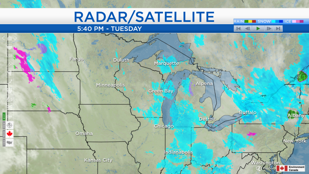
Across Northeast Michigan, we have seen overcast skies with a breeze out of the northwest. That breeze is bringing lake effect snow mainly to areas west of I-75. Dry weather over Minnesota and Iowa will shift into our area tomorrow. After that, some snow currently affecting North Dakota and South Dakota will bring a chance of some snow showers to Northern Michigan late Thursday.
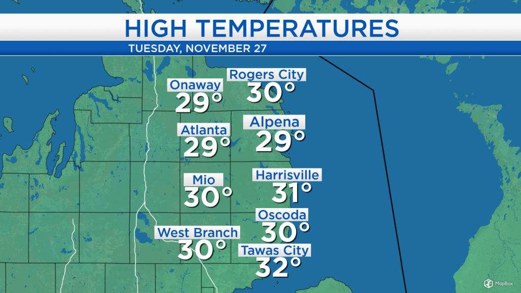
High temperatures today reached close to 30 degrees across Northeast Michigan. Slightly warmer temperatures and lighter winds are expected tomorrow, and the warming trend will continue through the end of this week.
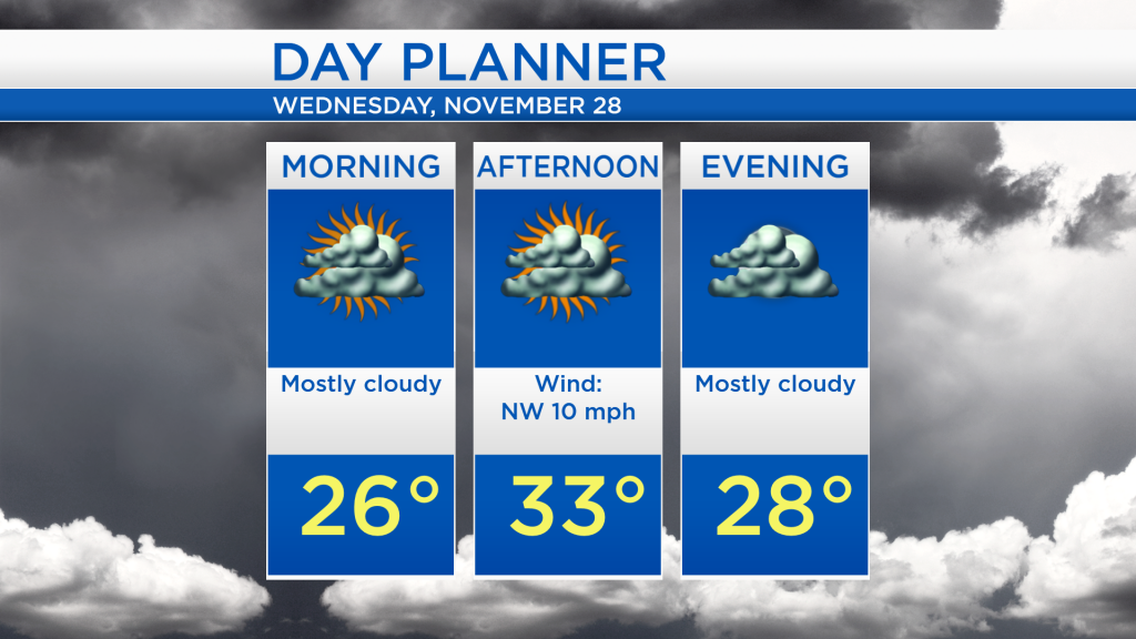
Overnight lows will drop to the mid-20s with mostly cloudy skies. Generally dry weather is expected throughout Wednesday as afternoon highs reach around 33 degrees. Wind speeds will weaken to about 10 mph out of the northwest tomorrow.
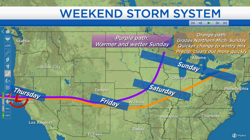
Looking ahead to the weekend, a storm system over the Pacific Ocean heading to the U.S. bears watching. The two most likely scenarios are illustrated below, shown by the purple and orange paths. The two scenarios are in good agreement through Friday: The storm system will remain offshore of northern California tomorrow, then enter California on Thursday somewhere in the vicinity of San Francisco. From that point, it will head east, ending up in southern Colorado on Friday. After that, it may veer farther north ending up in southern Iowa on Saturday, or continue on a more southern path ending up in eastern Missouri on Saturday. The possible paths continue to diverge going into Sunday, possibly ending up anywhere between southeastern Minnesota and Lake Erie. A chance of rain showers will arrive Saturday evening in Northeast Michigan, then the scenario for Sunday would depend on the path of the storm system. The purple (northern) path would bring warmer and wetter conditions, lasting later into Sunday. The orange (southern) path would bring precipitation that only grazes Northern Michigan with a quicker changeover from rain to a wintry mix and quicker clearing on Sunday.
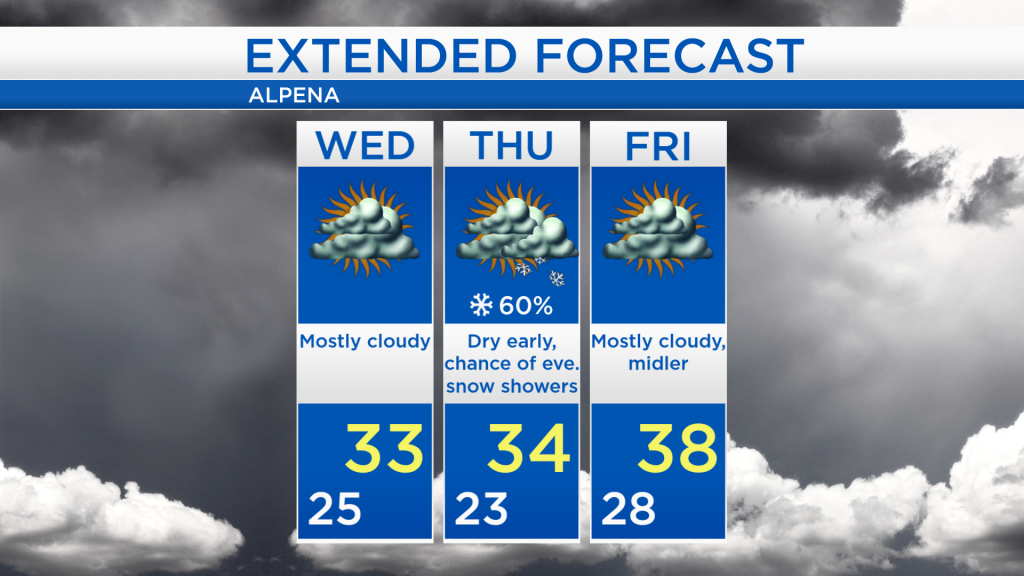
In the meantime, for Wednesday, calm and mostly cloudy weather is expected with highs in the lower 30s. Thursday will start dry, highs are forecast to reach the mid-30s, then a chance of snow showers will arrive in the evening. For Friday, highs will warm to the upper 30s with a return to mostly cloudy skies and dry weather. For the rest of Northeast Michigan’s weather forecast, watch the latest weather video by clicking the weather tab at the top of the page.