Wintry mix possible late Sunday; Milder temperatures early next week
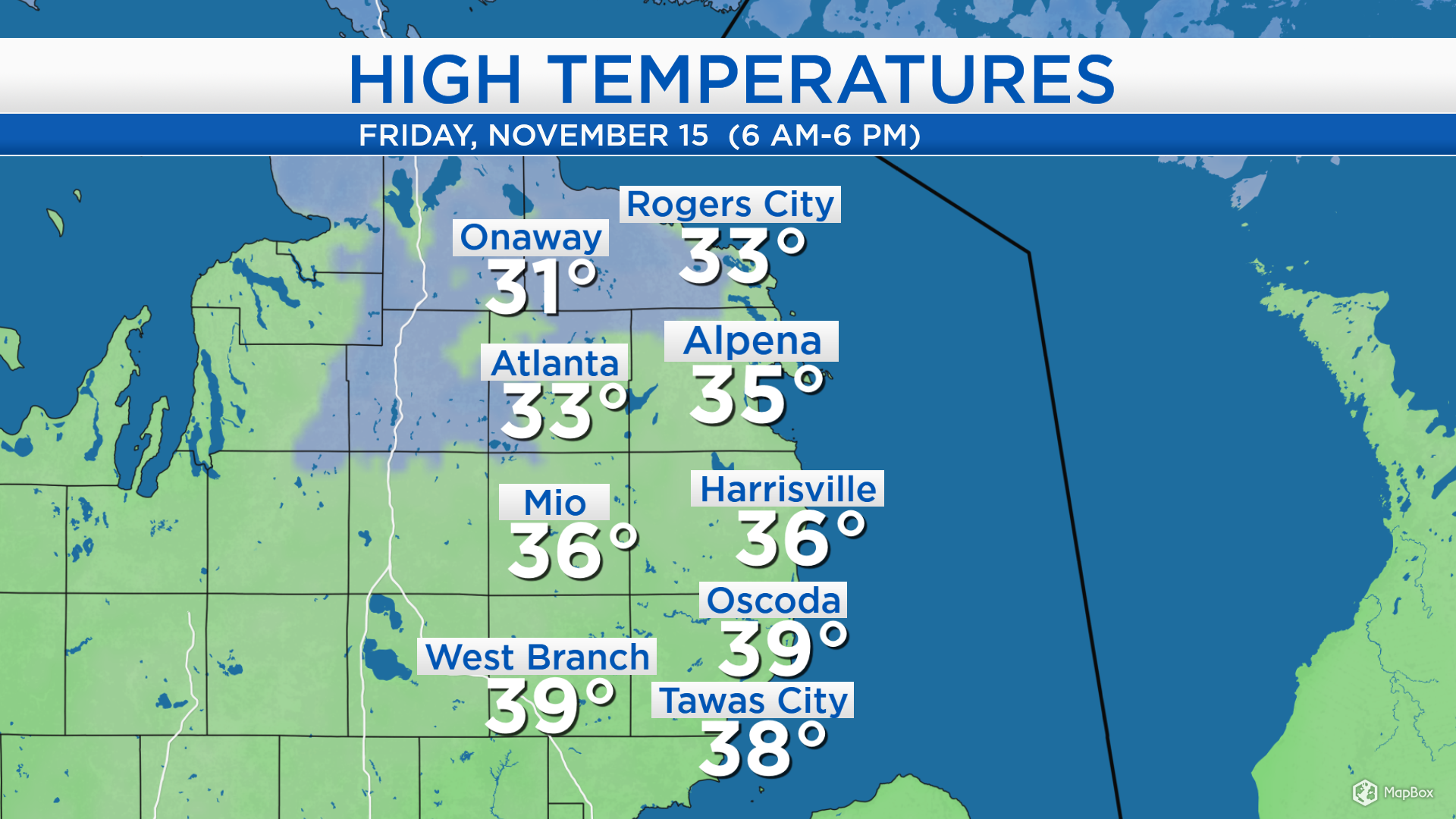
High temperatures today reached the middle 30s for most of Northeast Michigan, although temperatures got into the upper 30s in Ogemaw and Iosco counties. A breeze from the north at 15-20 mph gave a noticeable wind chill. Temperatures will become cold tonight and tomorrow, then temperatures will gradually warm early next week.
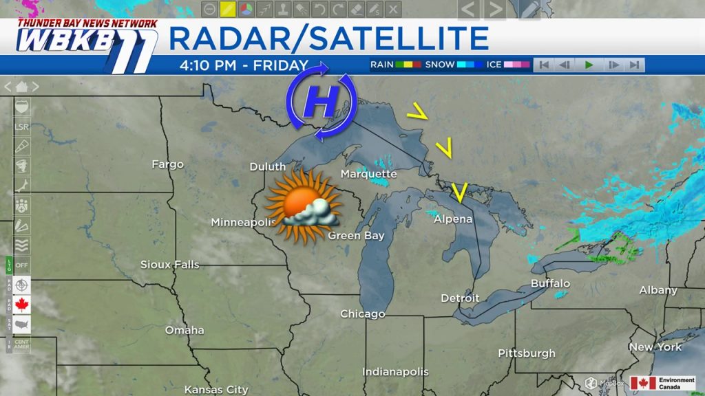
A high pressure system currently located north of Lake Superior is bringing dry conditions to our area which will continue Saturday . It is also steering cool winds from the north, but the wind direction will change as the high pressure system travels to the east. A light breeze from the south will introduce slightly warmer temperatures beginning on Sunday.
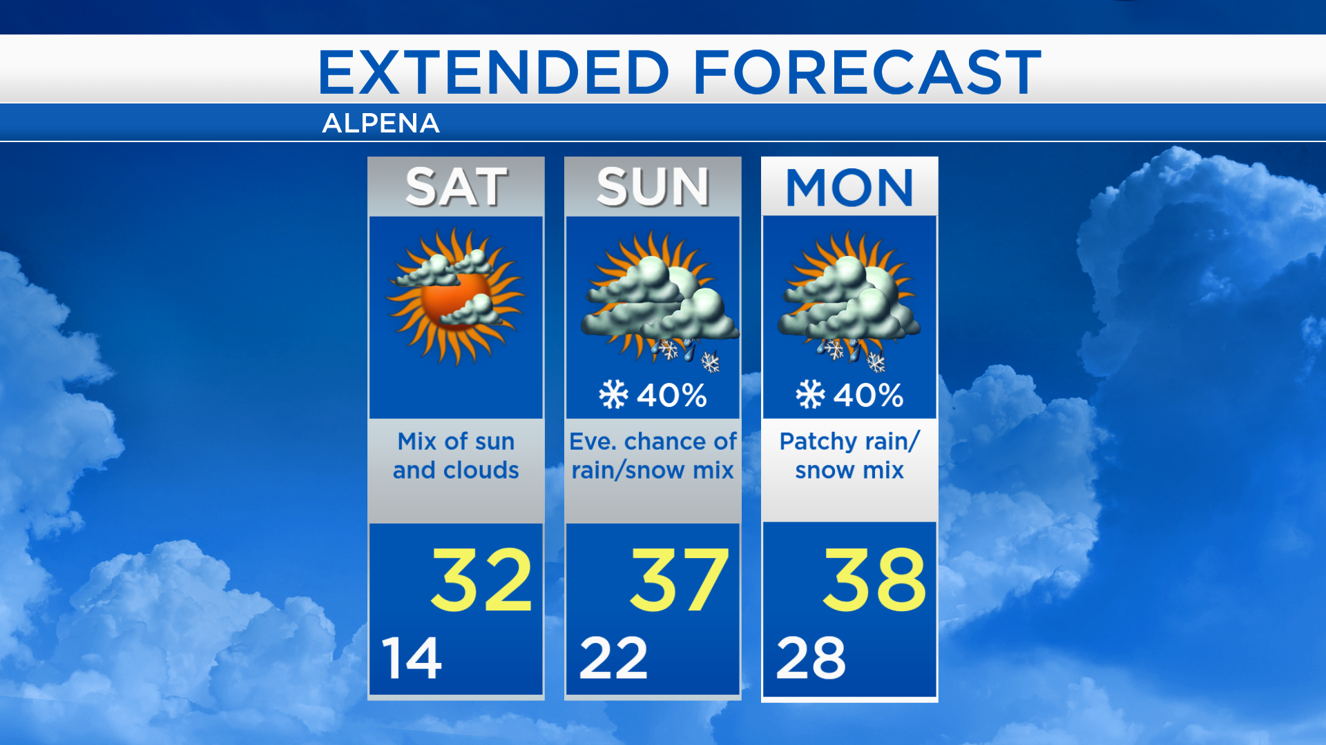
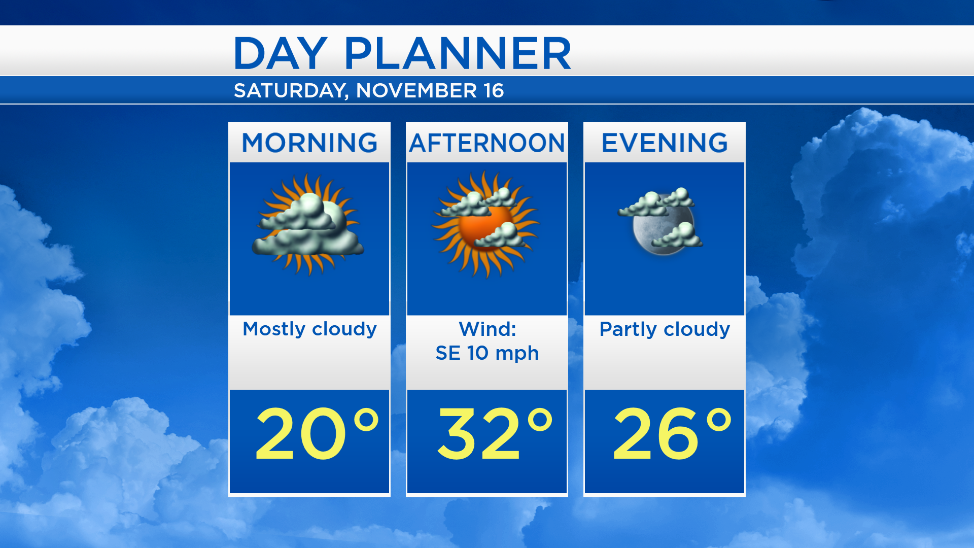
Low temperatures tonight will drop to 14 degrees under partly cloudy skies. Saturday will start with cool temperatures, near 20 degrees in the morning. A mix of sun and clouds is expected tomorrow afternoon and high temperatures will reach the lower 30s
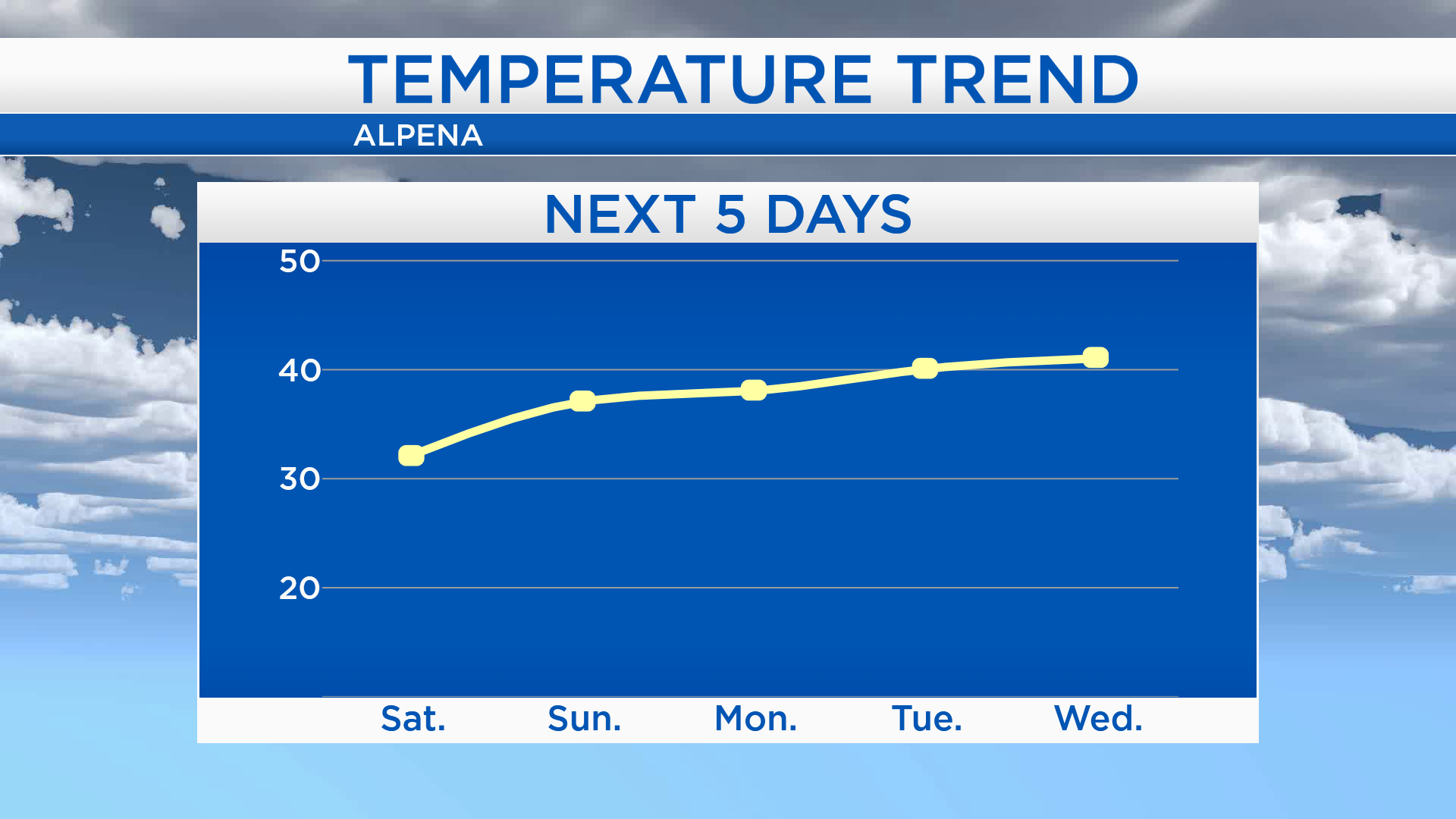
Temperatures will climb to the upper 30s for afternoon highs Sunday and Monday. Slightly warmer temperatures are forecast for the middle of the week, near 40 degrees on Tuesday and lower 40s on Wednesday. It has been a while since we’ve even had upper 30s — the last time the temperature in Alpena reached 39 degrees was November 10, and the most recent 40 degree temperature was November 4.
Saturday will be the brighter day of the weekend. Cloudy skies and highs in the upper 30s are expected on Sunday, then a rain/snow mix is possible Sunday evening. Patchy rain or snow showers are possible on Monday, although precipitation amounts will be very light and minimal. For the rest of Northeast Michigan’s weather forecast, watch the latest weather video by clicking the weather tab at the top of the page.