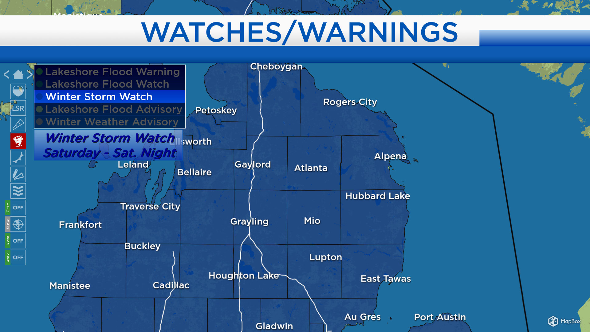
Winter Storm Watch issued for Saturday

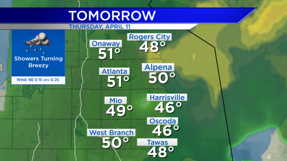
Light mixed precipitation has changed to rain showers as temperatures continue to warm throughout the evening. A gap of dry weather over the Upper Plains will settle over our area Friday. A storm system that is still developing over the southwestern states will move through the Plains, then arrive in Michigan early Saturday.
The National Weather Service has issued a Winter Storm Watch that begins early Saturday and continues through Saturday night. Snow and ice amounts will make travel difficult. In addition, wind gusts up to 40 mph will be possible. Wind plus the weight of ice and tree limbs and power lines could result in localized outages. Wind combined with periods of heavy snow can create blowing snow conditions.
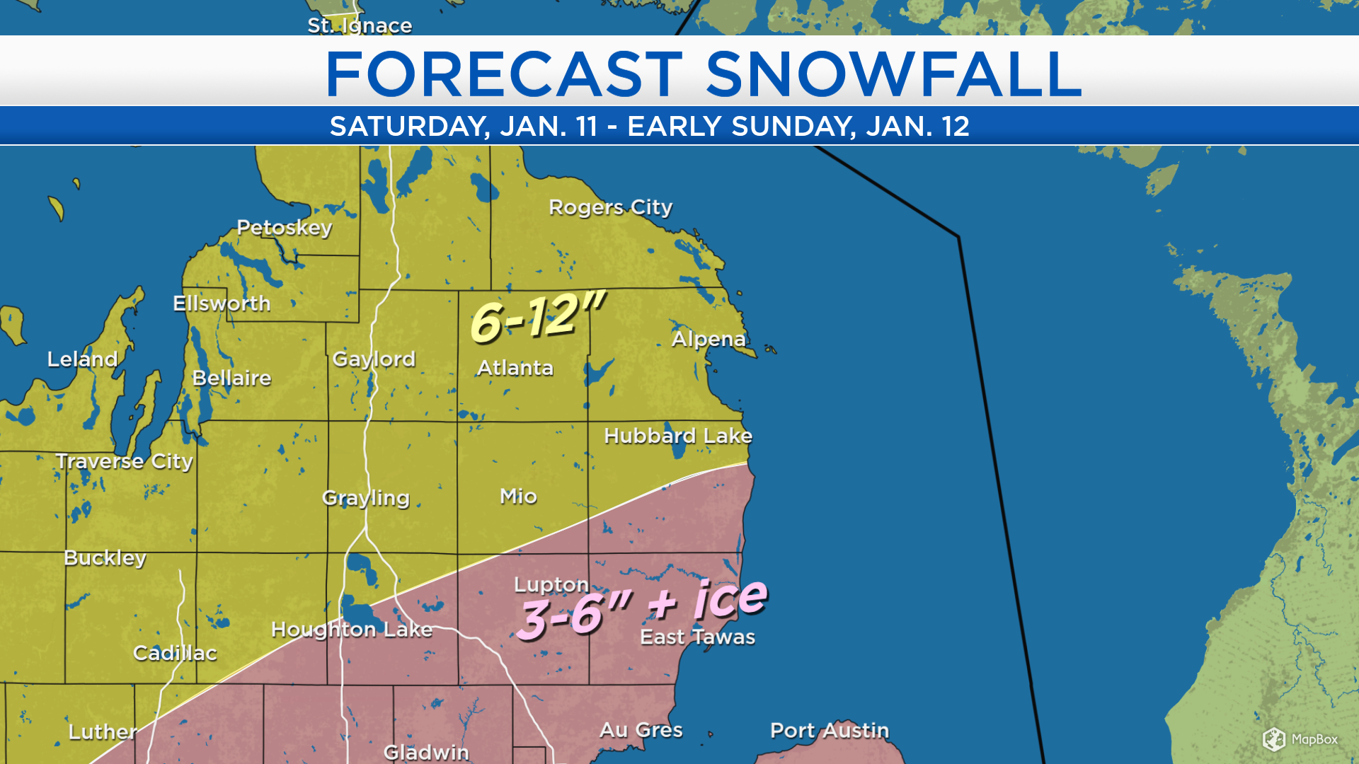
Two rounds of heavier snow will be likely — early Saturday and late-day through nighttime. A lull or lighter snow showers will be possible late-morning to midday. The greatest risk of ice due to sleet and freezing rain will be south of M-72. The exact storm track will have to be pinned down, and that will determine where the transition between snow and ice sets up.

Areas that stay all snow will likely get 6 to 12 inches in total. At this point, the transition zone separating more snow from more ice looks to set nearly along a line from Harrisville to Roscommon. For areas shaded in pink, ice amounts around 0.25 inches will be possible 3-6 inches of snow likely. (The forecast could still be refined on Friday.)
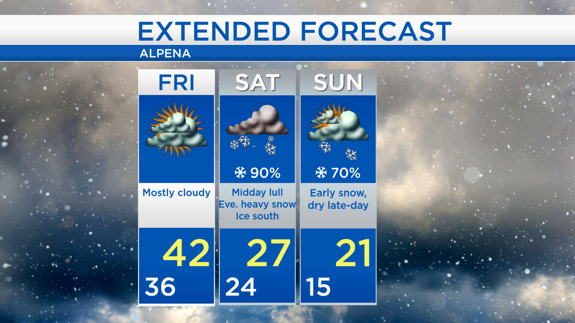
Friday will be the calm before the storm, a dry day with mostly cloudy skies and highs near 42 degrees. Snow and ice will be hazardous on Saturday and highs will be in the upper 20s. Early snow will move out on Sunday, and drier conditions are expected for the afternoon and evening. Cooler temperatures are expected Sunday with highs in the lower 20s. Monday is looking mainly dry with highs in the upper 20s. For the rest of Northeast Michigan’s weather forecast, watch the latest weather video by clicking the weather tab at the top of the page.