
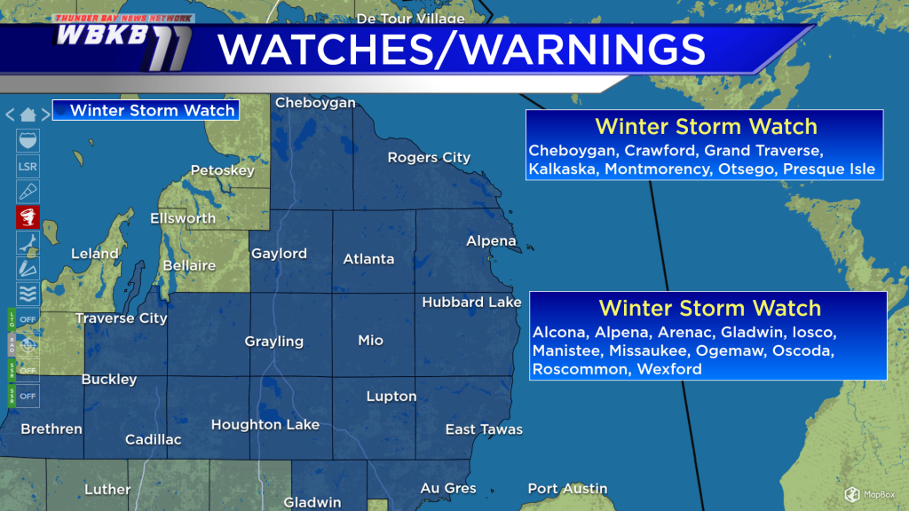
Winter Storm Watch in effect for Saturday’s incoming snowstorm
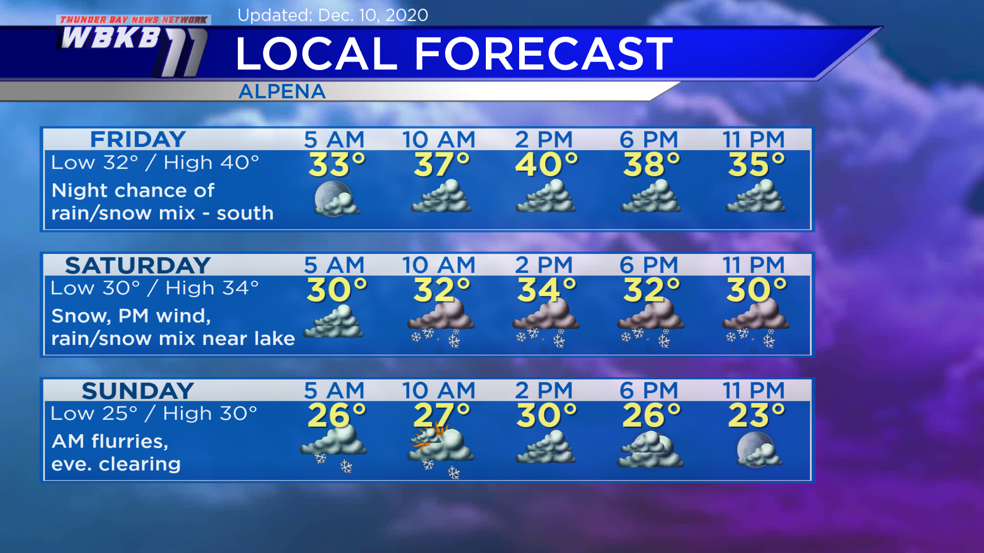
Cloud cover will increase overnight with patchy fog possible. Consider Friday the calm before the storm, a cloudy day with any rain/snow chances holding off until the evening. The storm currently over the southwestern part of the country will travel through northern Indiana and southeastern Michigan Saturday.
The forecast track of the incoming storm puts most of Northern Michigan in line for substantial snowfall. The National Weather Service has issued Winter Storm Watches, including all of Northeast Michigan. These watches cover the incoming snowstorm beginning Friday night and lasting until early Sunday.

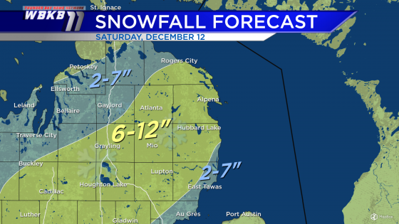
A total of 6-12 inches of snow are forecast south of a line from Rogers City to Johannesburg to Kalkaska, Michigan. Amounts more than 6 inches are expected to be common, but amounts on the high end (near 12 inches) will be isolated! Eastern Iosco County could end up with lower snowfall because any mixed precipitation will cut down on amounts. Also, less snowfall is expected farther north toward the Tip of the Mitt because they’re farther away from the storm track.
Friday: Cloudy, then a chance of rain/snow mix in the evening south of Alpena. Early-morning temperatures will begin in the lower 30s. Afternoon highs will be near 40 degrees. Evening temperatures will be in the upper/middle 30s.
Saturday: A messy day with several inches of snow and increasing winds. Snow gets heavier and winds become stronger in the afternoon/evening. Temperatures will start off near 30 degrees predawn. Afternoon highs will be near 34 degrees.
Sunday: Morning flurries followed by partial clearing in the evening. Early-morning temperatures will cool to the middle 20s. Afternoon highs will be near 30 degrees. Evening temperatures will be in the middle 20s.
For the rest of Northeast Michigan’s weather forecast, watch the latest weather video by clicking the weather tab at the top of the page.


