Wet Wednesday; Roller coaster temperatures this week
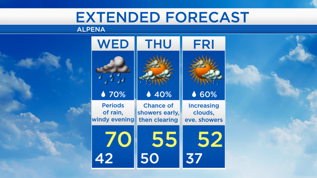
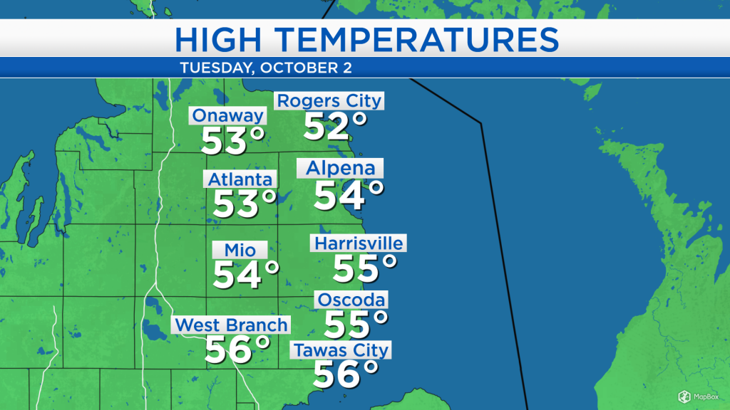
High temperatures today reached the mid-50s under cloudy skies and a breeze out of the north at 10-15 mph. Warmer temperatures will move in tomorrow, but that also comes with periods of rain all day long.
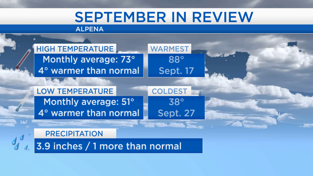
As we look back on September, the month ended up warmer than normal. The average of all the daily high temperatures was 66 degrees, and the average of low temperatures throughout the month was 51 degrees. The monthly averages for both high temperatures and low temperatures were 4 degrees warmer than normal. September was a wetter-than-average month, about 1 inch more rainfall than normal was measured.
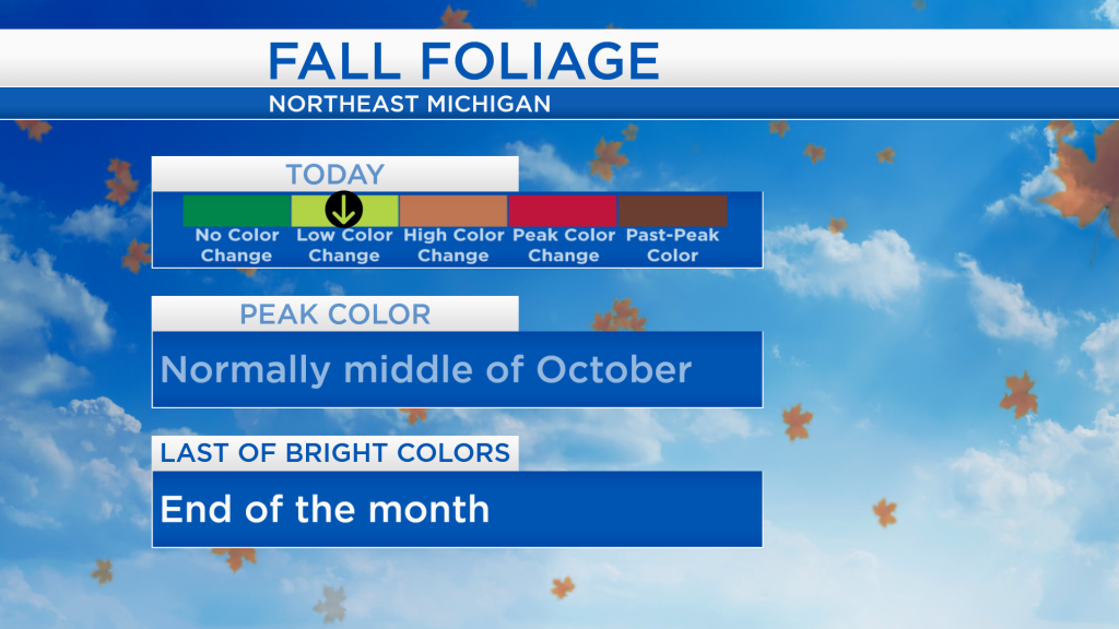
Recent cooler temperatures have brought the beginning of some changing colors on the leaves. The current fall foliage report shows low color change across the area. Peak color changes are typically expected in the middle of October.
A low pressure system coming out of the upper plains will bring a warm front across the area, and after the warm front passes through, temperatures will rise close to 70 degrees in the early-evening. The system will bring periods of rain for much of the day, and also a risk of thunderstorms tomorrow evening just ahead of the cold front. Following the cold front, much colder temperatures will enter on Thursday.
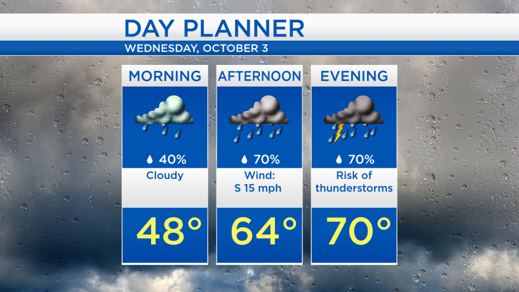
Rainfall amounts tomorrow will likely end up close to a half-inch, the steadiest rain is expected during the afternoon and evening hours. After the cold front passes through, temperatures will only reach the 50s on Thursday with mostly dry conditions. Friday will also be mostly dry until the evening when some showers will enter Northeast Michigan. Warmer temperatures are then forecast for Saturday — for the rest of Northeast Michigan’s weather forecast, watch the latest weather video by clicking the weather tab at the top of the page.