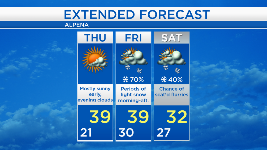
Warmer tomorrow; Chance of light snow Friday-Saturday
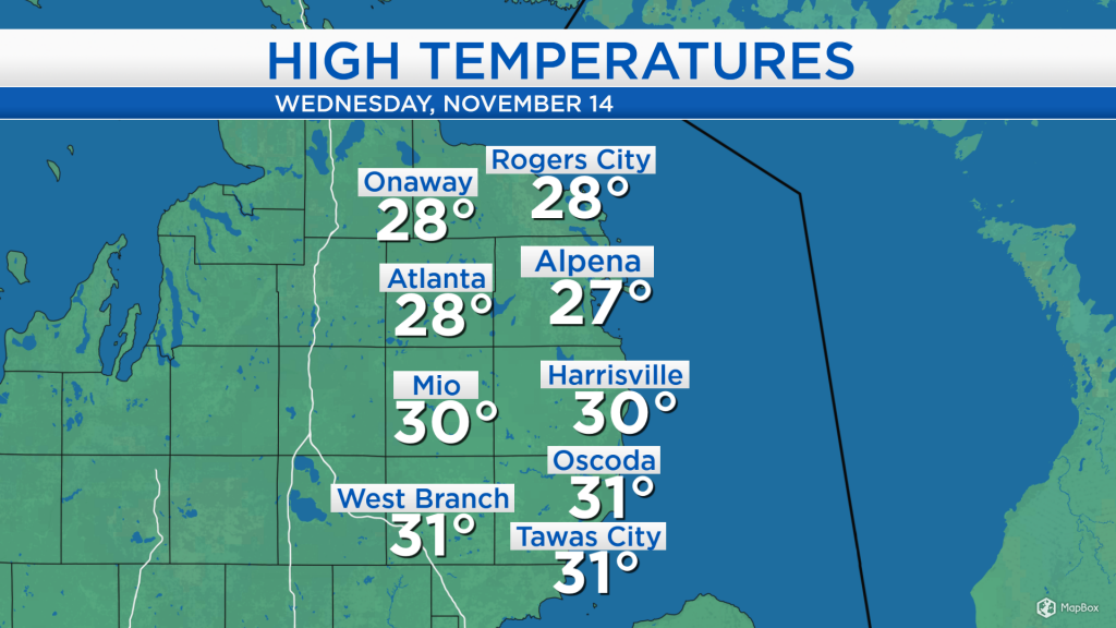
High temperatures today reached the upper 20s and lower 30s around Northeast Michigan. Mostly cloudy cloudy skies have persisted through much of the day, but some of the cloud cover is diminishing this evening.
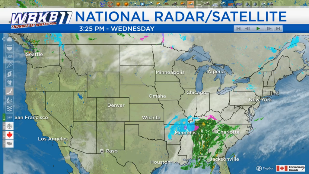
To our south and to our west, there are two storm systems worthy of attention. The stronger storm system to the south is producing wintry types of precipitation, including snow, sleet and freezing rain, as far south as Memphis, Tenn. This storm system will bring all types of precipitation to the Mid-Atlantic and Northeast, and could graze shoreline areas of Northeast Michigan with some light flurries Thursday night. A second, weaker system in the Upper Plains will likely bring some widespread scattered snow showers on Friday.
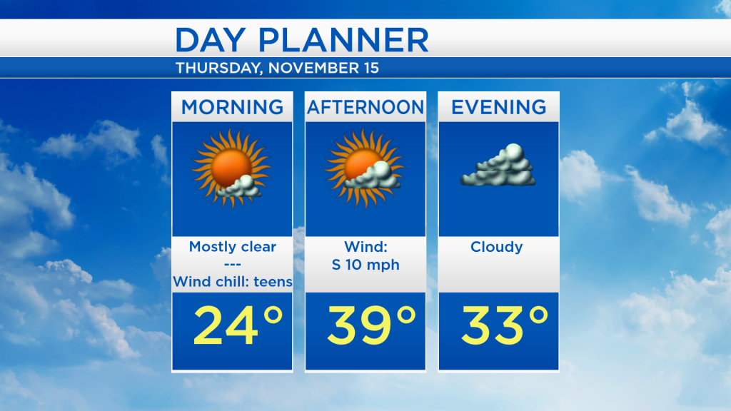
For tomorrow, the morning will start with mostly clear skies and temperatures in the lower or middle 20s. Clouds will increase beginning in the afternoon, as the high temperature warms to 39 degrees in Alpena. By tomorrow evening, cloudy skies are expected with temperatures in the lower 30s.
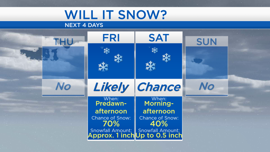
Except for the low chance of some light flurries Thursday night, no significant snowfall is expected tomorrow. On Friday, widespread snow showers are expected, though accumulations should remain minimal, around 0.5-1 inch. Scattered flurries are possible on Saturday with minimal accumulations, then dry weather will return on Sunday.
Dry weather and warmer temperatures will last through the daytime hours tomorrow with highs in the upper 30s and increasing clouds late in the day. Highs are forecast to reach the upper 30s again on Friday afternoon, although there will likely be some snow showers to contend with during the first half of the day. Temperatures will then cool to the lower 30s for afternoon highs this weekend. For the rest of Northeast Michigan’s weather forecast, watch the latest weather video by clicking the weather tab at the top of the page.