Warmer this weekend; Damp Sunday
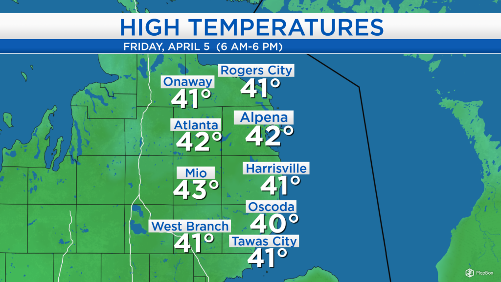
High temperatures today reached the lower 40s across Northeast Michigan, helped by light winds out of the south at 5-10 mph. The day started with mixed precipitation types in the morning, then cloudy skies lingered into the afternoon. Warmer temperatures are on our doorstep, beginning tomorrow.
The leading edge of the next storm system is already producing scattered showers over Minnesota, North Dakota and South Dakota. This system currently over the Rocky Mountains will move into the Great Lakes on Sunday, bringing higher chances of rain to our area.
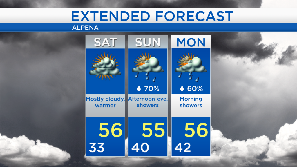
Overnight, increasing moisture content and nearly calm winds could result in areas of fog with low temperatures dropping to the lower and middle 30s. High temperatures tomorrow should warm into the middle 50s under mostly cloudy skies.

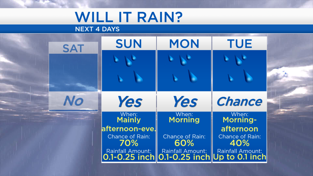
The chance of rain becomes likely during Sunday afternoon. Up to 0.25 inch of rain is possible Sunday and additional rain Monday morning. Still, a few patchy showers remain possible on Tuesday although the chance of rain is lower.
Tomorrow should remain mainly dry with warmer temperatures, reaching 56 degrees in the afternoon. Temperatures will remain warm throughout the weekend. Sunday will start with low temperatures close to 40 degrees and dry weather early. Showers become likely in the afternoon and evening with high temperatures in the middle 50s. Showers remain possible Monday morning, though drier weather is expected late Monday with highs also in the middle 50s. Slightly cooler temperatures will arrive in the middle of the upcoming week. For the rest of Northeast Michigan’s weather forecast, watch the latest weather video by clicking the weather tab at the top of the page.