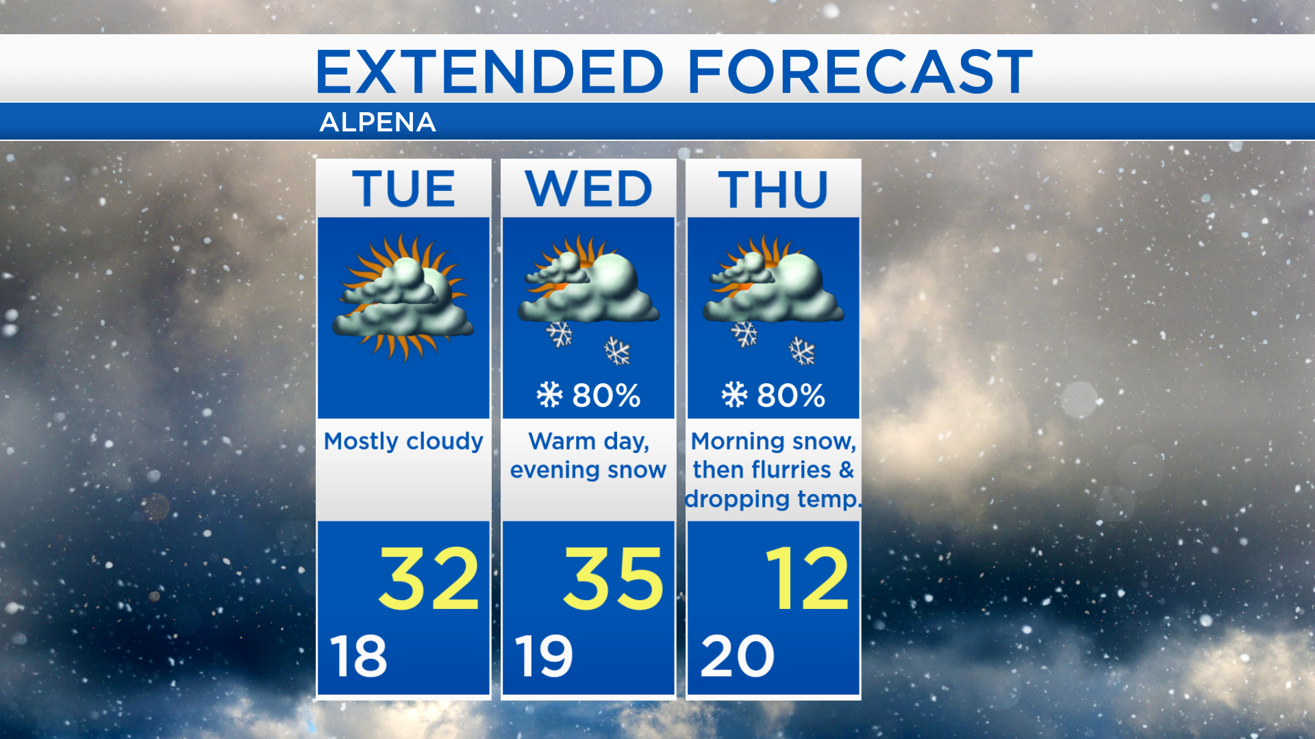
Warm until midweek; Snow likely late Wednesday

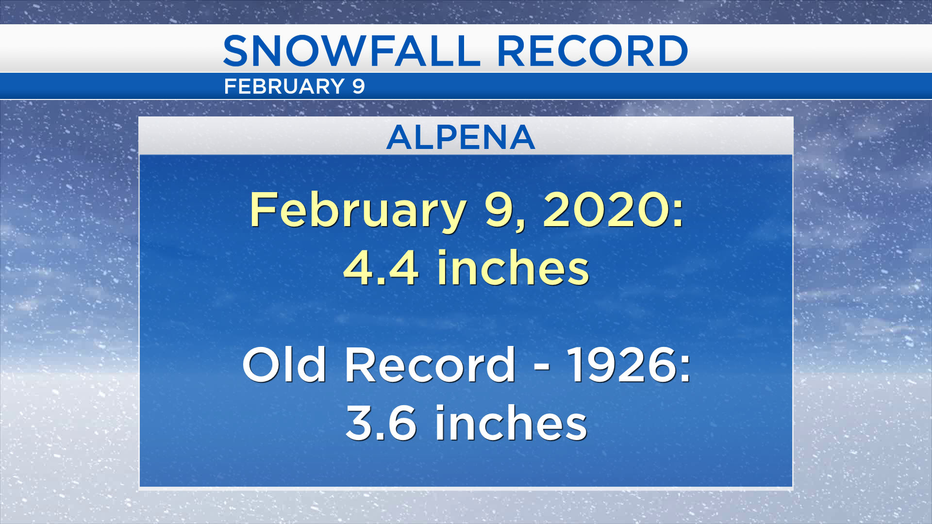
Looking back at Sunday’s snowfall, 4.4 inches were measured in Alpena. That beats a daily record for snowfall on February 9 — the old record of 3.6 inches was set Feb. 9, 1926.
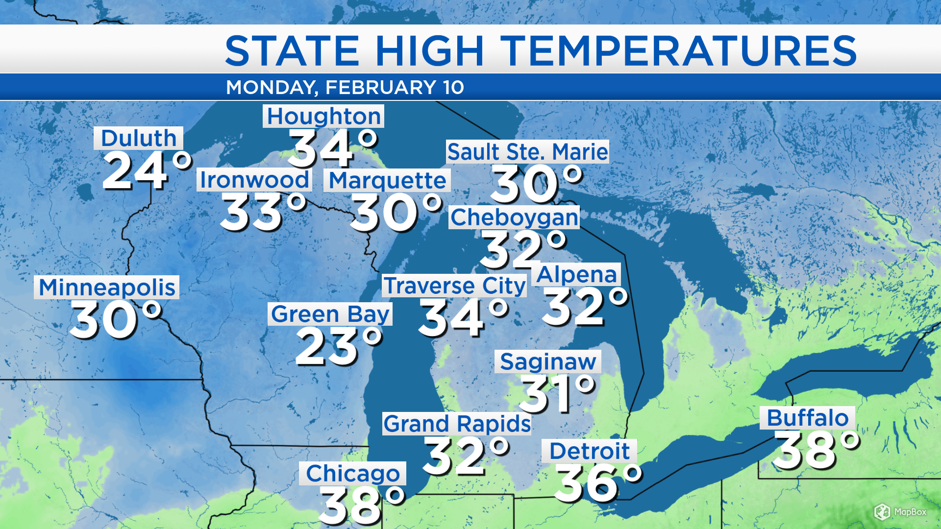
High temperatures today reached the lower 30s across most of Michigan. Temperatures got up to 32 degrees in Alpena, 31 in Saginaw, and 30 in Marquette. Warm temperatures with daytime highs in the 30s will continue for the next couple days.
Cloud cover has cleared out this afternoon, and mainly clear skies will last through tonight. A weak disturbance over northern Minnesota and North Dakota will bring a chance of flurries to the Upper Peninsula and more cloud cover to Northeast Michigan for Tuesday. A cold front currently located in northern Canada will drop southward and move through our area late Wednesday. The cold front will bring a likely chance of snow late Wednesday and then colder, arctic-like temperatures will follow on Thursday.
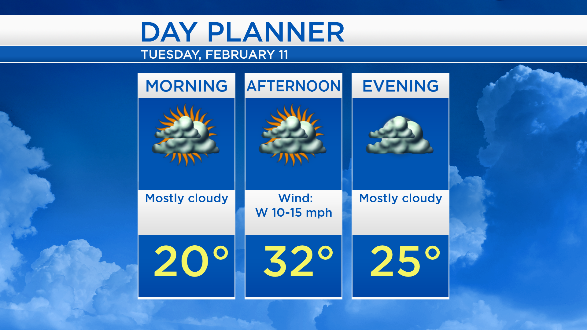
Low temperatures overnight will cool to the upper teens and winds will remain very light. Tuesday will start with morning temperatures near 20 degrees, highs will reach about 32 degrees in the afternoon, and evening temperatures will be in the middle 20s. More cloud cover is expected and winds will come from the west at 10-15 mph.
Tuesday should be mainly dry with highs in the lower 30s. Wednesday will start with dry weather and highs will warm to about 35 degrees. Snow will move in Wednesday evening and continue through Thursday morning as a cold front from northern Canada moves through. Temperatures will likely drop all day Thursday: Morning temperatures will be near 20 degrees, then about 12 degrees in the afternoon, and plummet below zero early Friday. For the rest of Northeast Michigan’s weather forecast, watch the latest weather video by clicking the weather tab at the top of the page.