Warm Tuesday; Temperatures crash later this week
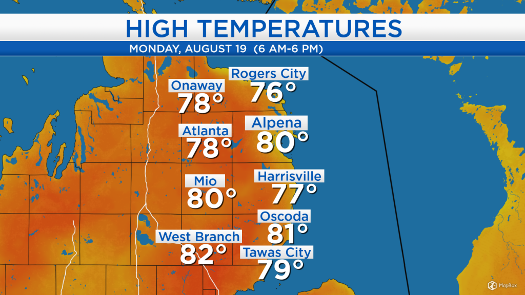
High temperatures reached close to 80 degrees this afternoon. Winds out of the west helped bring warmer temperatures toward the shoreline, as the breeze came off of the land and not the water. Once a lake breeze set up in the afternoon, temperatures at the lakeshore fell a few degrees.

Skies are mostly dry across the Midwest. Plenty of sunshine is expected through tomorrow, until the next cold front moves in. That cold front is currently near the Canadian border, and will progress through the Upper Plains over the next 24 hours. A few showers are possible in our area early Wednesday. The cold front will bring colder temperatures, most notably Thursday and Thursday night.
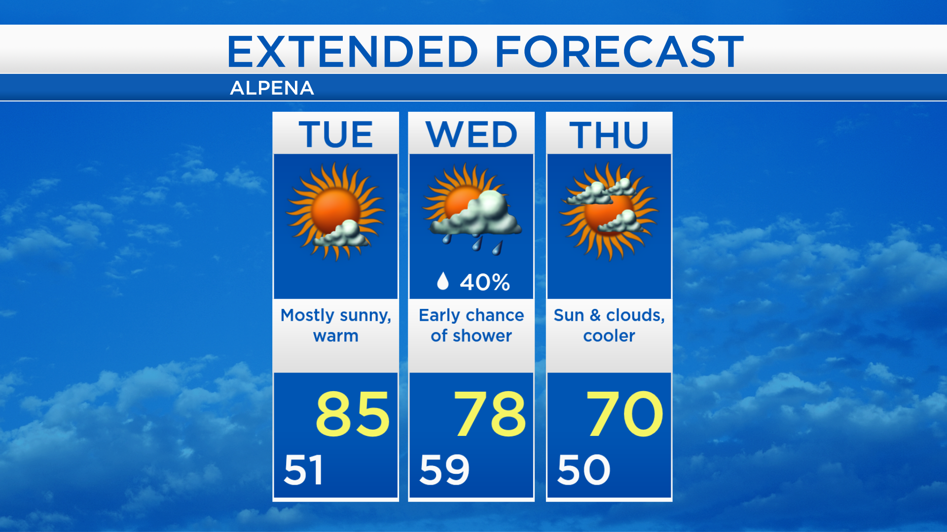
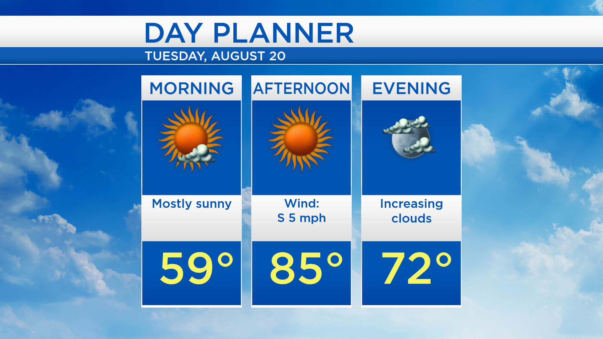
Overnight low temperatures will cool to the lower 50s and patchy fog is possible. Tomorrow will start with mostly sunny skies as temperatures rise to the upper 50s in the morning. Afternoon temperatures will warm to the middle 80s under sunny skies. Cloud cover will increase tomorrow evening, leading to a chance of showers Wednesday predawn/morning.
Tomorrow is the warmest day of the forecast with high temperatures in the middle 80s. Afternoon temperatures will reach the upper 70s on Wednesday. Winds out of the northwest will bring colder temperatures Thursday with highs near 70 degrees. Temperatures will slowly warm Friday through the weekend.
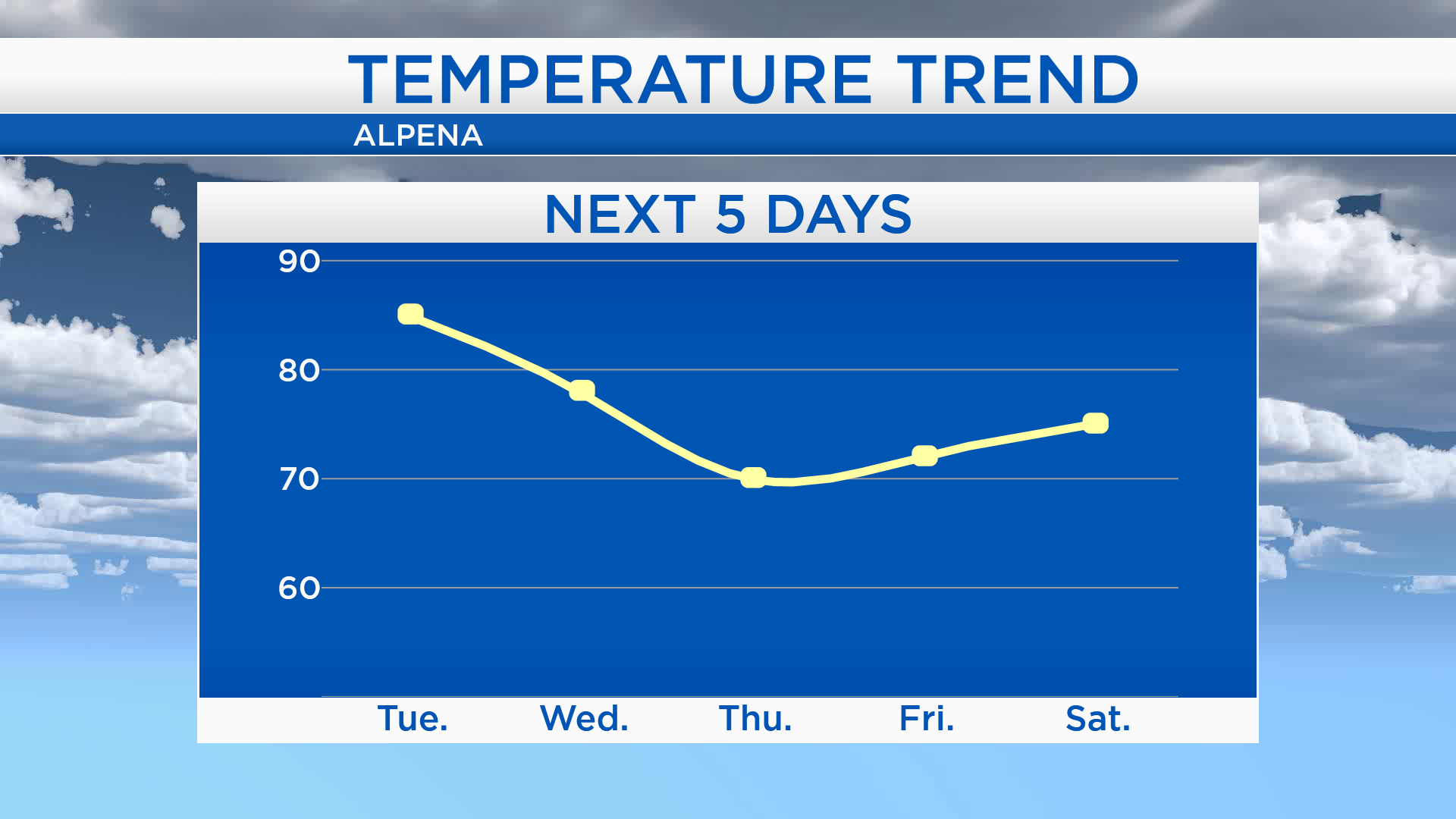
Mostly sunny skies are expected tomorrow and high temperatures will warm to 85 degrees. A few showers are possible early Wednesday then cloud cover will gradually clear, and high temperatures will reach the upper 70s. Colder temperatures will arrive Thursday with high temperatures close to 70 degrees. The coldest temperatures over the next week will arrive early Friday, starting with lows in the middle 40s, then afternoon highs will climb to the lower 70s. For the rest of Northeast Michigan’s weather forecast, watch the latest weather video by clicking the weather tab at the top of the page.