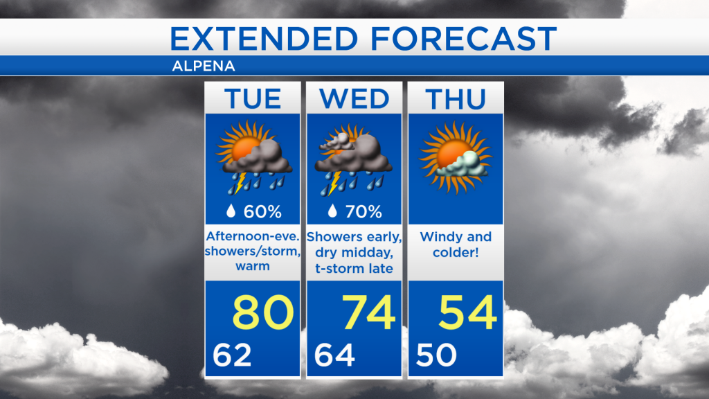
Warm Tuesday; Stormy late Wednesday; Cold end to the week
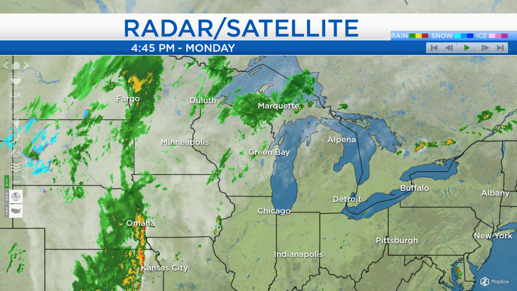
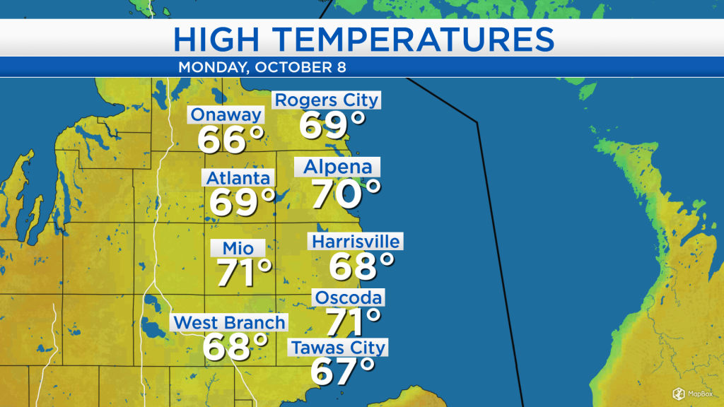
Earlier this morning, ½-¾ inch of rain fell across Northeast Michigan, just north of a warm front. After the warm moved to our north, temperatures have warmed close to 70 degrees. Temperatures will warm even further tomorrow.
Within the warm sector, after the warm front and before the cold front, a few scattered thunderstorms will pop up tomorrow afternoon/evening. After that, the cold front currently in parts of Iowa, Nebraska and Kansas will bring widespread soaking rain and thunderstorms late Wednesday.
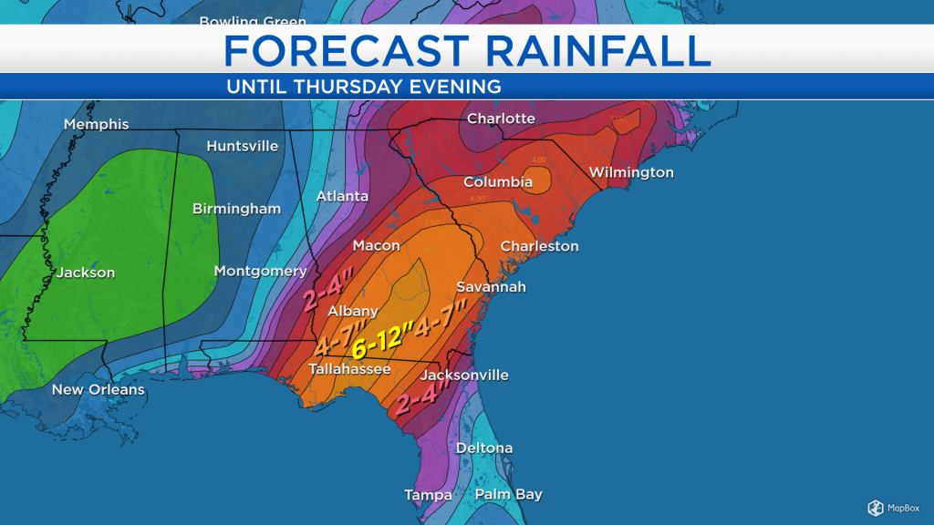
In the Gulf of Mexico, Michael has strengthened to a category 1 hurricane today, and it will continue to intensify as it heads north. The hurricane is expected to make landfall along the Florida Panhandle Wednesday midday, likely as a category 3 hurricane.
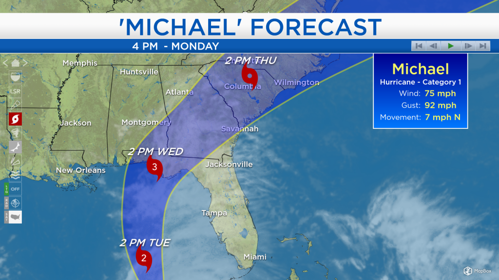
Frequent wind gusts over 70 mph and rainfall amounts of 6-12 inches are expected for parts of the Florida panhandle, from early Wednesday until late Thursday.
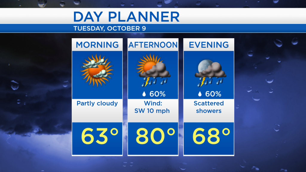
Around northeast Michigan, tomorrow will start with a mix of sun and clouds and temperatures in the lower/middle 60s. A few scattered thunderstorms will move in during the afternoon as temperatures warm up to 80 degrees, there will be a few dry breaks in between some thunderstorms.
After an exceptionally warm Tuesday, temperatures will remain warm into Wednesday. Early-morning temperatures will start in the lower 60s, and highs will reach the mid-70s. A few showers are forecast early Wednesday, then several dry hours are expected midday, followed by rain and thunderstorms in the late-afternoon and evening. That final round of rain and thunderstorms will come with a cold front — after that, much colder temperatures will enter Thursday and Friday. For the rest of Northeast Michigan’s weather forecast, watch the latest weather video by clicking the weather tab at the top of the page.