Warm but Less Humid This Week; June Review
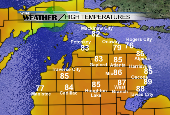
High temperatures today warmed into the mid-80s with a breeze out of the west until the early afternoon, except cooler temperatures were observed in Presque Isle county. Later in the day, the breeze shifted out of the east, off of Lake Huron, knocking temperatures down into the 70s in Alpena.
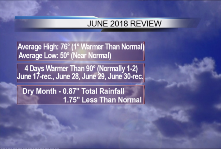
The heatwave over the weekend marked an unusually warm finish to June. Overall, high temperatures averaged over the month of June were just one degree warmer than normal, and low temperatures averaged over the month were near normal. There were four days warmer than 90 degrees — June 17 (Father’s Day) and the three last days of June; new record high temperatures were set June 17 and June 30. In comparison, normally there are one or two days warmer than 90 degrees in June. Last month was unusually dry, only 0.87 inches of rain fell.
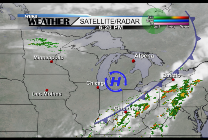
A cold front came through last night producing a few showers and thunderstorms, and also put an end to the high humidity for the start of this week. High pressure over southern Michigan is brightening the skies over Northeast Michigan with sunshine lasting through midweek.
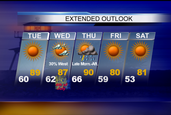
Looking ahead to the Fourth of July, most areas should remain warm and dry with partly cloudy skies. However, there is a chance of spotty showers in the afternoon in Montmorency, Oscoda and Ogemaw counties. High temperatures will warm into the upper 80s, and temperatures will be in the 70s for evening fireworks.

Although high temperatures will warm into the upper 80s tomorrow, humidity levels will be more tolerable than we felt over this past weekend. Wednesday should be mostly dry except for a chance of spotty showers west of Alpena. A higher chance of showers and thunderstorms will move through Thursday along a cold front. Temperatures will feel refreshing on Friday and Saturday, especially early in the day with low temperatures cooling into the 50s for the first time in about a week.