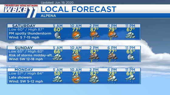
Warm and humid over the weekend; Risk of storms mainly on Sunday

A cold front is currently located over the Upper Peninsula, Wisconsin, Iowa and northern Missouri — it is moving very slowly eastward. With a sultry air mass in place, there could be an isolated pop-up shower or storm Saturday afternoon. A higher chance of showers/thunderstorms will move through Northeast Michigan Sunday midday-afternoon.
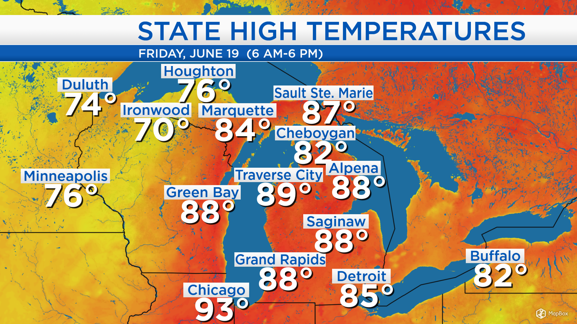
To the east of the cold front, high temperatures soared to the upper 80s and lower 90s. Highs reached 88 degrees in Alpena, 89 degrees in Traverse City and 93 degrees in Chicago. To the west of the cold front, high temperatures were only in the 70s, Ironwood had a high of 70 degrees and 74 degrees in Duluth. The change in the weather pattern will be slow to evolve, it will take until Tuesday for cooler temperatures to arrive in Northeast Michigan.
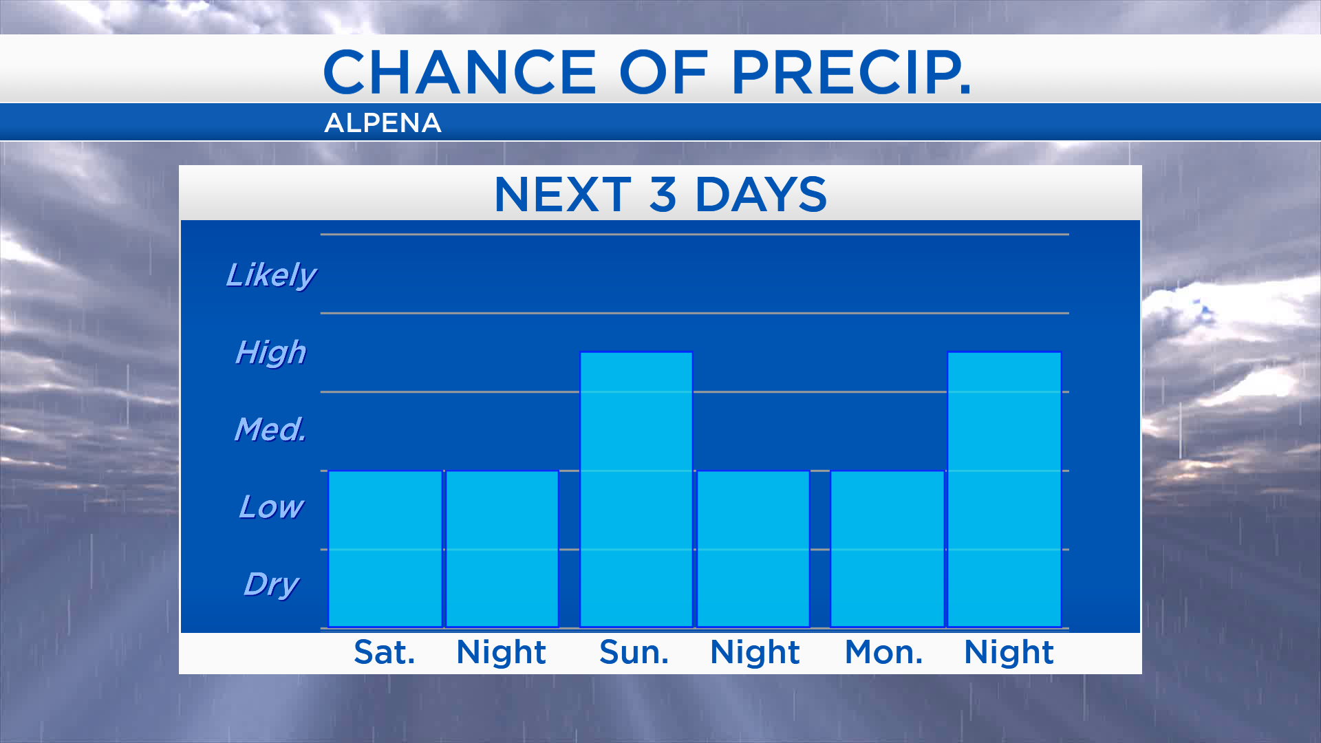
Saturday, the chance of showers will be relatively low. Sunday, the chance of showers/thunderstorms will be greater in the midday-afternoon. The chance of showers will become lower again Sunday night and through most of the daytime hours on Monday. The chance of showers will then increase Monday evening.
Saturday: A low-end risk of spotty thunderstorms in the afternoon-early evening. Low temperatures will be near 60 degrees predawn. By 10 a.m., temperatures will rise to the upper 70s. Afternoon highs will warm up to about 87 degrees along with high humidity. Temperatures will still be close to 80 degrees around 6 p.m.
Sunday: The morning will likely be rain-free, then the chance of showers/storms will be highest in the midday and afternoon hours. Early-morning lows will be in the middle 60s. Afternoon highs will reach close to 83 degrees. Winds will come out of the southwest, about 15 mph.
Monday: Starts dry, then a late-day chance of showers will move in. Predawn lows will be in the upper 50s. Temperatures will rise to the 70s by the late-morning. Afternoon highs will be in the middle 80s.