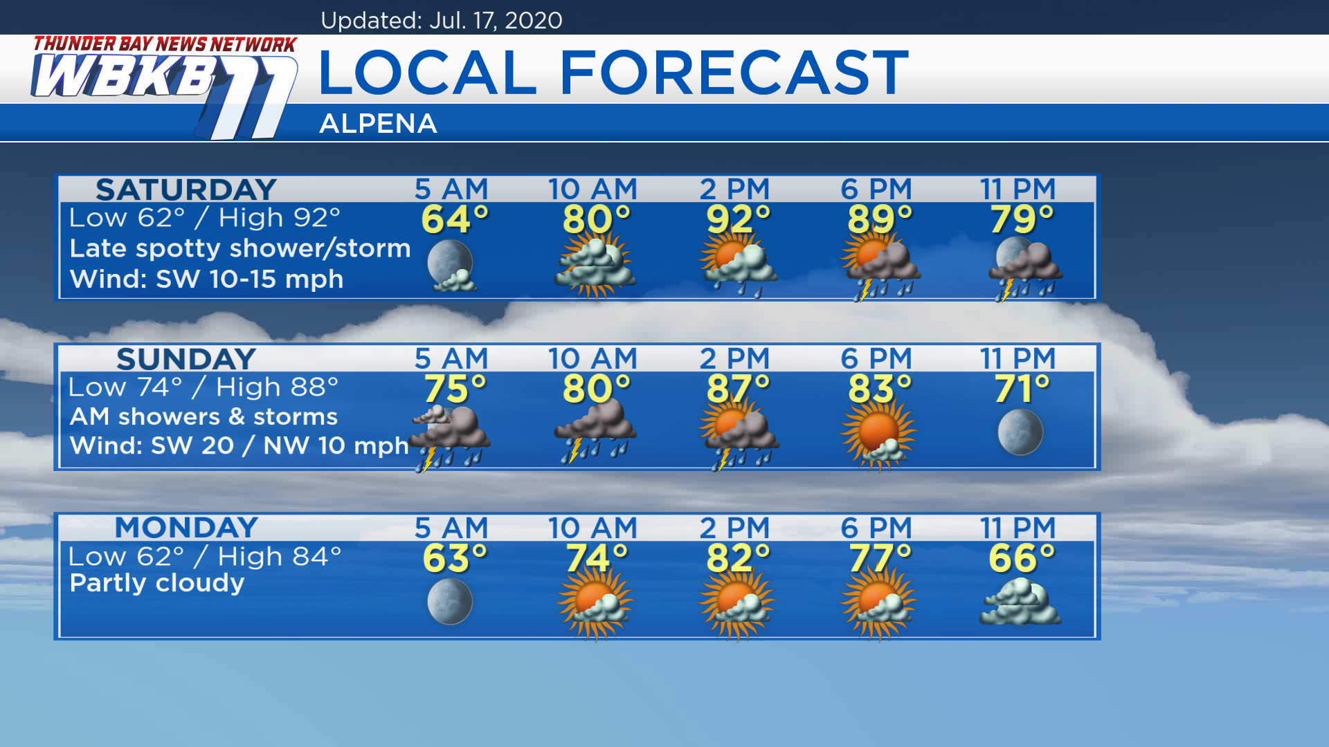
Very humid with a risk of thunderstorms late Saturday-early Sunday
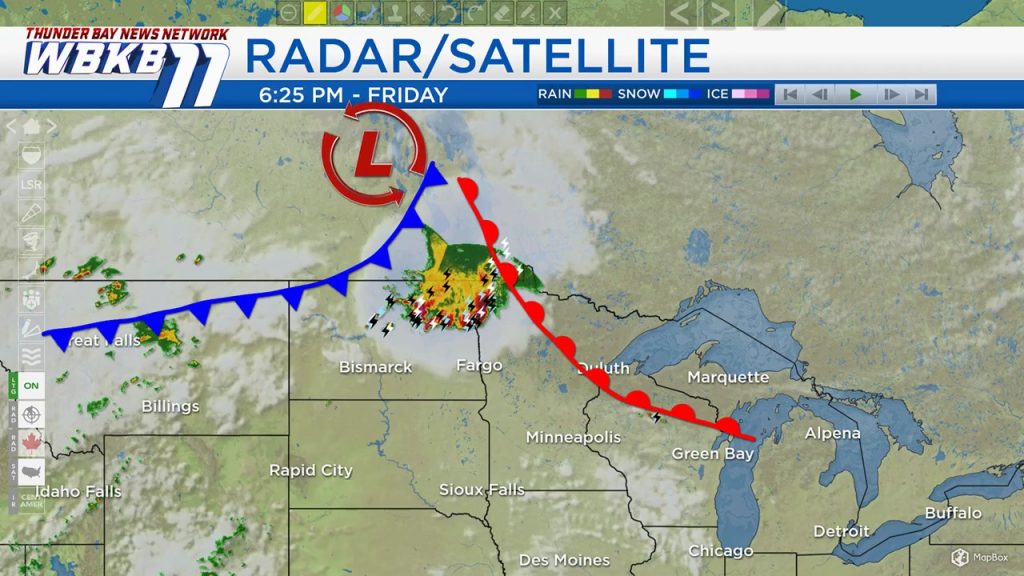
An approaching warm front is going to bring excessive humidity to our region tomorrow. The hottest and most humid air mass resides between the warm and cold fronts. An unstable air mass prior to the cold front will provide a risk of spotty showers/storms late Saturday. The cold front will bring a rain and thunderstorms early Sunday.
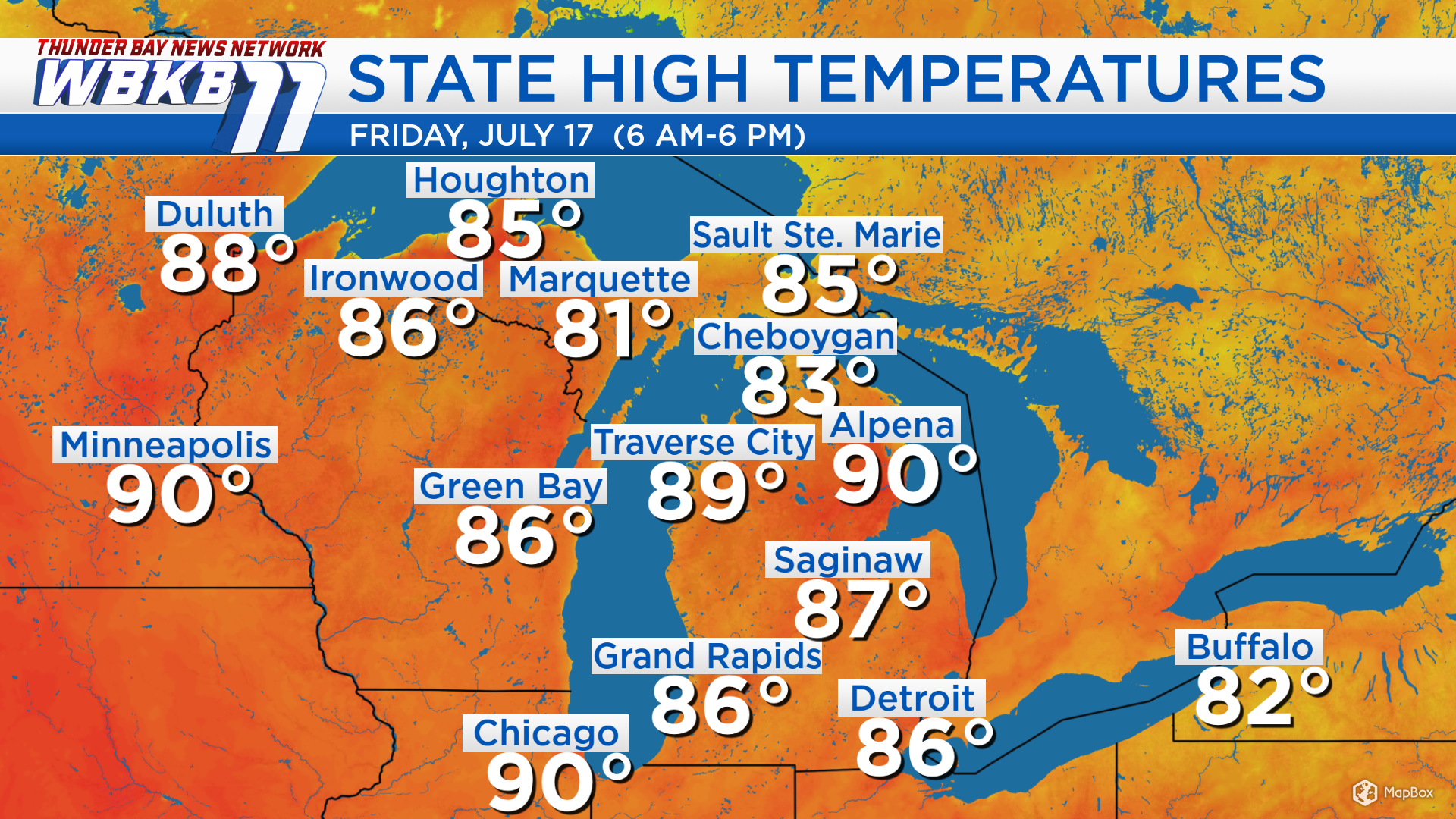
High temperatures today got up to 90 degrees in Alpena, Chicago and Minneapolis. Plenty of heat will be around this weekend. Some cooler temperatures will arrive following Sunday’s cold front.
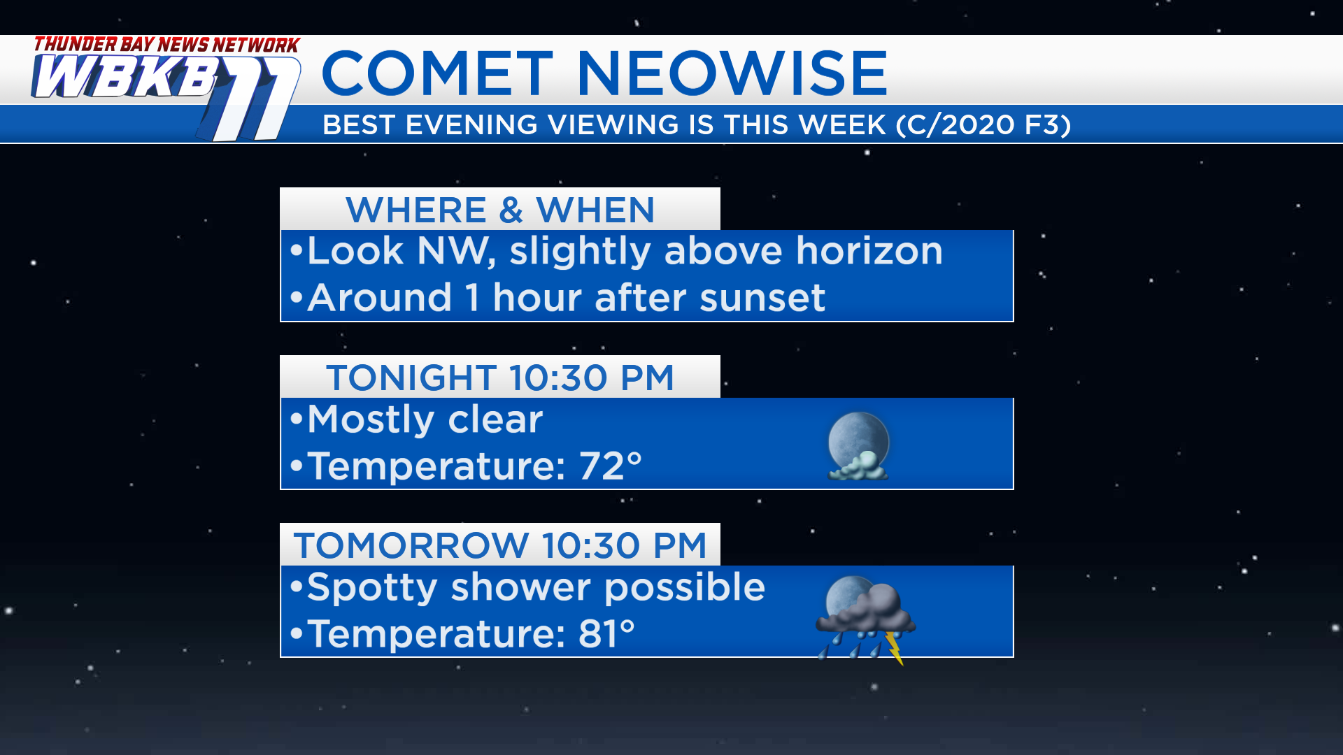
Tonight will have good viewing conditions of the comet NEOWISE. This evening, temperatures will be in the lower 70s with mostly clear skies. Saturday evening will be sticky with a risk of spotty showers or thunderstorms and temperatures in the lower 80s.
High temperatures will be in the lower 90s Saturday! Sunday, highs will be in the upper 80s. After a cold front moves through Northern Michigan on Sunday, temperatures will get cooler early next week. Highs will be around 84 degrees Monday, and near 80 degrees Tuesday.
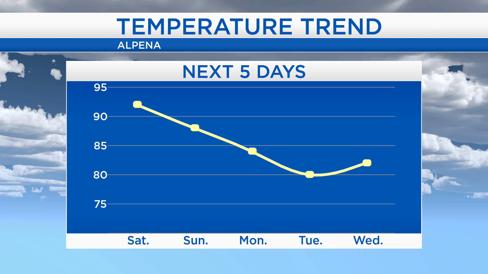
Saturday: Sweltering, increasing clouds, a chance of spotty showers/storms late-day and into the evening. Predawn temperatures will be in the lower 60s. By 10 a.m., temperatures will rise to 80 degrees. Afternoon highs will heat up to 92 degrees! Early-evening temperatures will remain sticky, in the upper 80s.
Sunday: Starting muggy with a risk of thunderstorms, very warm and clearing late-day. Predawn temperatures will be in the 70s. Afternoon highs will reach about 88 degrees. Early-evening temperatures will be in the lower 80s.
Monday: Partly cloudy and slightly less muggy. Predawn lows will be in the lower 60s. Afternoon highs will get close to 84 degrees. Early-evening temperatures will cool off to the middle 70s.