Two chances of snow/rain this weekend, lots of dry time in between
We enjoyed bright, blue skies over Northeast Michigan Friday. Cloud cover is increasing this evening. A weak and disorganized disturbance just to the west of our area will provide a chance of snow showers or rain/snow mix early Saturday. That’s going to move out of the area by midday and the rest of Saturday is looking dry, from the afternoon through nighttime hours.
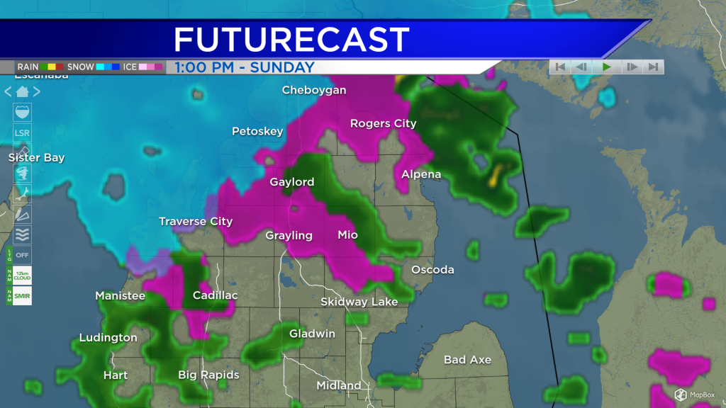
The first chance of precipitation this weekend will move in early Saturday and clear out by midday. That will bring either snow showers or a rain/snow mix to our area with unsubstantial amounts. The second chance of precipitation will come mostly in the form of rain showers Sunday afternoon.
Winds will not be an issue Saturday, from the west near 10 mph. Early Sunday, winds will remain gentle and shift out of the south. Winds will become much stronger Sunday afternoon/evening, becoming from the west close to 20 mph. Monday will be blustery with winds from the northwest around 25 mph. The strong northwest winds will also bring in much colder temperatures.
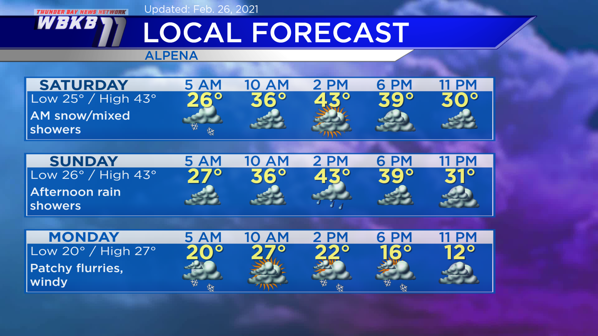
Saturday: Early snow showers or rain/snow mix, then drying out. Early-morning lows will be near 25 degrees. Temperatures will rise to the middle/upper 30s in the late-morning. Afternoon highs will get up to about 43 degrees. Evening temperatures will be in the middle/lower 30s.
Sunday: Dry early, then some afternoon rain showers. Predawn lows will be close to 26 degrees. Late-morning temperatures will climb to the middle/upper 30s. Afternoon highs will be near 43 degrees. Evening temperatures will head into the middle/lower 30s.
Monday: Much colder and windy! Also, a chance of patchy flurries. Early-morning lows will be near 20 degrees. Highs will be around 27 degrees midday. Temperatures will drop to the teens Monday evening.
For the rest of Northeast Michigan’s weather forecast, watch the latest weather video by clicking the weather tab at the top of the page.


