Tropical Storm Gordon in the Gulf of Mexico; Separate showers and thunderstorms Tuesday and Wednesday
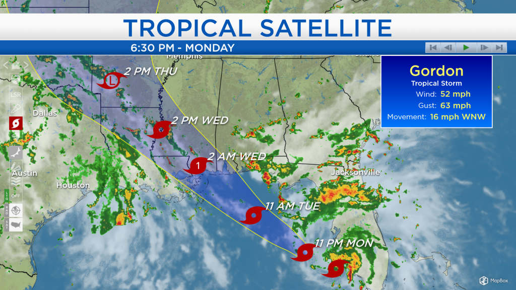
Tropical Storm Gordon formed earlier this morning near southwestern Florida. It will continue to move northwestward through the Gulf of Mexico, likely intensifying to a category 1 hurricane tomorrow evening, and it will then make landfall along the Gulf Coast between eastern Louisiana and the Florida panhandle. Many areas along the coast from eastern Louisiana to the Alabama-Florida border will get 4-10 inches of rain, 40-70 mph winds, and storm surge up to 5 feet. After landfall, the tropical storm is forecast to move northward and weaken.
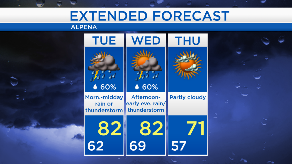
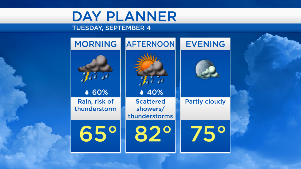
Around our area, the weather has remained dry for most of the day. A round of showers and thunderstorms currently over Wisconsin is heading toward our area. Showers and a couple of thunderstorms will start tonight and last through tomorrow midday.
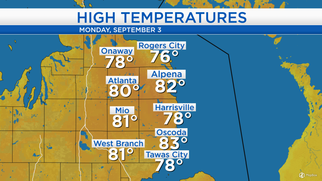
High temperatures around the area warmed into the lower 80s for many locations in Northeast Michigan. Afternoon temperatures will reach similar values tomorrow and Wednesday.
For tomorrow, the greatest chance of rain and thunderstorms will last from the early-morning hours until midday. Several hours of dry weather are expected in the late-afternoon and evening.
Despite a damp start to the day, high temperatures will warm into the lower 80s tomorrow afternoon. Another round of thunderstorms will move through Wednesday afternoon through early-evening, ahead of a cold front. The cold front will put an end to the warmth and unsettled weather. A calmer and cooler pattern will take over beginning Thursday. For the rest of Northeast Michigan’s weather forecast, watch the latest weather video by clicking the weather tab at the top of the page.