Toasty Tuesday; Damp Midweek
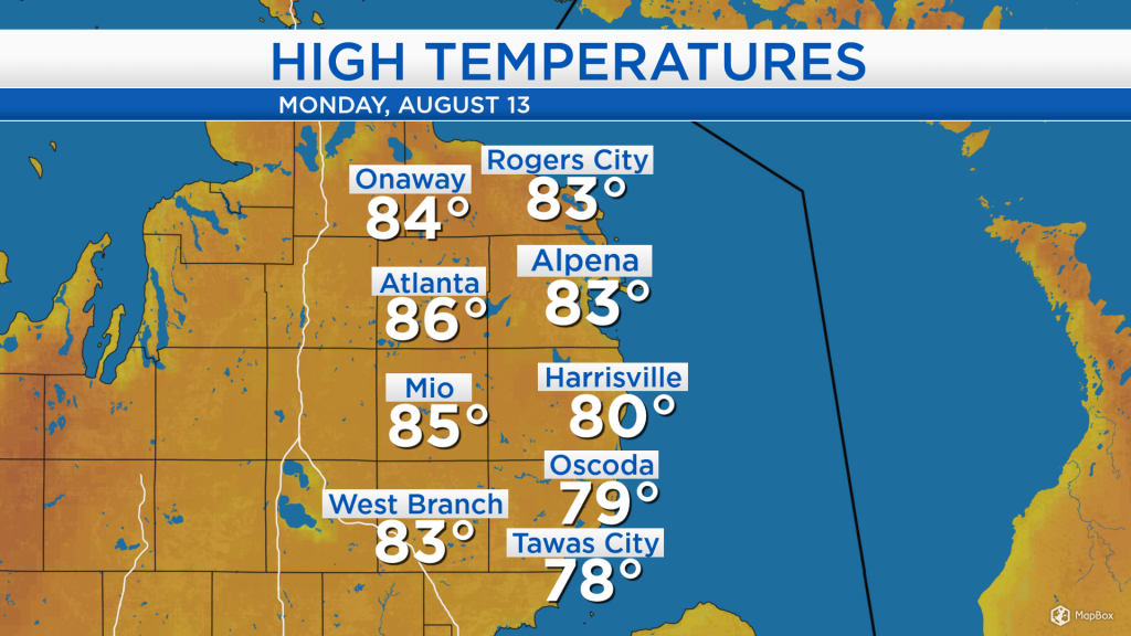
Temperatures earlier this afternoon warmed up to the mid-80s across most of Northeast Michigan under mostly sunny skies. A breeze out of the southeast around 10 mph kept temperatures a few degrees cooler at the shoreline, from Harrisville to Tawas City.
The radar and satellite animation is largely quiet from Michigan to Minnesota, a sign of the mostly clear weather ahead tonight and tomorrow. The next low pressure system currently over South Dakota will gradually progress to the east, bringing chances of rain to the Sunrise Side Wednesday and Thursday.
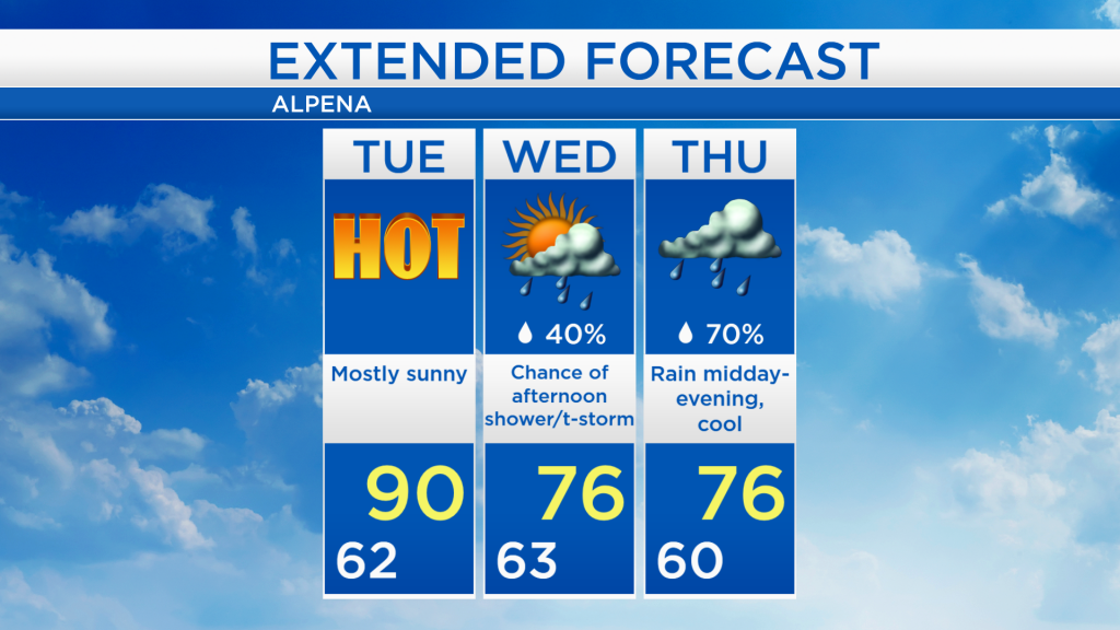
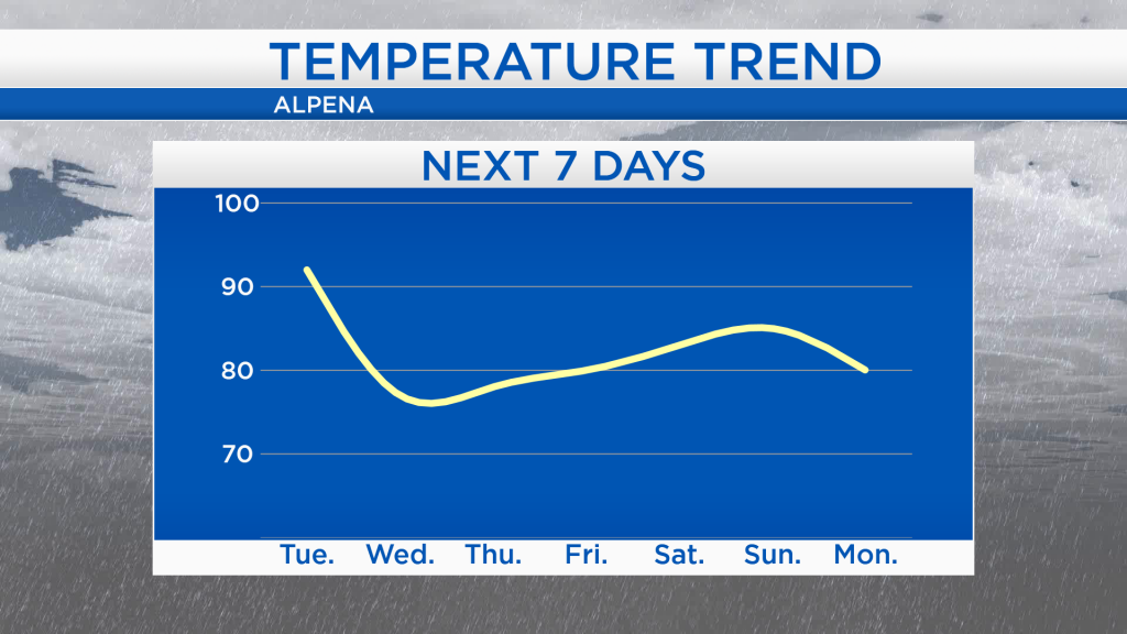
Tomorrow will be a scorcher with highs reaching 90 degrees in the afternoon. The cold front of the low pressure system from South Dakota will bring colder temperatures Wednesday and Thursday with afternoon highs in the 70s. After that, temperatures will gradually warm heading into the upcoming weekend.
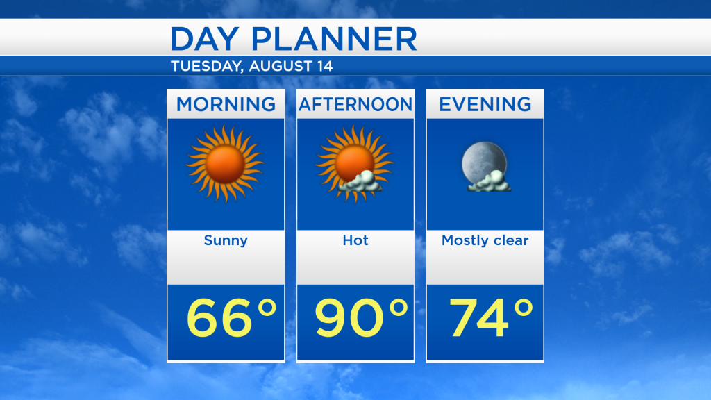
Tomorrow morning will start comfortably warm with temperatures in the mid-60s and sunny skies. Temperatures will heat up to around 90 degrees in the afternoon. Mostly clear skies and warm temperatures, gradually easing into the mid-70s, will continue into the evening.
After tomorrow’s unseasonable heat, a chance of scattered showers will enter the area Wednesday afternoon, including the possibility of a brief thunderstorm. Steadier periods of rain are expected on Thursday with highs in the mid-70s. By the end of the week, dry conditions will return and temperatures will trend upward. For the rest of Northeast Michigan’s weather forecast, watch the latest weather video by clicking the weather tab at the top of the page.