Thunderstorms tonight, then more storms late Tuesday
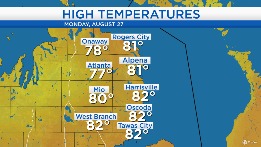
High temperatures today warmed up to the lower 80s across most of Northeast Michigan. Skies were partly cloudy for most of the day, though a few isolated showers moved in this afternoon.
We are in the midst of a warm, muggy and buoyant air mass ahead of a cold front currently crossing through Minnesota. A round of thunderstorms is forecast to move through our area after midnight tonight, then another round of thunderstorms tomorrow evening.
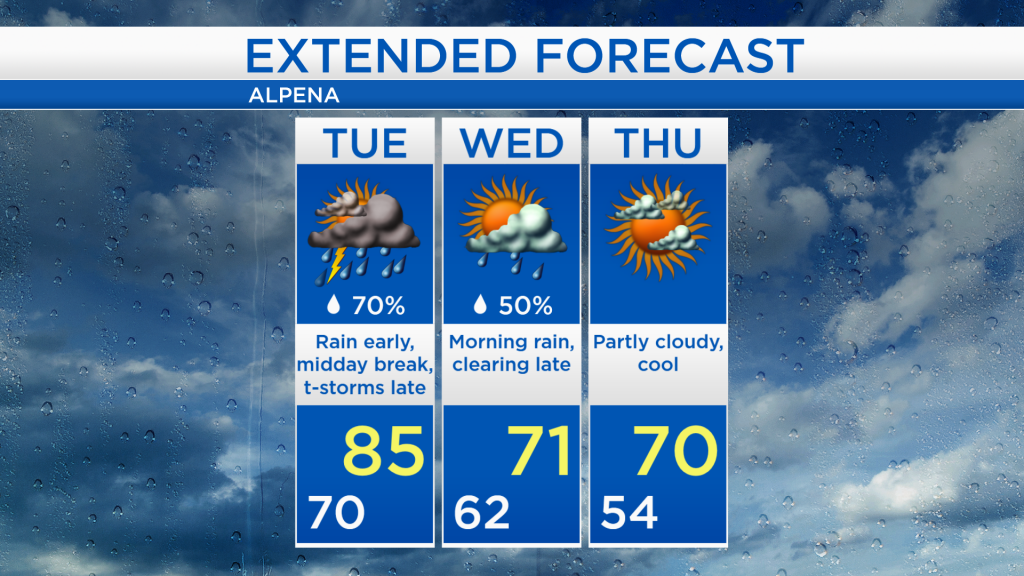
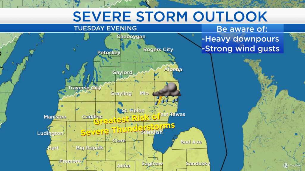
Thunderstorms tonight should generally remain below severe storm criteria. Some periods of dry weather are forecast tomorrow midday. The Storm Prediction Center of the National Weather Service has included much of Northeast Michigan in a risk of severe thunderstorms for tomorrow evening. The main weather hazards to be aware of are heavy downpours and strong wind gusts.
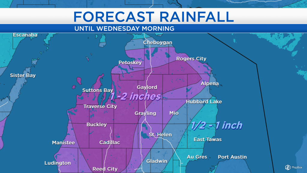
The rainfall forecast shown below includes any rain beginning tomorrow evening through early Wednesday. Much of northern Michigan is forecast to receive 1-2 inches of rainfall. About half of the total rainfall forecast shown will be produced by thunderstorms late tomorrow.
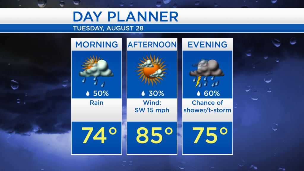
After a round of thunderstorms tonight, some showers may last into tomorrow morning. Temperatures tomorrow afternoon will warm to a high of 85 degrees, and the midday-afternoon hours should be mostly rain-free with a mix of sun and clouds. Then, another round of thunderstorms will move in tomorrow evening — including the risk of severe weather.
After strong storms tomorrow evening, the weather will gradually dry out late Wednesday. Much cooler temperatures will move in beginning on Wednesday, high temperatures are forecast to reach only into the lower 70s Wednesday and Thursday. For the rest of Northeast Michigan’s weather forecast, watch the latest weather video by clicking the weather tab at the top of the page.