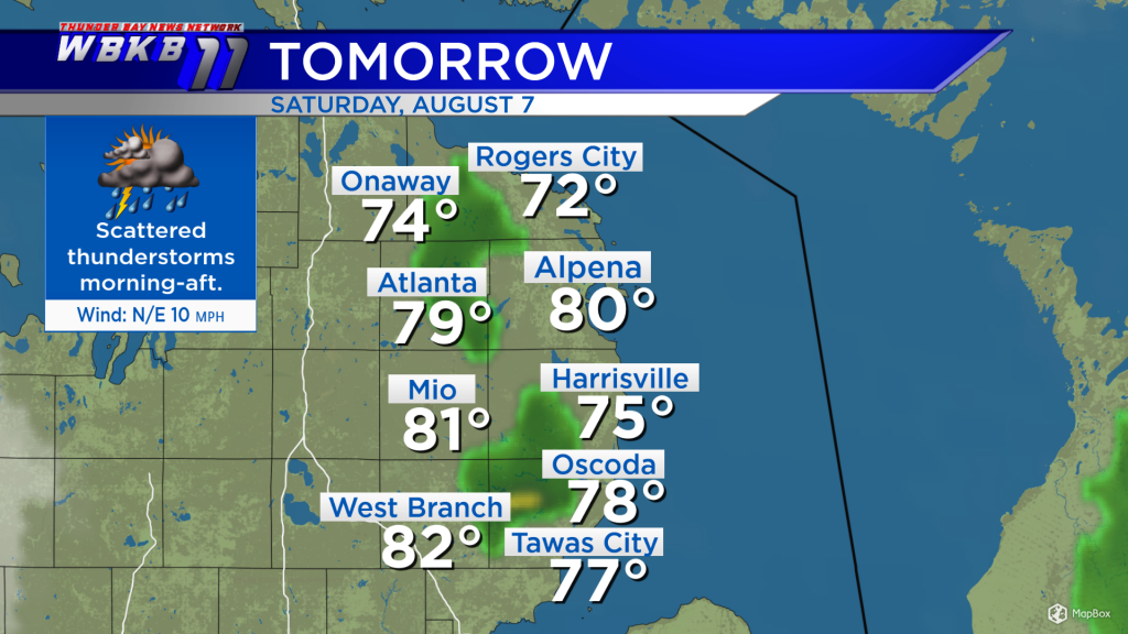
Thunderstorm chances continue over the weekend with high humidity
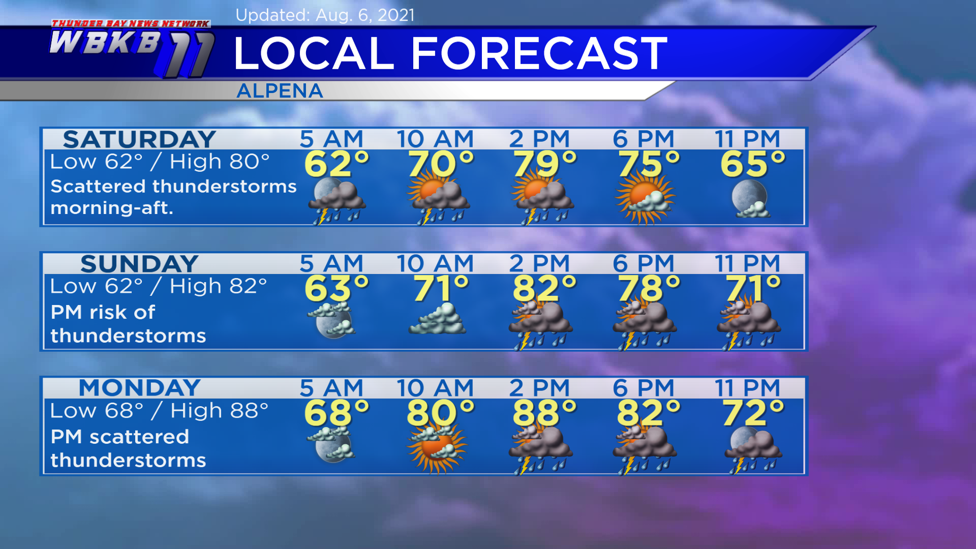
Two disturbances will affect the weekend forecast. The first is already producing scattered showers/thunderstorms over the Great Lakes region. Chances of scattered thunderstorms will continue into Saturday. Then we should get a break of drier weather Saturday evening to Sunday midday. The next storm system is giving rainy weather to parts of Montana, Wyoming, North Dakota and South Dakota. This second disturbance will move in Sunday, providing rain/thunderstorms chances Sunday afternoon and evening.
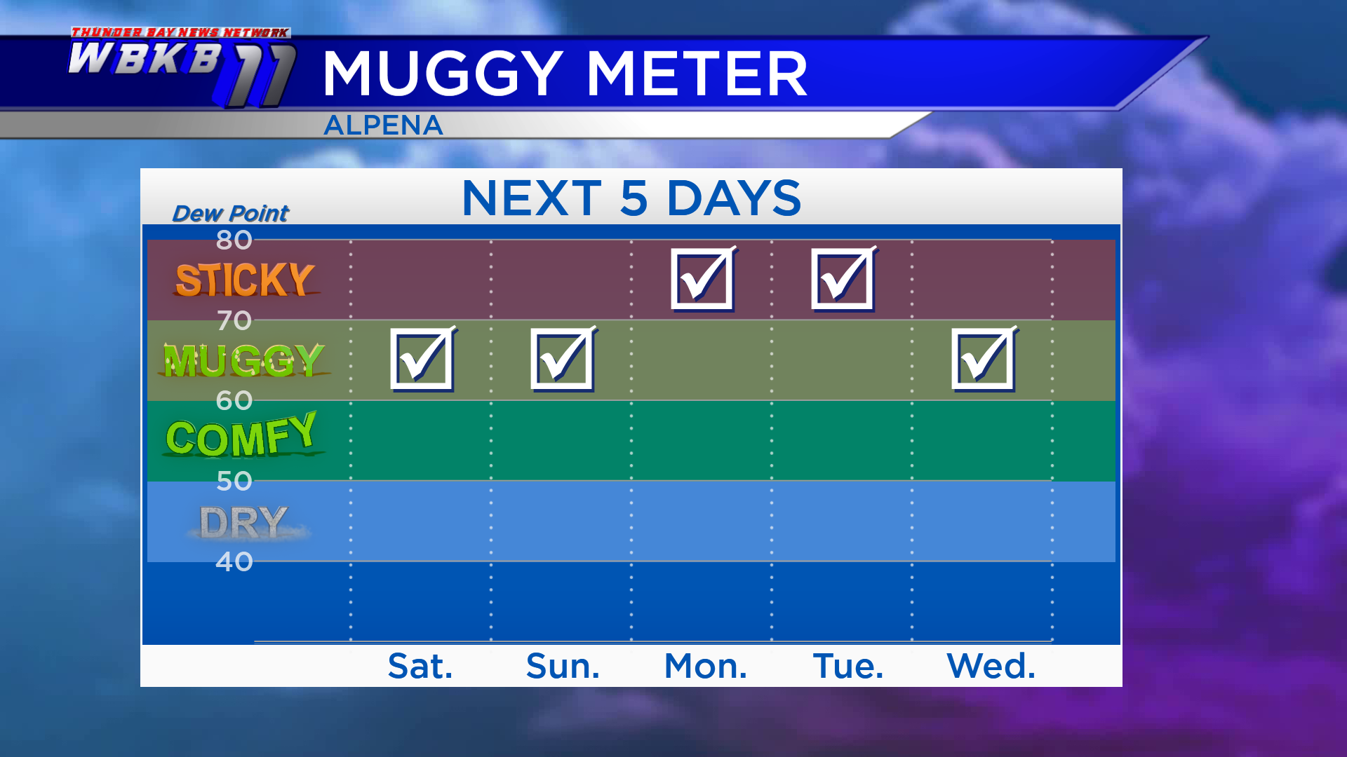
It’s going to feel muggy over the weekend with dew points in the 60s. Dew points will rise to near 70 or the lower 70s Monday and Tuesday, so it will feel even more sticky early next week.
Saturday: Scattered thunderstorms in the morning-afternoon, then drier in the evening. Early-morning lows will head down to about 62 degrees. Afternoon highs will get up to near 80 degrees. Evening temperatures will go from the lower 70s to upper 60s.
Sunday: Dry early, then a chance of spotty thunderstorms in the afternoon-evening. Early-morning temperatures will begin with lows close to 62 degrees. Afternoon highs will reach around 82 degrees. Evening temperatures will head into the 70s.
Monday: Scattered thunderstorms in the afternoon-evening, and feeling steamy. Predawn lows will start off in the upper 60s. Afternoon highs will warm to about 88 degrees. Evening temperatures will continue to feel very warm in the lower 80s and 70s.
For the rest of Northeast Michigan’s weather forecast, watch the latest weather video by clicking the weather tab at the top of the page.


