Temperatures get warmer Saturday; Watching potential snowfall Monday
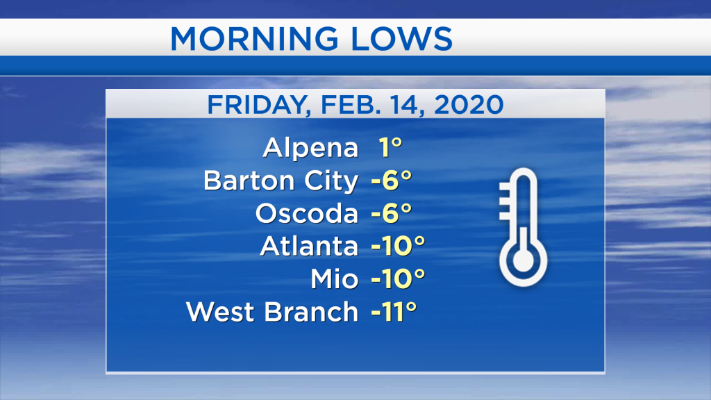
An arctic air mass settled over our area last night. An area of high pressure that originated in Northwestern Canada brought very cold air as it moved into the Midwest. Friday morning started with lows of 1 degree in Alpena, -6 degrees in Oscoda, and -10 degrees in Mio.

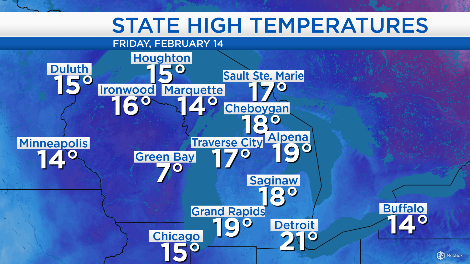
High temperatures today reached the upper teens in much of Northern Michigan. Well to the west, significantly warmer temperatures (above freezing) are moving through the Plains and on the way toward our area. Northeast Michigan will likely not get above the 32 degree mark, but it will be noticeably warmer this weekend.
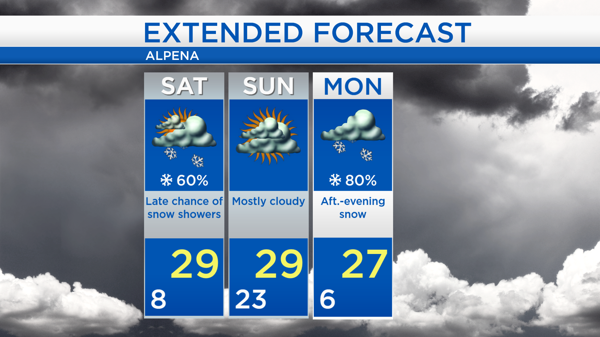
Dry weather extends well to our west and tonight will be partly cloudy, then more cloud cover is on the way for tomorrow. Snow showers currently over Montana will scurry to the east, and Northeast Michigan will have a chance of light snow showers late Saturday. Most of Sunday is looking dry.
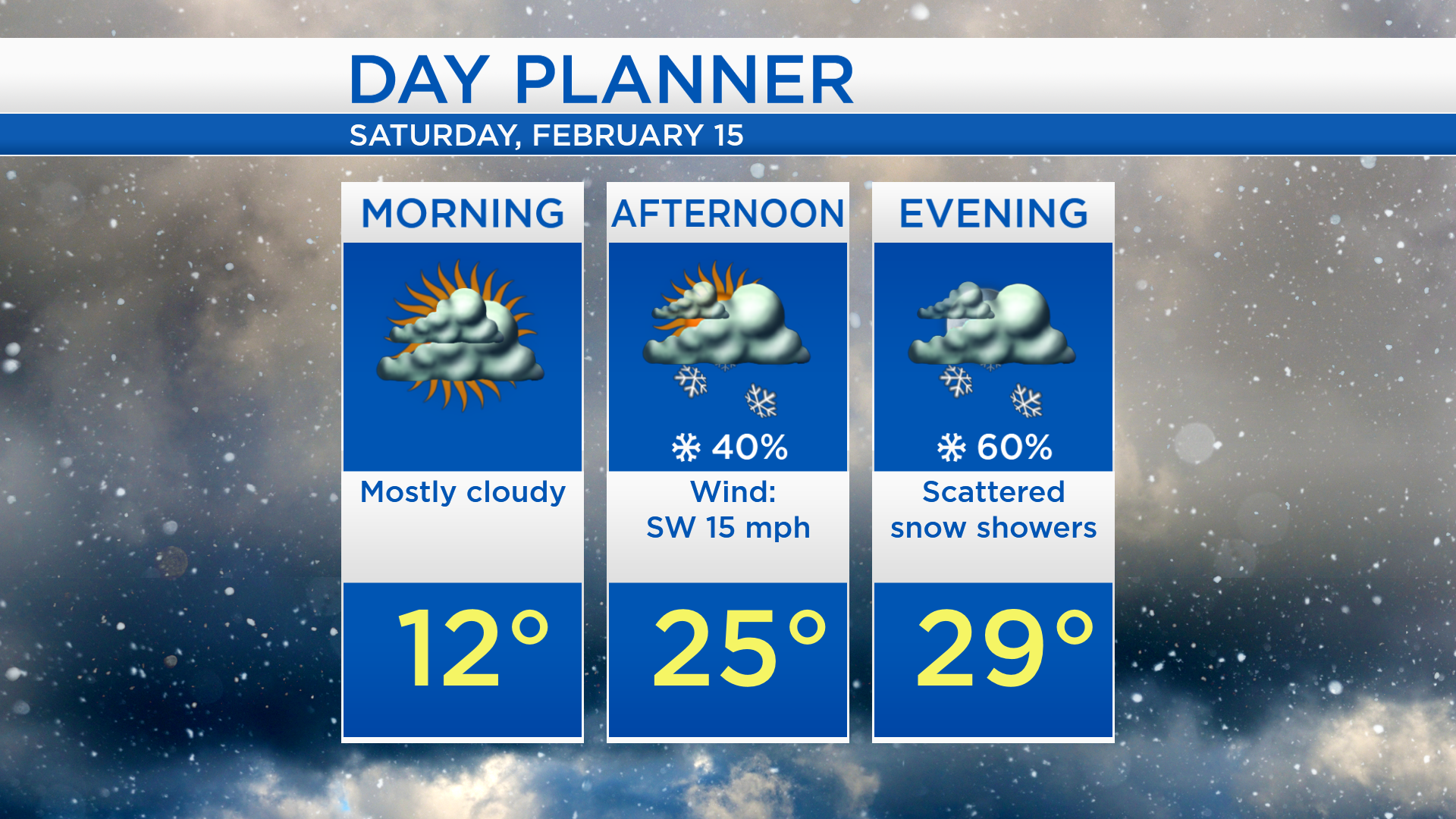
Overnight lows will dip to about 8 degrees. Morning temperatures will climb to the lower teens with mostly cloudy skies. In the late-afternoon and evening, a few snow showers are possible. A breeze from the southwest will bring warmer temperatures to our area. High temperatures will reach about 29 degrees — likely happening after sunset.
Highs will reach the upper 20s this weekend. Saturday will like start dry, then a scattered snow showers are possible late. Sunday will start with mild temperatures, highs will reach the upper 20s. Then temperatures will drop to the single digits early Monday. Monday will start with mostly cloudy skies, then snow will become likely in the afternoon-evening. A wintry mix is possible early Tuesday. For the rest of Northeast Michigan’s weather forecast, watch the latest weather video by clicking the weather tab at the top of the page.