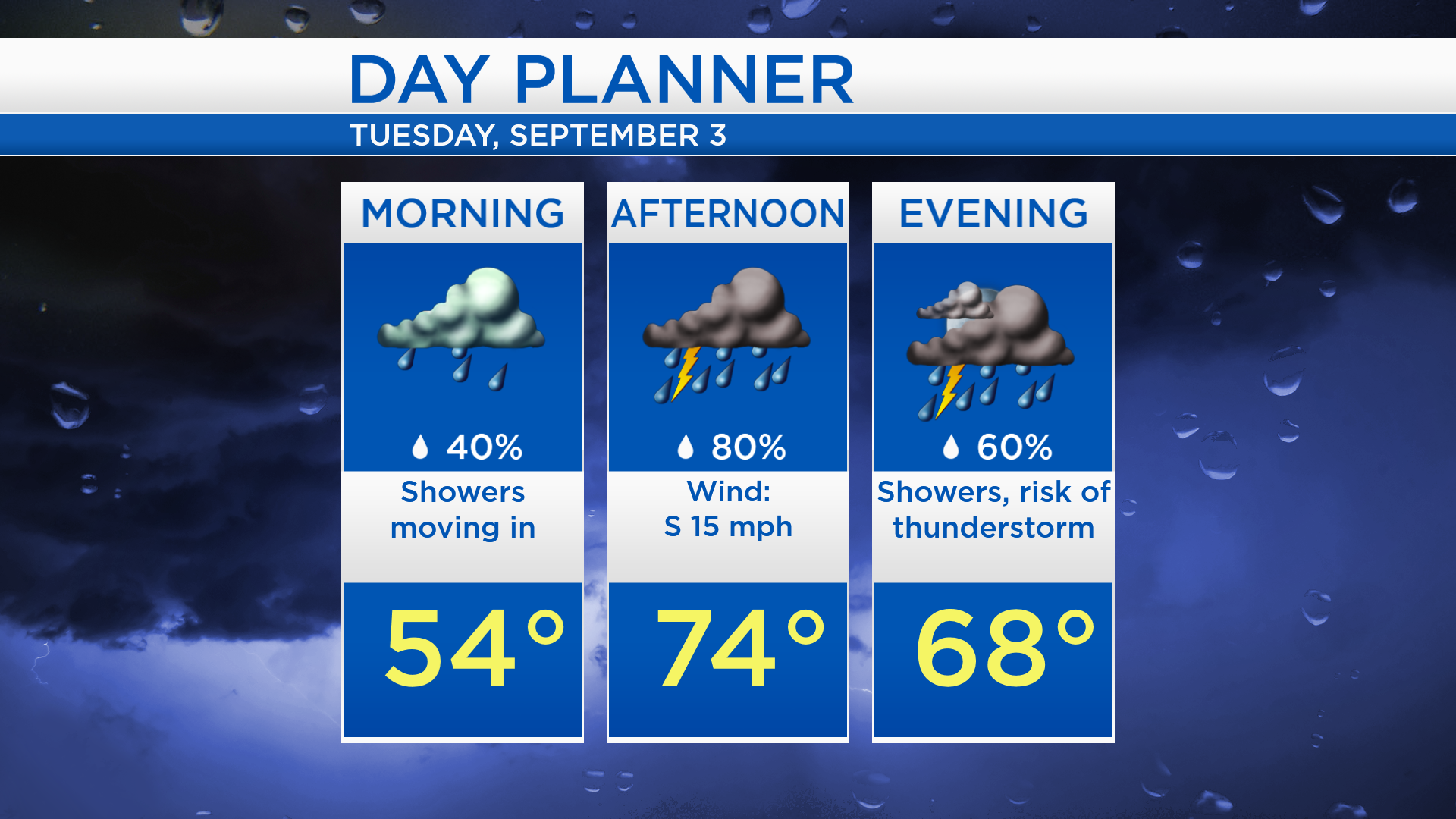
Stormy Tuesday afternoon; Cooler and brightening Wednesday

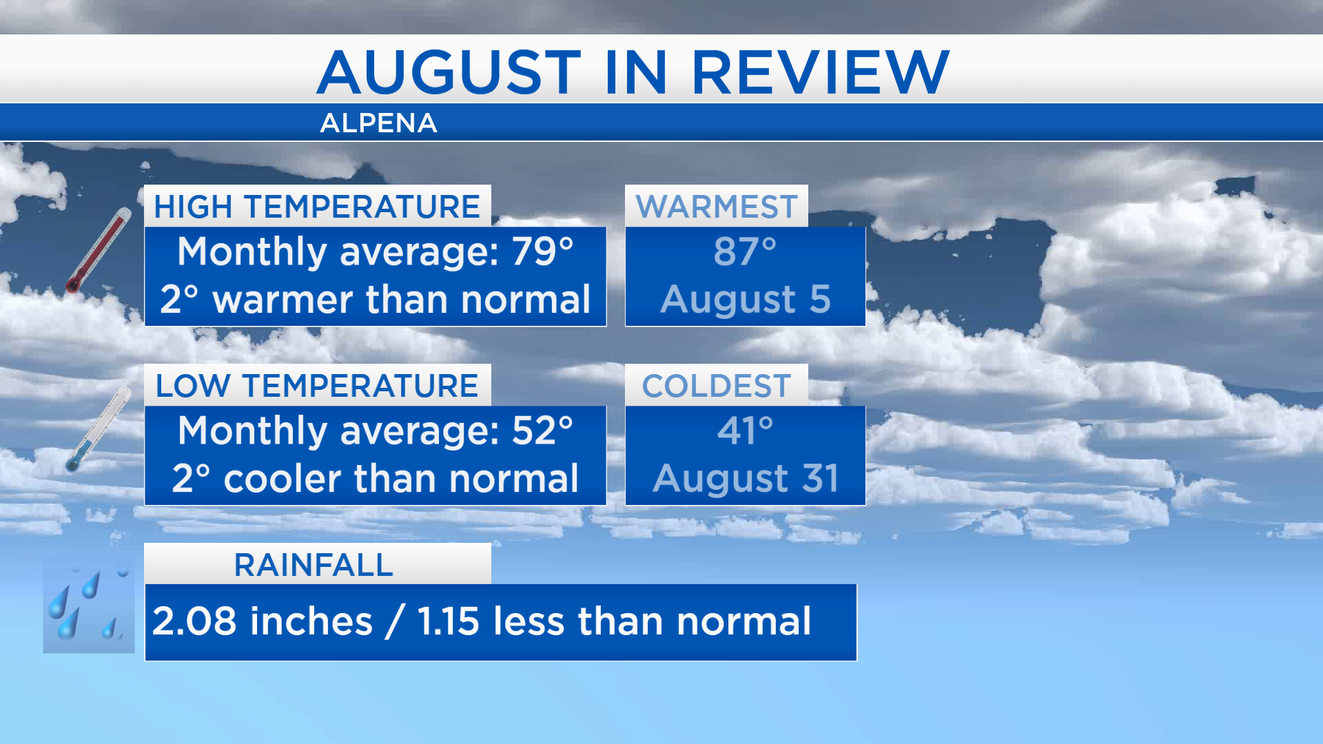
Firstly, reviewing August: High temperatures throughout the month averaged to 79 degrees, which is 2 degrees warmer than the long-term normal. Low temperatures averaged 52 degrees which is 2 degrees cooler than normal. The dry trend from July continued into August, rainfall measured about 1 inch less than normal.
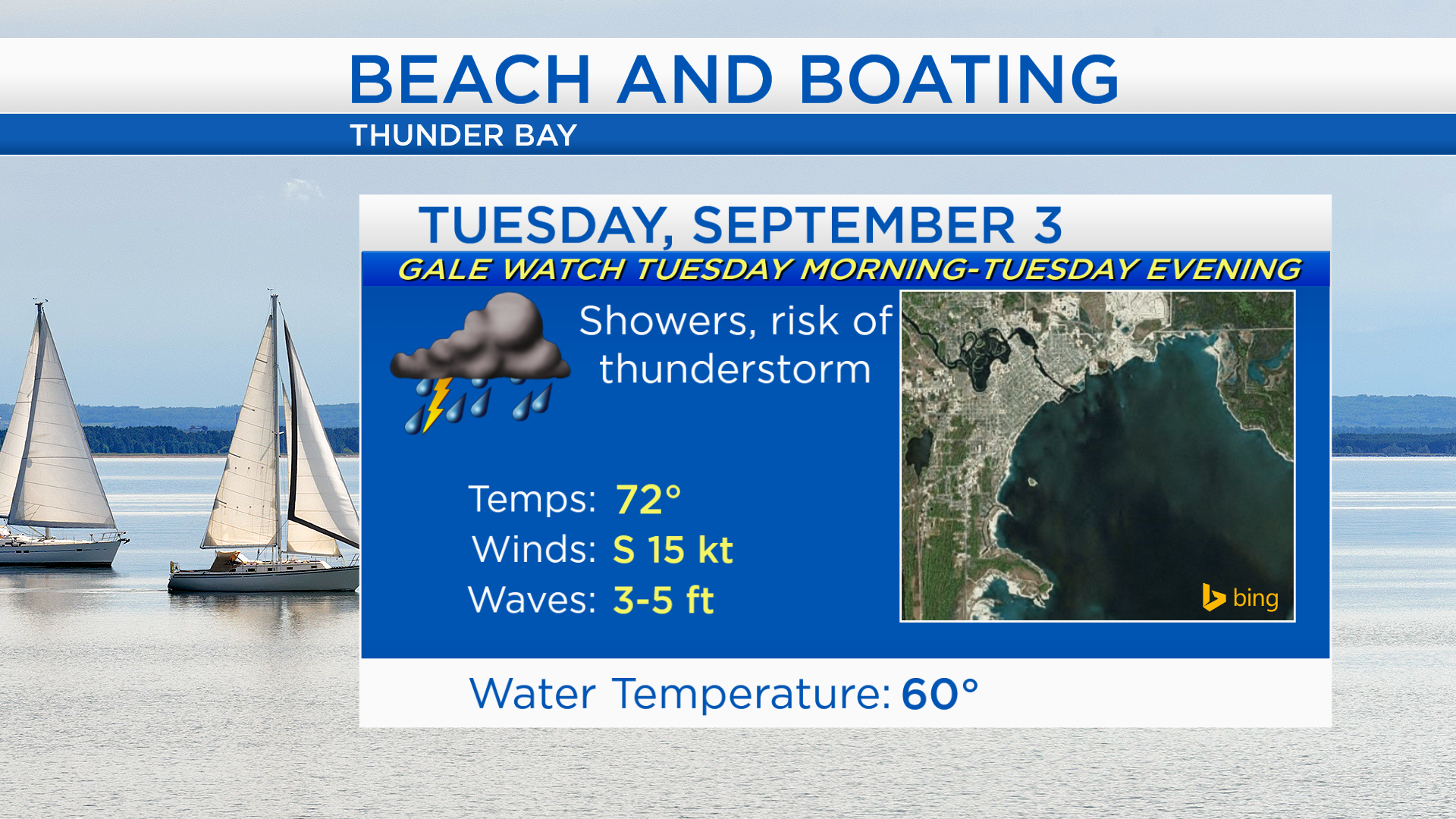
Temporary clearing will take place through tonight. A storm system currently producing gusty winds, lightning and hail over North Dakota will move eastward. Showers will arrive in our area tomorrow late-morning or midday. Rain is likely tomorrow afternoon, downpours and thunderstorms could continue into the evening.
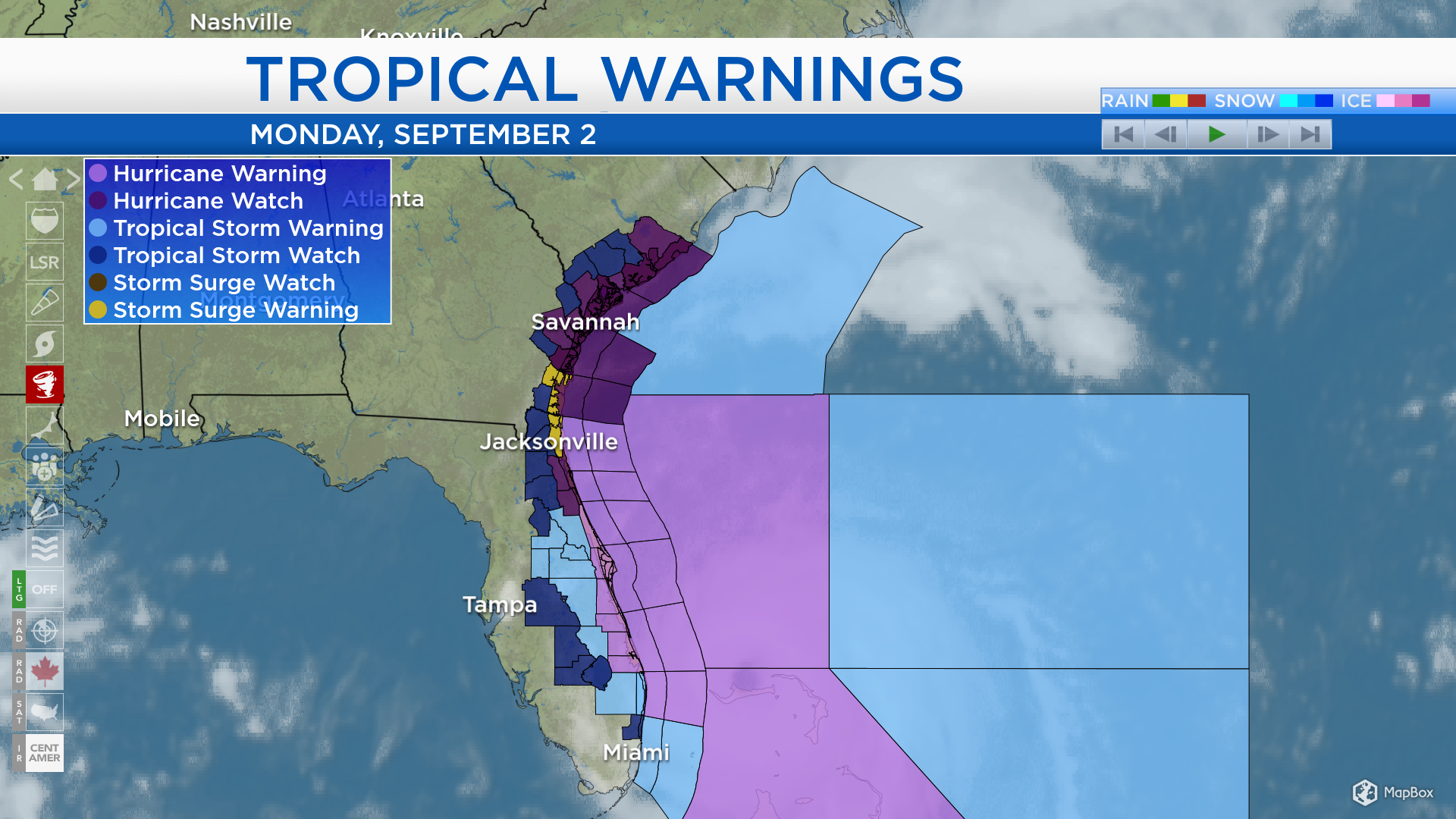
Hurricane Dorian has slightly weakened to a category 4 hurricane, producing winds about 140 mph in the strongest part of the storm. It had reached category 5 status over the weekend. It is spreading scattered showers and thunderstorms over parts of Florida, where conditions will worsen over the next 24-36 hours. Hurricane warnings (light purple) are in effect for portions of the east coast of Florida. Hurricane watches (dark purple) extend north along the coastlines of Florida, Georgia and South Carolina. The storm will move extremely slowly as it turns northward. The latest forecast track keeps the center of Dorian slightly offshore — regardless, areas along the coast will get battered by hurricane conditions.
Low temperatures tonight will cool to the upper 40s with partly cloudy skies. The storm over the Upper Plains will move into our area, and winds out of the south will pick up tomorrow. High temperatures will reach the middle 70s with rain and thunderstorms likely in the afternoon-evening.
Gusty winds and stormy conditions have caused a Gale Watch to be issued for the near-shore waters of Lake Huron. Tomorrow will not be good for beach and boating activities because of high waves and a risk of thunderstorms.
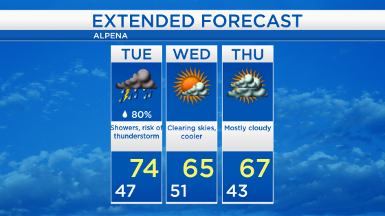
High temperatures will reach close to 74 degrees tomorrow but rain and thunderstorms will be moving through our area. Clearing skies are expected Wednesday, but high temperatures will reach only the middle 60s as winds shift out of the northwest. More cloud cover will move in Thursday as cool temperatures continue. For the rest of Northeast Michigan’s weather forecast, watch the latest weather video by clicking the weather tab at the top of the page.