
Some sun to begin the weekend; Tracking snow to arrive late Sunday
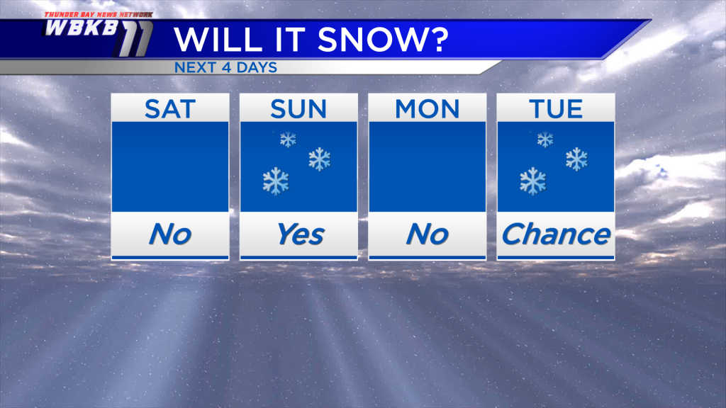
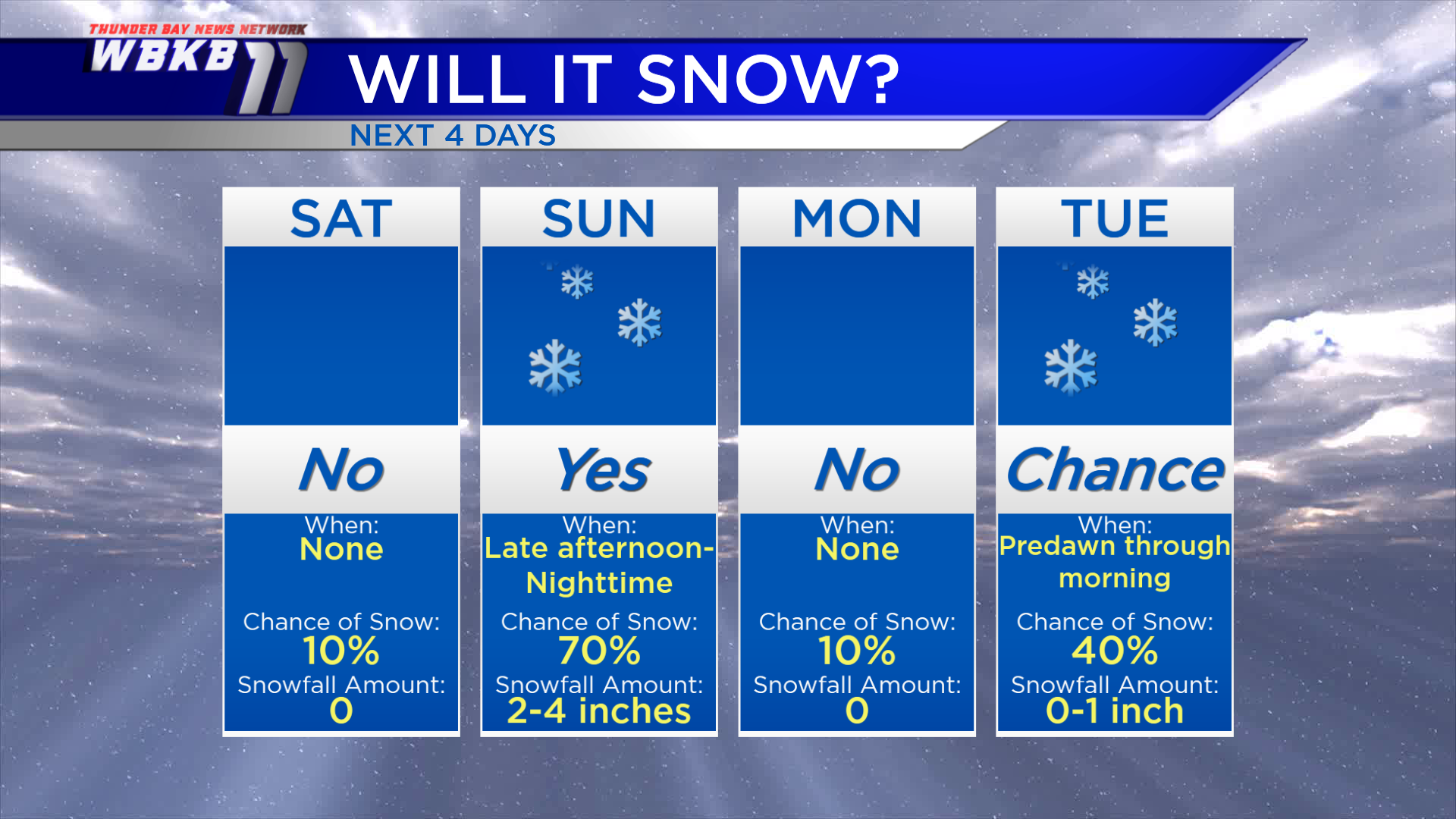
A few scattered snow showers have been moving through northern Michigan today. Those will wind down later tonight, and drier weather will build in. A high pressure system over Kentucky will have a stronger influence on our weather for Saturday. We’ll see some breaks of sun over the first half of the weekend.
After that, our attention turns to a storm system currently centered near the Oregon-Idaho border. That will likely bring snow to Northeast Michigan late Sunday, expect 2-4 inches of fresh snowfall. Dry weather returns on Monday. A weak disturbance could give a chance of a few snow showers early Tuesday with very minor amounts.
Saturday: Mix of sun and clouds. Early-morning low temperatures will be near 8 degrees. Temperatures will climb to about 20 degrees in the late-morning. Afternoon highs will get close to 30 degrees. Evening temperatures will cool from the lower 20s to the upper teens.
Sunday: Starts dry with increasing clouds. Snow moves in late-day or in the evening. The early-morning hours will start quite chilly with lows near 6 degrees. Temperatures will rise to about 20 degrees in the late-morning. Afternoon highs will be around 30 degrees. Evening temperatures will be in the 20s.
Monday: Drying out and getting warmer. Early-morning temperatures will begin in the 20s. Afternoon highs will reach close to 36 degrees. Evening temperatures will be in the lower 30s.
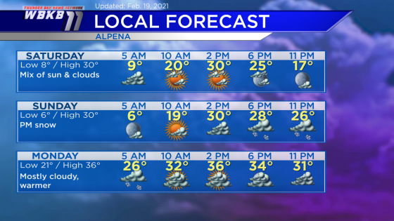
Temperatures will likely get a few degrees warmer on Tuesday. For the rest of Northeast Michigan’s weather forecast, watch the latest weather video by clicking the weather tab at the top of the page.


