Snow tonight-early Tuesday; Warm temperatures Tuesday afternoon
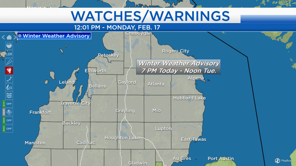
Winter Weather Advisories are in effect for all of Northern Lower Michigan. In Northeast Michigan, the advisory lasts from 7 p.m. Monday evening until 12 noon Tuesday. Total snowfall amounts of 4-6 inches are expected for most of Northeast Michigan. However, less snowfall is possible in Iosco County if mixed precipitation occurs tonight to early Tuesday.
An area of low pressure over Iowa will move through Northern Michigan, bringing snowfall this evening through Tuesday morning. Most of the area is expected to remain cold enough for an all-snow event. Areas near Saginaw Bay have a slightly greater potential to get a wintry mix with low amounts of sleet/freezing drizzle involved, but still mostly snow is expected.
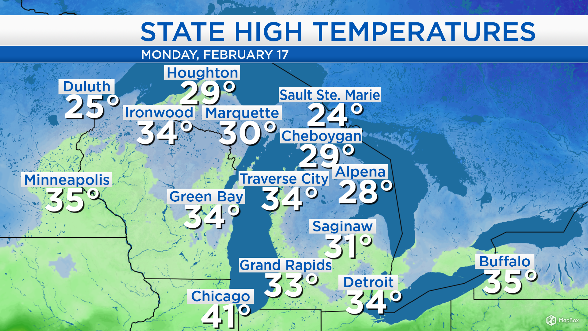
High temperatures today reached the upper 20s in Alpena. But just to our west, temperatures were slightly warmer — highs reached 34 degrees in Traverse City and Green Bay, and highs got up to 41 in Chicago. West winds will carry slightly milder temperatures into our area tomorrow.
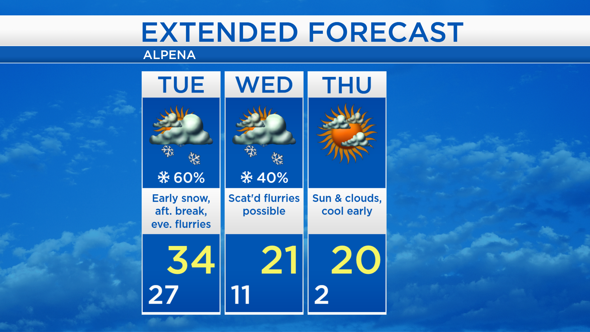
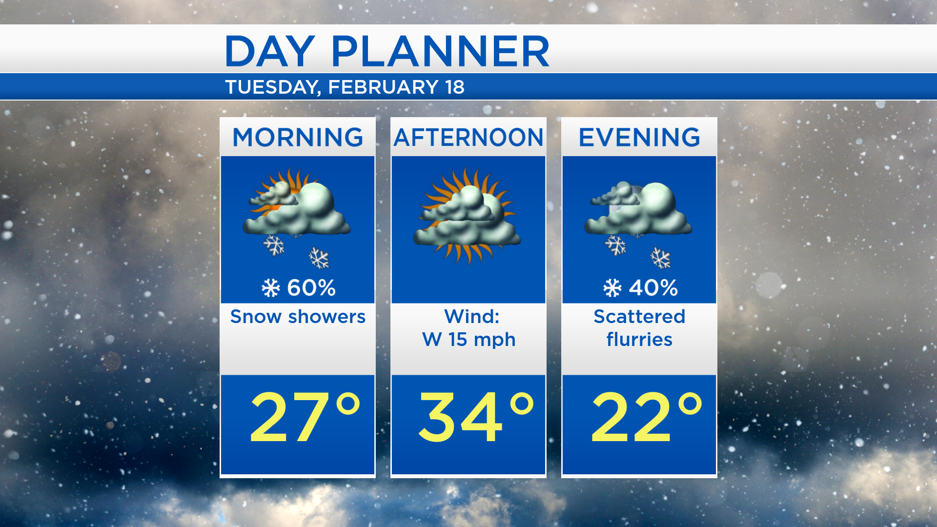
Snow is nearly a guarantee during the overnight period, and lows will be in the upper 20s. Tuesday, the greatest chances of snow will be in the morning. A break of dry weather is expected Tuesday afternoon, and high temperatures will reach about 34 degrees. A breeze from the west could possibly generate a few lake effect flurries drifting off of Lake Michigan Tuesday evening.
Highs will get into the middle 30s on Tuesday. Northwest winds will eventually bring significantly colder air to Northern Michigan. Highs Wednesday afternoon will reach only the lower 20s. Temperatures will get cold early Thursday, starting near 2 degrees. Highs will be close to 20 degrees Thursday afternoon with a mix of sun and clouds. For the rest of Northeast Michigan’s weather forecast, watch the latest weather video by clicking the weather tab at the top of the page.