Snow showers Wednesday but minimal amounts

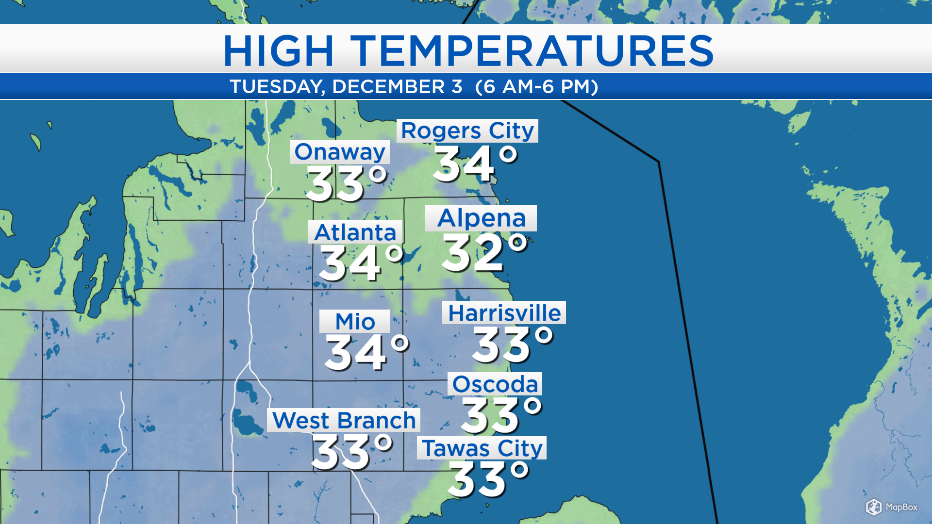
High temperatures today reached the lower to middle 30s, including 34 degrees in Atlanta, 32 degrees in Alpena, and 33 degrees in Oscoda. Temperatures will get just a couple degrees wearmer tomorrow.
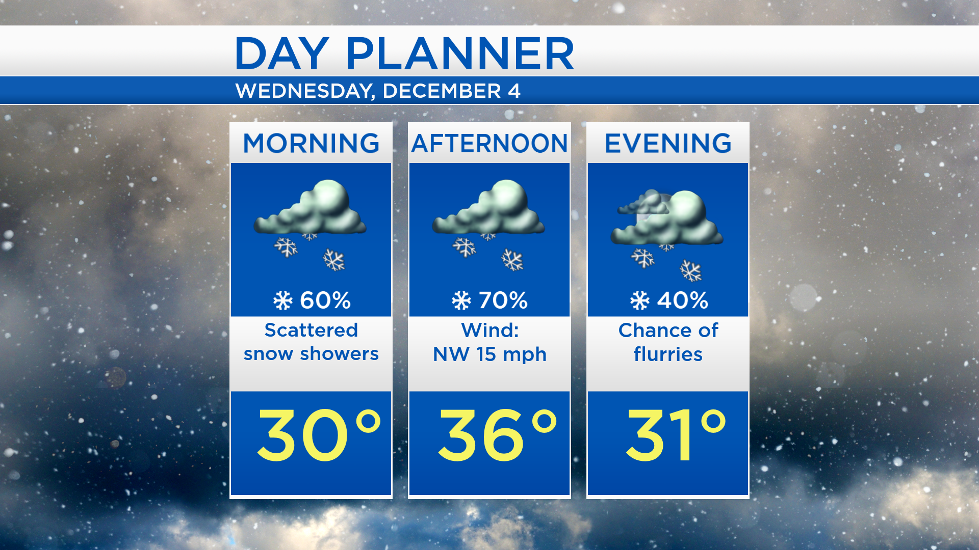
A cold front currently north of Lake Superior is generating some snow showers that are drifting south. In addition, northwest winds tomorrow will help produce lake effect snow (mostly off of Lake Michigan). Scattered snow showers are expected for most of the day. Then drier conditions will move in late tomorrow night and last into the daytime hours of Thursday.
Overnight lows will drop to the upper 20s and a few flurries are possible. Snow showers will extend across much of Northern Michigan on Wednesday. High temperatures will climb a few degrees above the freezing mark which will help to keep snowfall amounts light.
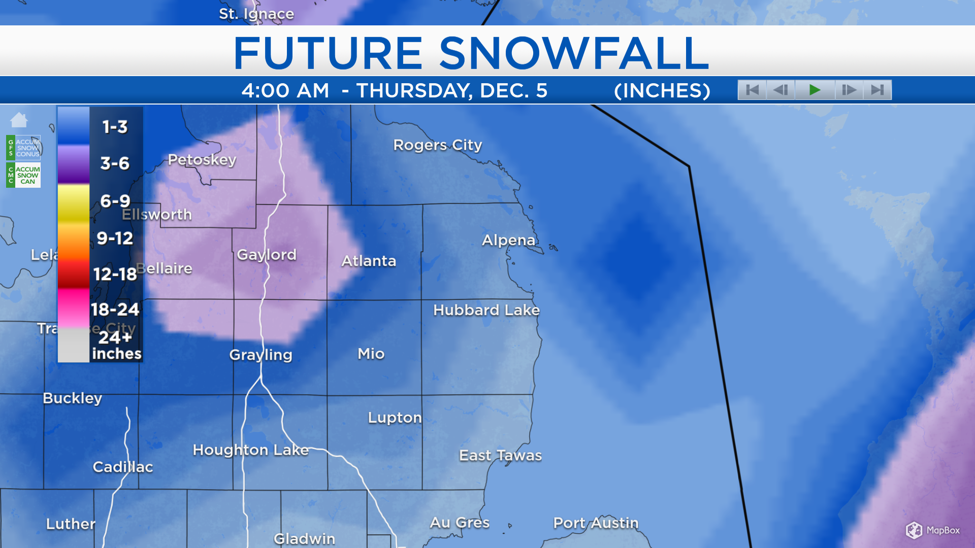
Forecast snowfall totals from tonight through tomorrow night are a trace to 2 inches of snow for most of Northeast Michigan, shown in blue. Greater amounts are shown in purple — areas near and west of I-75 could get 3-6 inches of snow.
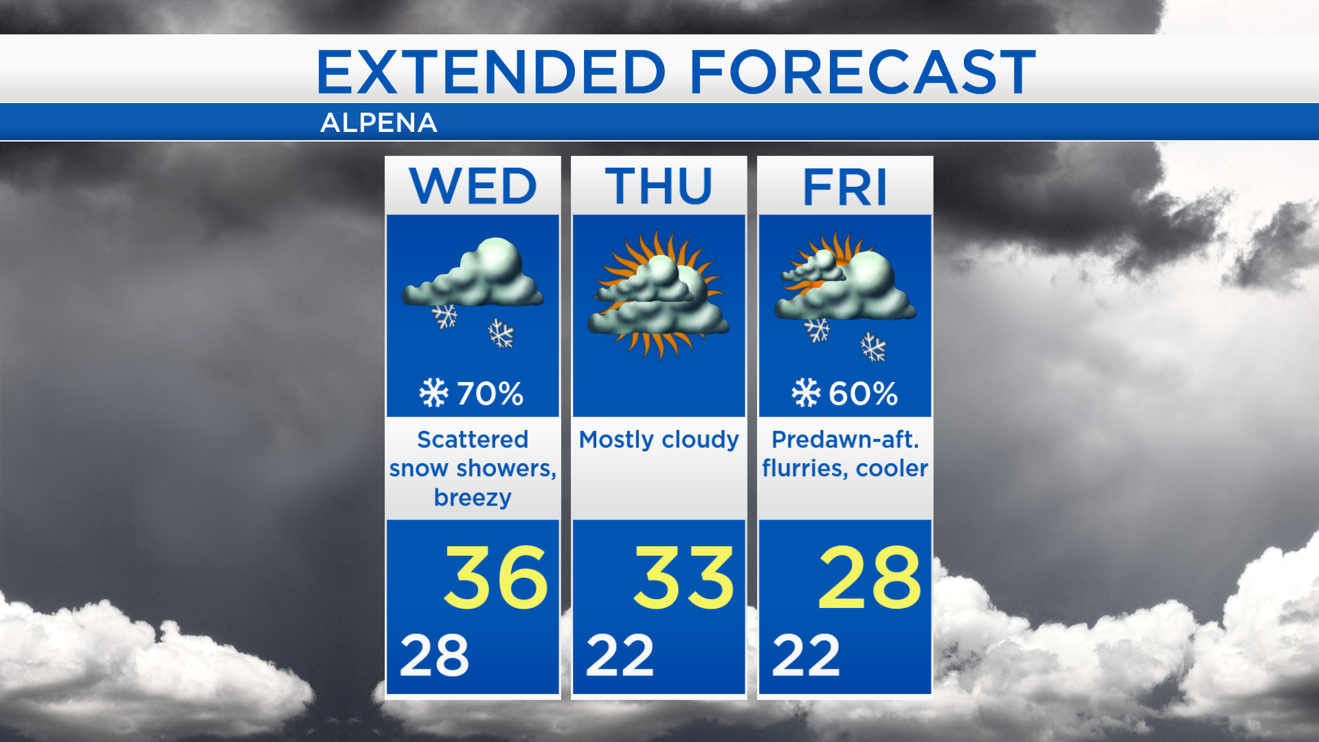
High temperatures will climb to about 36 degrees on Wednesday with scattered snow showers. The chance of flurries will decrease tomorrow evening, and temperatures will cool to the lower 20s by early Thursday. Mostly cloudy skies are expected during the daytime hours of Thursday and afternoon highs will reach close to 33 degrees. Another round of flurries will be possible late Thursday night to Friday afternoon. Over the weekend, Saturday will be dry and cold, then Sunday is looking more unsettled with mixed precipitation changing to rain. For the rest of Northeast Michigan’s weather forecast, watch the latest weather video by clicking the weather tab at the top of the page.