Snow showers north and west tomorrow; Widespread snow likely Friday
High temperatures today reached the lower 50s in Alpena, though it was tough to enjoy with periods of rain throughout the day. Off to the west, much colder temperatures will gradually enter Northern Michigan, with a downward trend in afternoon highs for the rest of this week.
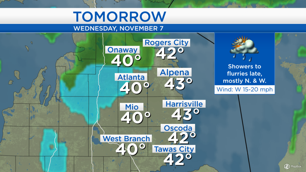
The low pressure center has moved to the east of our area, and the remaining rainfall is wrapping around the counterclockwise flow. In Northern Minnesota and North Dakota, the precipitation type has changed over to snow. Where precipitation will fall tomorrow, mainly north and west of Alpena, snowflakes will likely mix in.
For tomorrow, most of the shower activity is expected to remain to the north and west of Alpena. Areas from Harrisville to Tawas City should see mainly dry conditions, while a few more raindrops will fall around Atlanta and Onaway. High temperatures should reach 43 degrees in Alpena tomorrow, with a stiff breeze from the west at 15-20 mph.
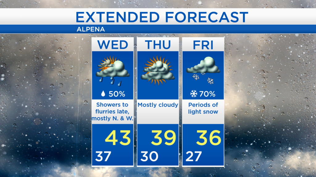
High temperatures will reach the lower 40s tomorrow, then by the end of the week, much colder air will move into the area. For Friday and the upcoming weekend, afternoon highs will reach only the mid-30s.
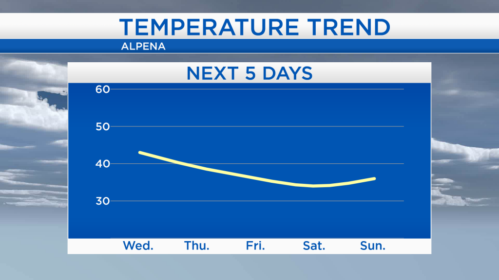
Depending on where you are in Northeast Michigan, areas south of Alpena will see mostly dry conditions tomorrow, while the chance of showers is higher to the northwest. Thursday should be mostly dry for everyone in Northeast Michigan with high temperatures close to 40 degrees. Starting on Friday, afternoon highs reaching the 30s will continue for several days. Also on Friday, periods of snow are likely across the area. For the rest of Northeast Michigan’s weather forecast, watch the latest weather video by clicking the weather tab at the top of the page.