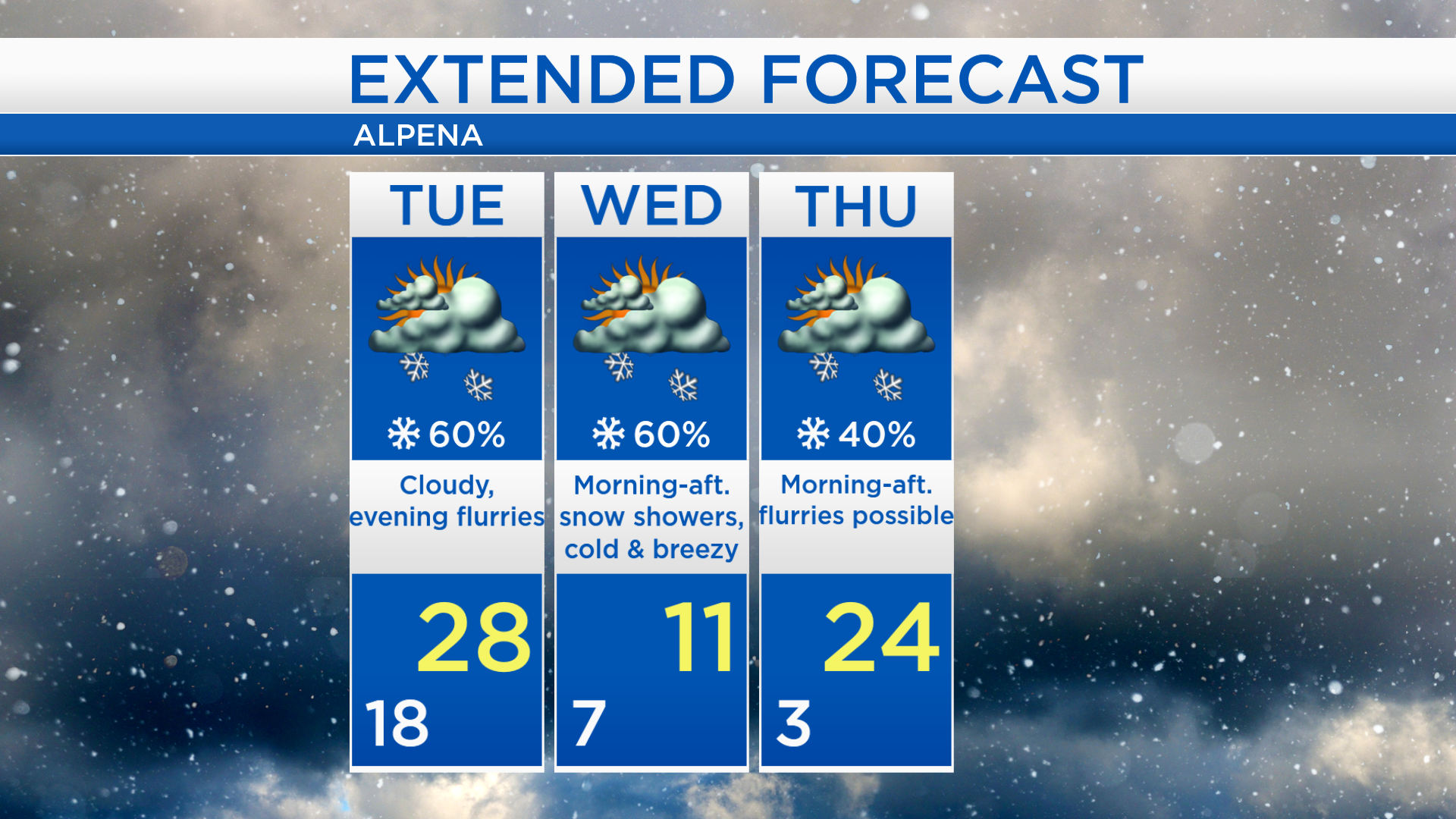
Snow showers beginning late Tuesday; Bitter cold air moving in
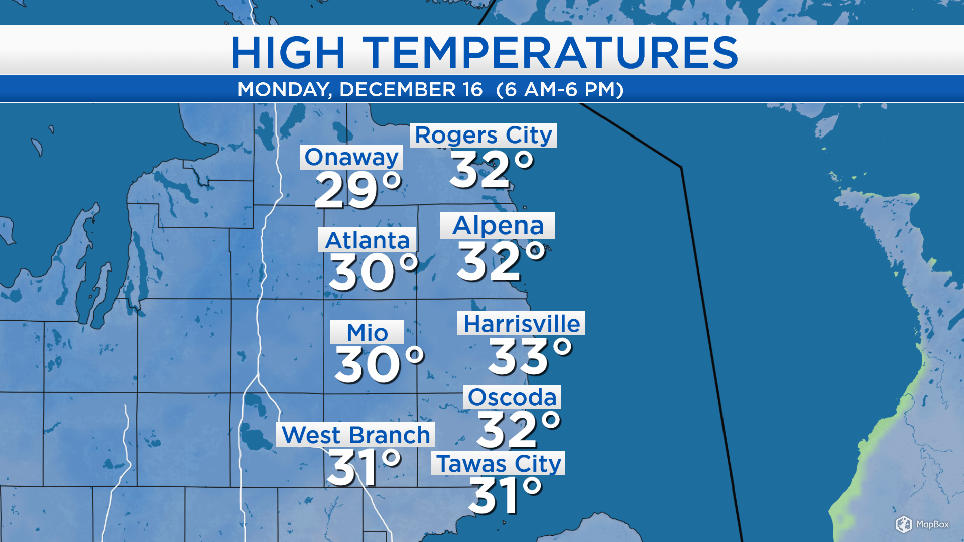
High temperatures today reached the lower 30s, a few breaks of afternoon sunshine and a light breeze from the southwest helped boost temperatures to near-normal values. A cold front dropping out of central Canada will bring a chance of flurries, and temperatures will crash Tuesday night.
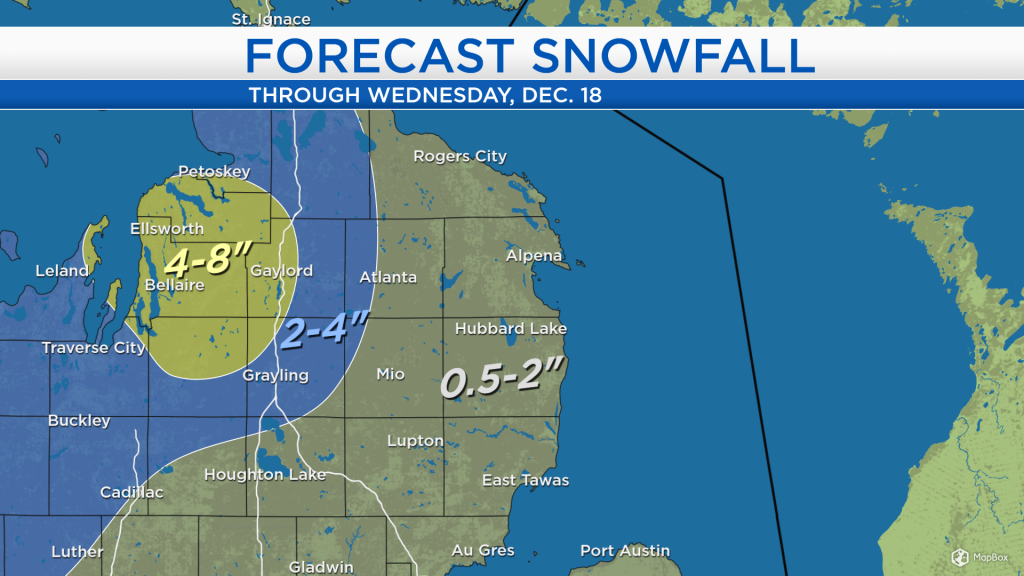
A chance of snow showers will begin Tuesday evening evening and last until Wednesday afternoon. Snowfall amounts will be light on the eastern side of the state. Lake effect snow off of Lake Michigan on Wednesday will give heavier amounts near and west of I-75. Areas between Kalkaska and Charlevoix could get 4-8 inches of snow. Near Lake Huron, lower amounts of snow are expected, totaling 0.5-2 inches.

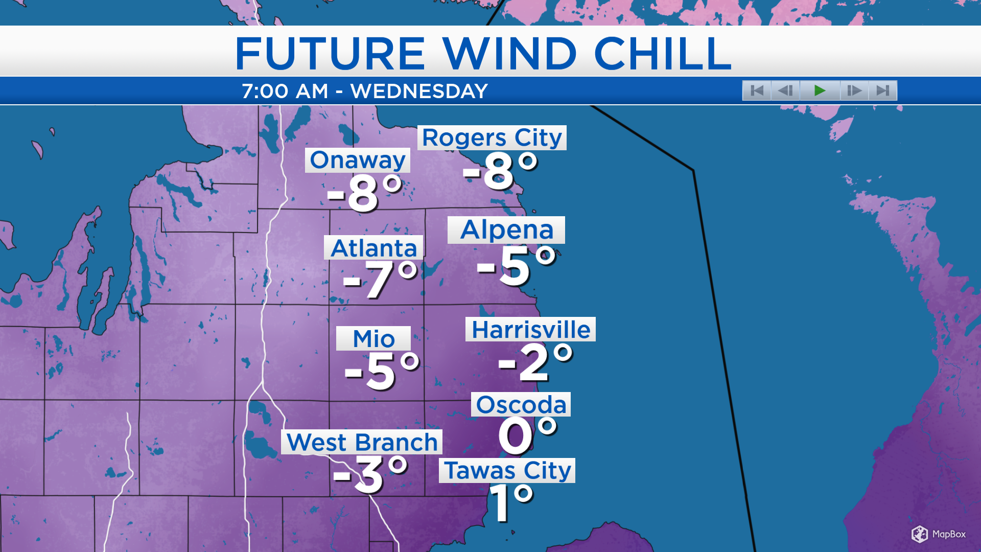
Wind chills will remain in the teens and 20s until Tuesday afternoon. After the cold front moves through, temperatures will drop to the single digits early Wednesday, and wind chills will drop below zero. It will feel extremely cold early Wednesday, so try to avoid having any exposed skin while outside.
Tuesday will start with early-morning lows near 18 degrees and cloudy skies. High temperatures will reach about 28 degrees and flurries will be possible in the evening. Highs Wednesday afternoon will reach only about 11 degrees with stronger winds. Snow showers off of Lake Michigan will be possible in the morning and afternoon. Thursday should be drier, and temperatures will go on a warming trend late-week. Highs will reach the middle 20s on Thursday, and lower to middle 30s Friday. For the rest of Northeast Michigan’s weather forecast, watch the latest weather video by clicking the weather tab at the top of the page.