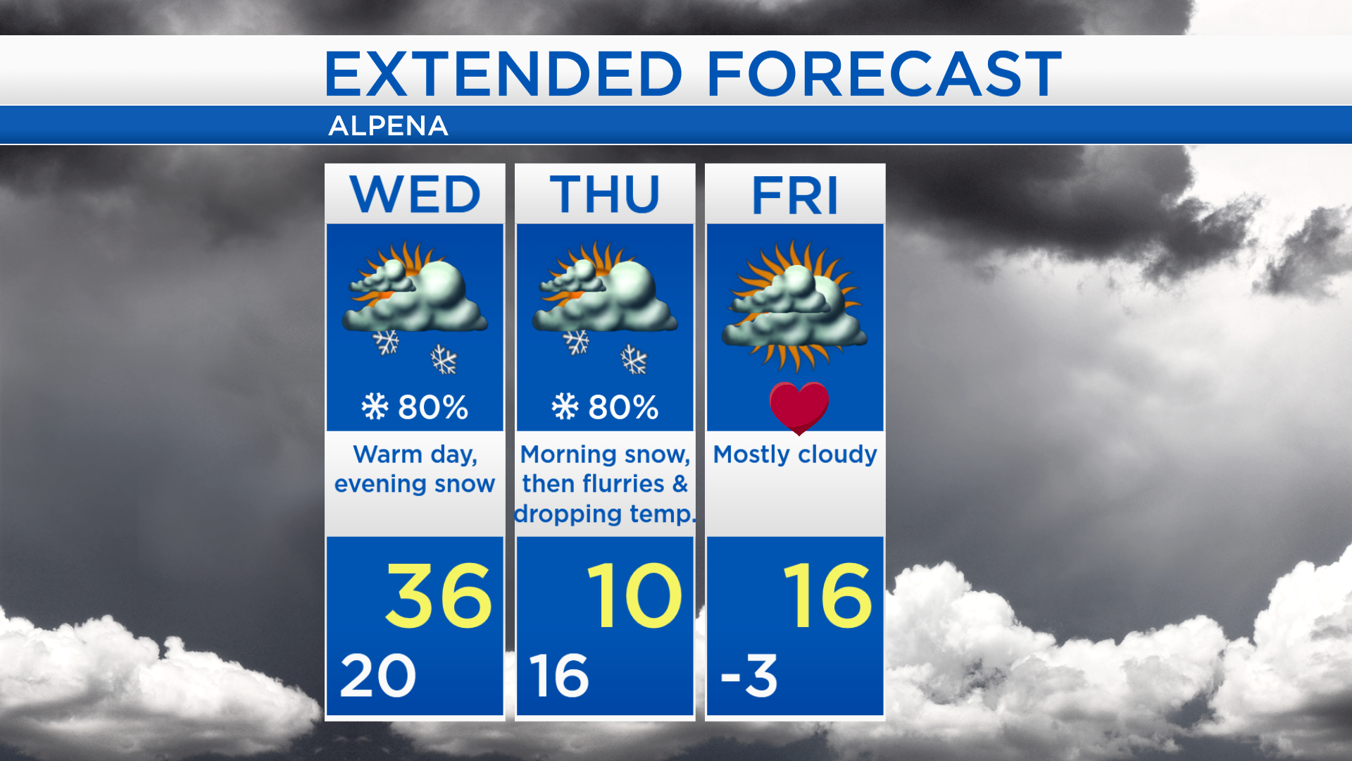
Snow moving in late Wednesday; Arctic blast Thursday
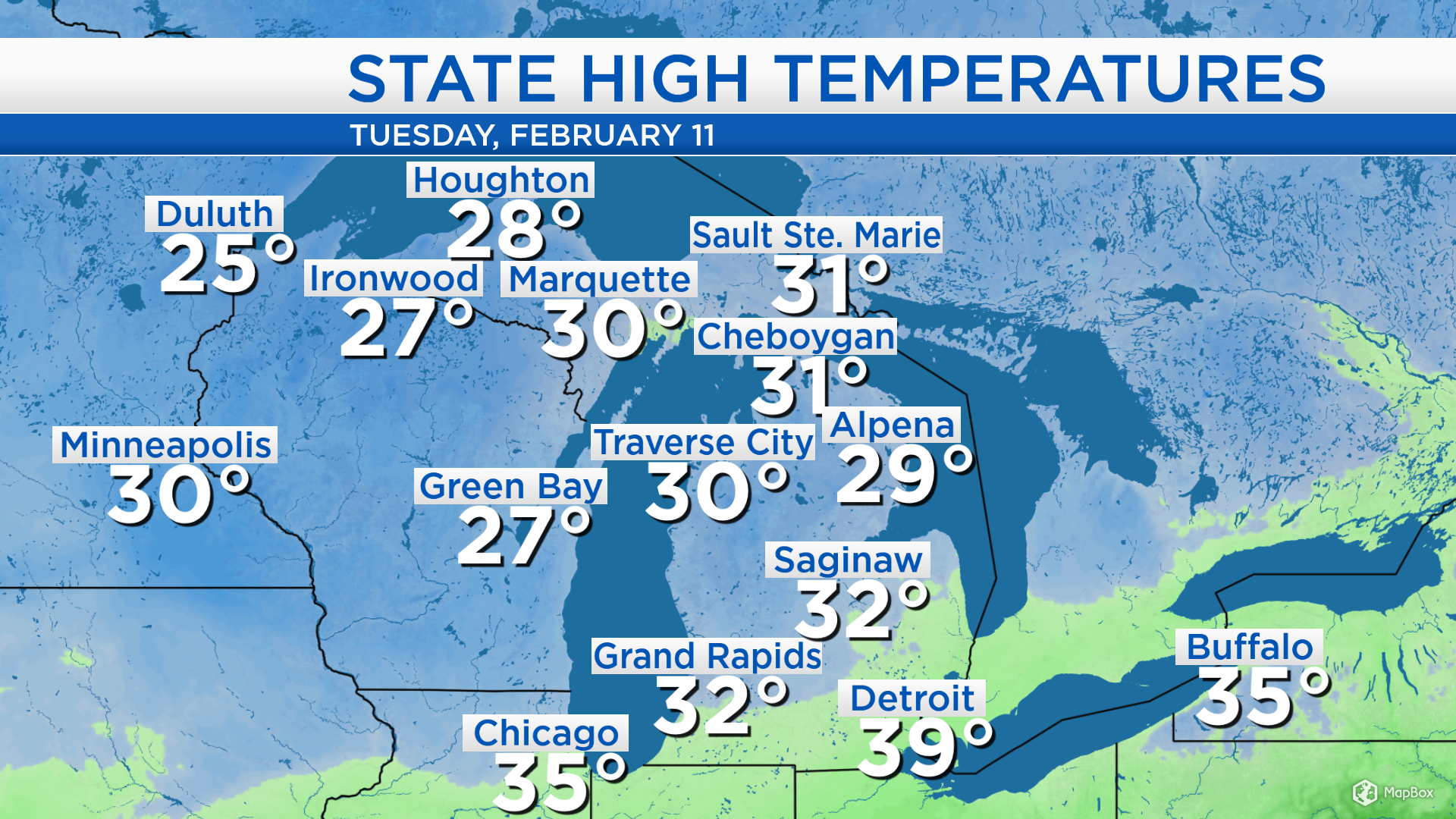
High temperatures today reached 29 degrees in Alpena, 30 in Traverse City and 32 in Saginaw. Brisk winds out of the southwest will bump up high temperatures by a few degrees tomorrow. Then a cold front coming out of central Canada will move through Northern Michigan late Wednesday.
This cold front over central Canada will bring a likely chance of snow beginning late Wednesday evening and continuing into Thursday morning. Following the cold front, temperatures will plummet Thursday with scattered flurries throughout the day. Also, Friday will start with bitter cold temperatures.
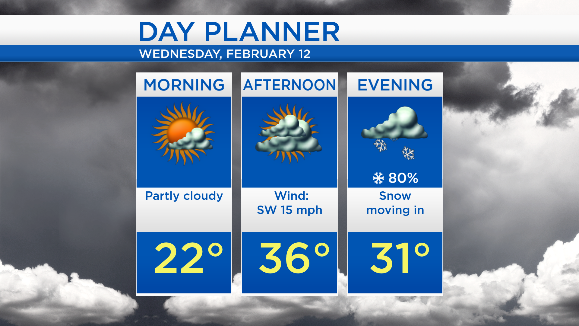
Low temperatures overnight will be near 20 degrees with partly cloudy skies. Tomorrow morning will start partly cloudy and temperatures will be in the lower 20s. Cloud cover will increase tomorrow afternoon and high temperatures will warm to about 36 degrees. Snow will become likely in the late-evening.
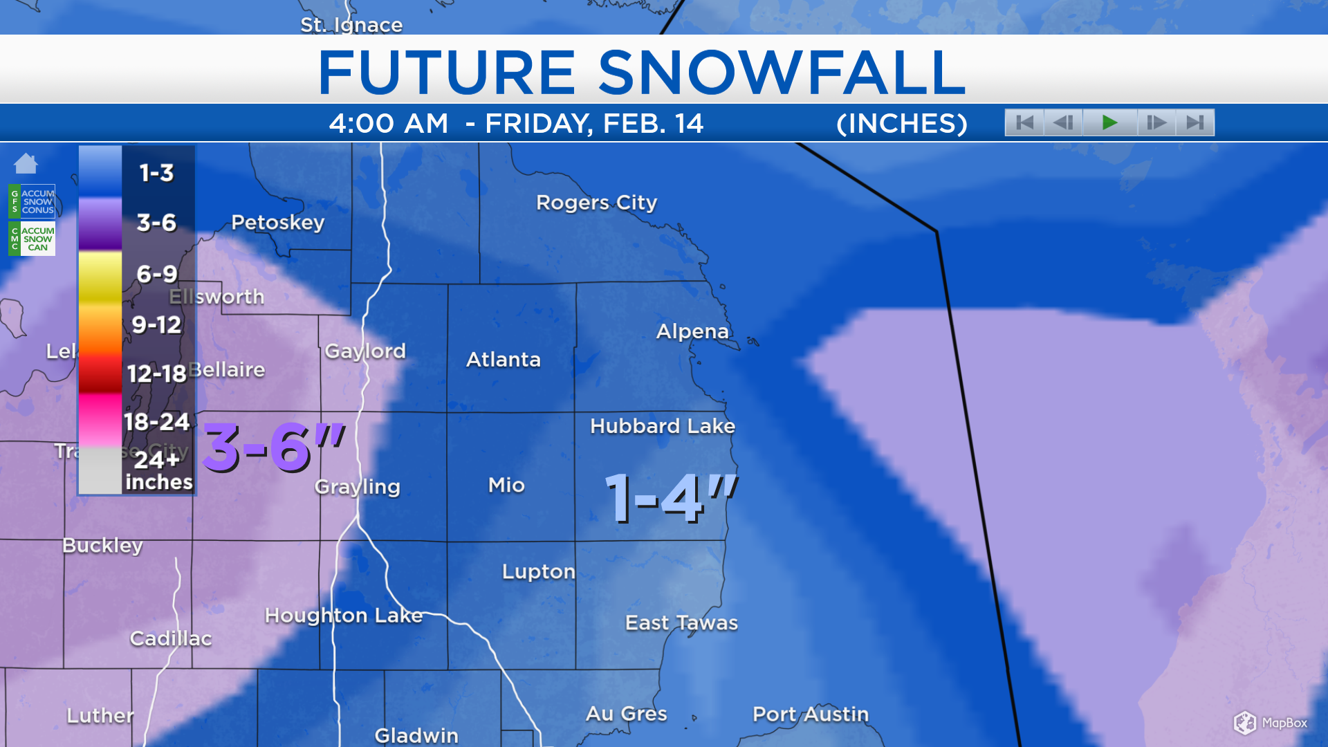
Snowfall amounts of 2-4 inches are expected for most of Northeast Michigan late Wednesday through Thursday (shown in blue). Heavier amounts look to stay just west of our local area (shown in purple).
Wednesday will start with dry weather, then snow will move in late-evening. High temperatures will reach the middle 30s with a breeze from the southwest. Winds will shift out of the north and an arctic air mass will intrude. Temperatures will fall to about 16 degrees around sunrise Thursday, then keep falling to about 10 degrees Thursday afternoon, and ultimately below zero early Friday. Valentines Day is looking dry and chilly with highs in the middle teens. Temperatures will warm to the upper 20s with a chance of snow showers late-day. For the rest of Northeast Michigan’s weather forecast, watch the latest weather video by clicking the weather tab at the top of the page.