Showers Saturday; Muggy Sunday; Cold front Monday
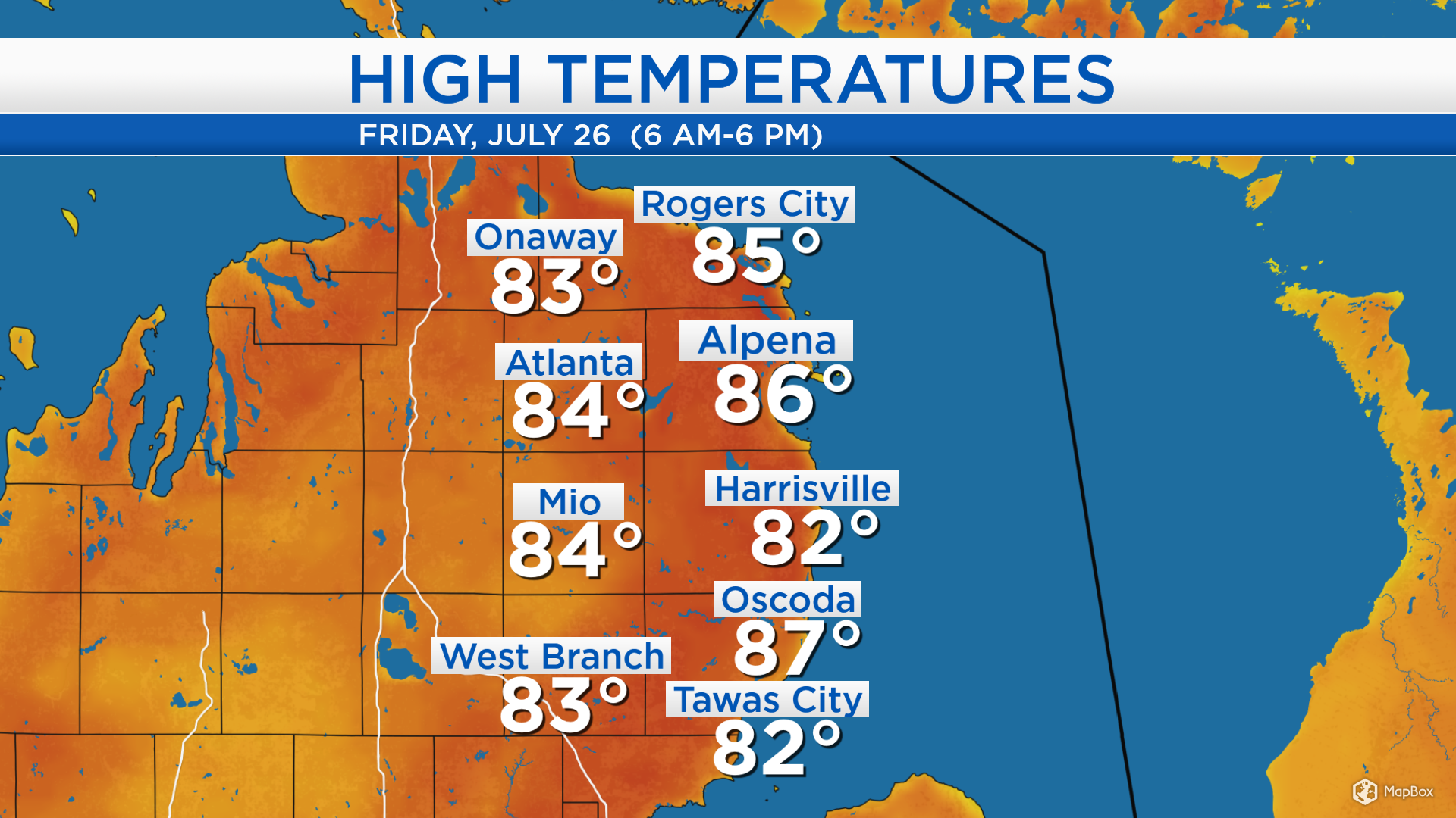
High temperatures today reached the middle 80s across Northeast Michigan. Winds out of the southwest at 10-15 mph are bringing warmer and increasingly muggy air to our area. The warmth will last through the weekend with noticeably higher humidity.
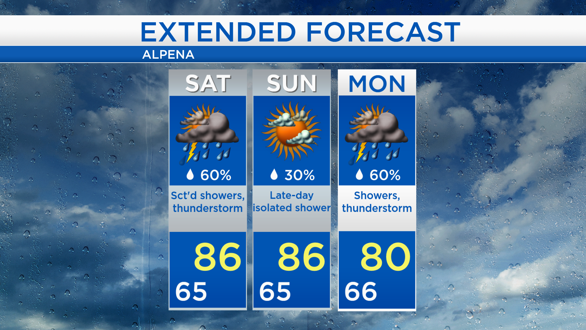
Two areas of unstable weather will affect Northeast Michigan on Saturday. The first, currently moving through the Upper Peninsula and Wisconsin will provide a chance of showers in the early morning. Some gaps of dry weather are expected midday Saturday. Then, the next area currently flaring up over Minnesota will provide showers and a risk of thunderstorms tomorrow afternoon-evening.
Low temperatures overnight will cool to the middle 60s with increasing clouds. A few showers or thunderstorms are possible at almost any time of day tomorrow, but Saturday will not be a complete washout. Temperatures will warm close to 86 degrees in the afternoon.
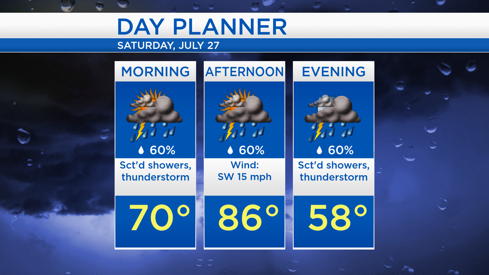
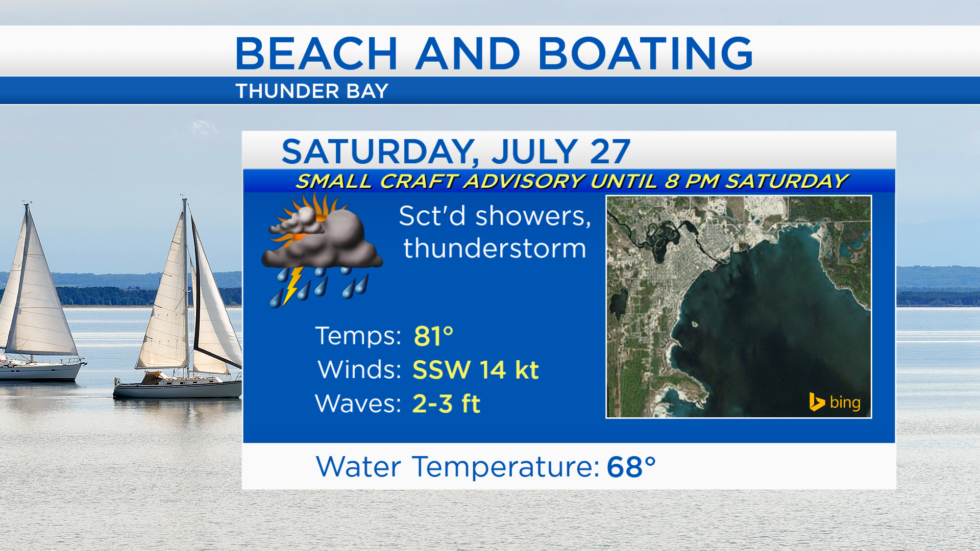
For any boating interests or Brown Trout festivities, the National Weather Service has issued a Small Craft Advisory, lasting until 8 p.m. Saturday. Thunderstorms are possible, near-shore waves will run as high as 3 feet, and wind speeds near 15 knots are expected.
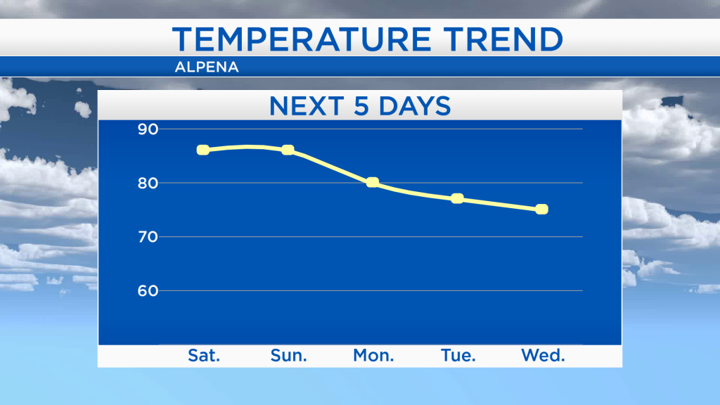
High temperatures will reach the middle 80s for Saturday and Sunday. A cold front will move through on Monday, and high temperatures will drop to the 70s for Tuesday and Wednesday which will feel noticeably cooler.

Saturday is looking unsettled and muggy. Although a few isolated showers are possible late Sunday, most of the day should end up rain-free. Showers and thunderstorms become more likely again on Monday just prior to an incoming cold front. Tuesday and Wednesday will be much drier with plenty of sunshine and cooler temperatures. For the rest of Northeast Michigan’s weather forecast, watch the latest weather video by clicking the weather tab at the top of the page.