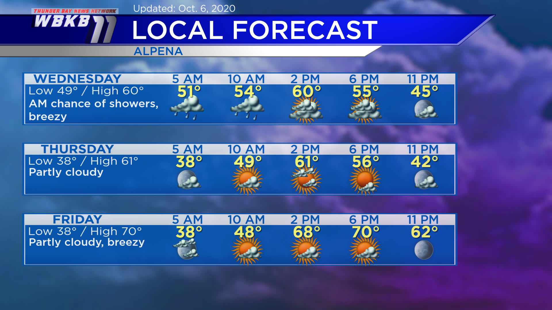
Showers overnight and cooler Wednesday-Thursday

A cold front moving through the Upper Peninsula and northern Wisconsin will move into our area, bringing showers overnight. The cold front will result in colder temperatures Wednesday and Thursday. A few showers will still be possible early Wednesday. Then drier conditions will move in Wednesday afternoon and winds out of the northwest will become stronger.
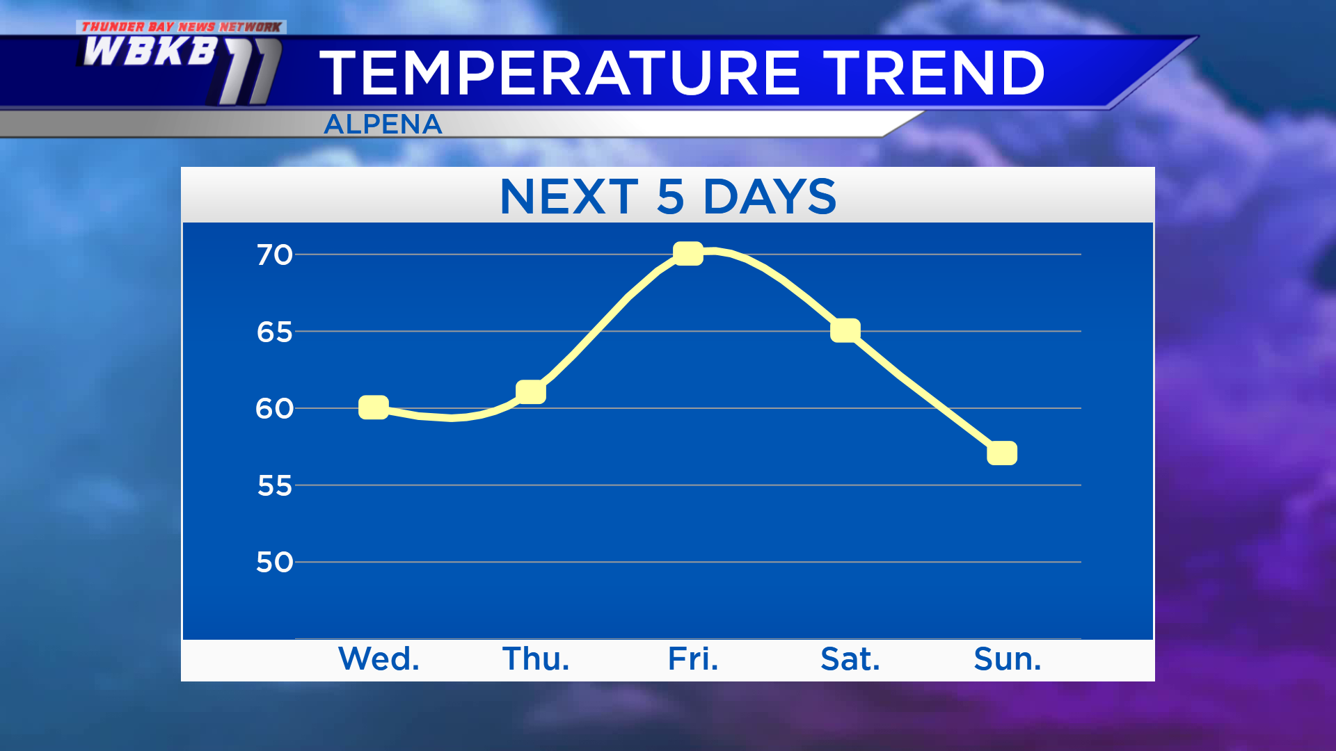
High temperatures will be near 60 degrees Wednesday and in the lower 60s Thursday. Winds out of the south-southwest will bring warmer temperatures Friday, reaching about 70 degrees. Temperatures will become cooler again over the weekend with highs in the middle 60s Saturday, and upper 50s Sunday.
Wednesday: Early chance of showers, then mostly cloudy. Early-morning temperatures will be in the upper 40s. Late-morning temperatures will be in the middle 50s. Afternoon highs will reach about 60 degrees. Early-evening temperatures will be in the lower 50s.
Thursday: Partly cloudy with a cool morning. Predawn temperatures will cool to the upper 30s. Temperatures will rise to about 50 degrees in the late-morning. Afternoon highs will be near 61 degrees. Early-evening temperatures will be in the lower/middle 60s.
Friday: Partly cloudy and breezy. Early-morning temperatures will be in the upper 30s. Late-morning temperatures will be in the upper 40s. By the late-afternoon, highs will climb to around 70 degrees. Evening temperatures will cool to the 60s.
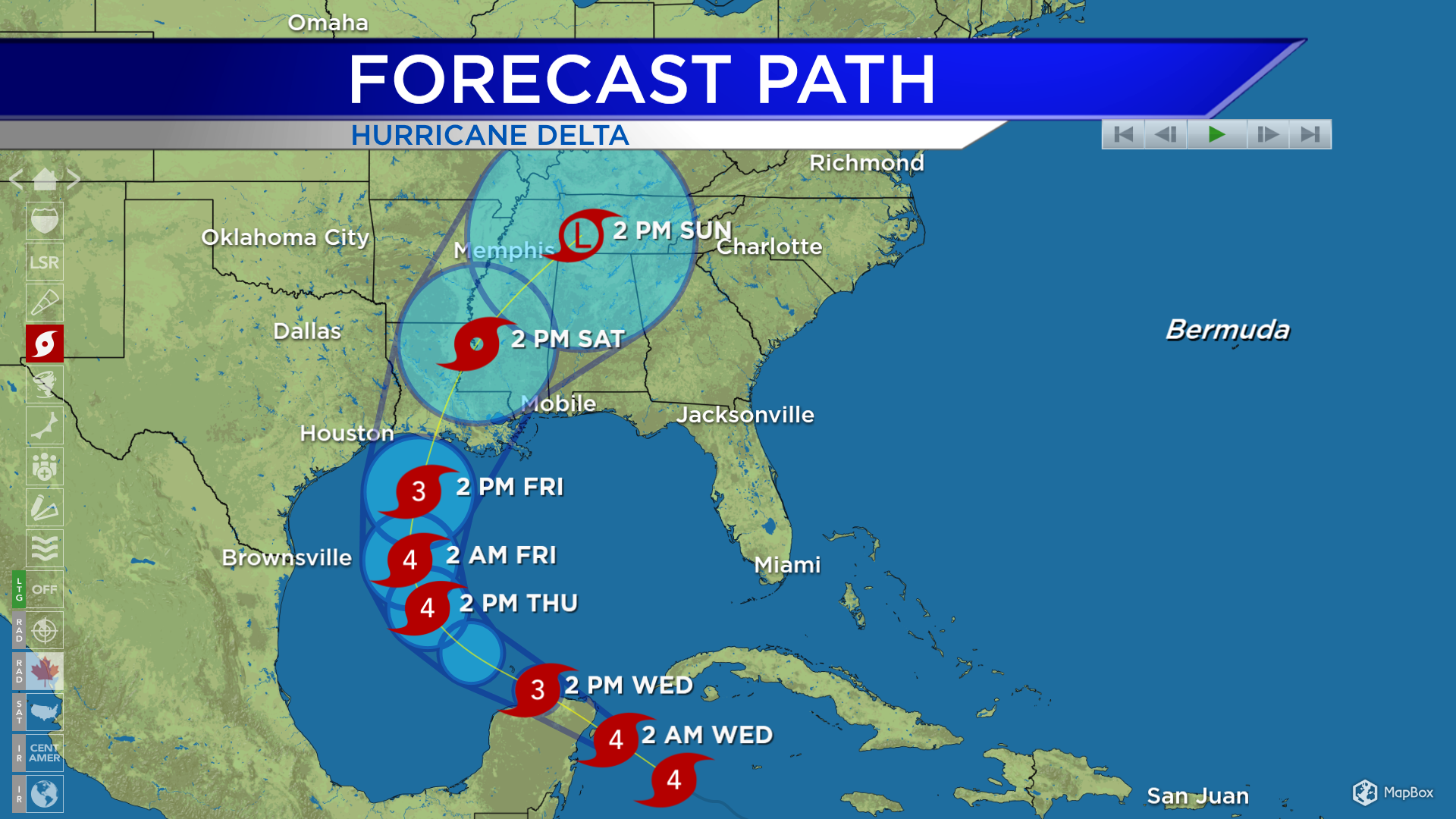
Hurricane Delta has strengthened to category 4 strength, maximum winds are close to 145 mph and the hurricane is approaching the Yucatan Peninsula of Mexico. It will then travel into the central Gulf of Mexico. Delta is expected to make landfall in Louisiana late Friday, potentially as strong as a category 3 hurricane at that time.
For the rest of Northeast Michigan’s weather forecast, watch the latest weather video by clicking the weather tab at the top of the page.


