
Showers moving in Saturday; Drier and warmer Sunday

A storm system centered over South Dakota is spreading rain ahead of it. Rain will move into Northeast Michigan Saturday afternoon and continue through Saturday night. There could possibly be a lingering shower early Sunday.
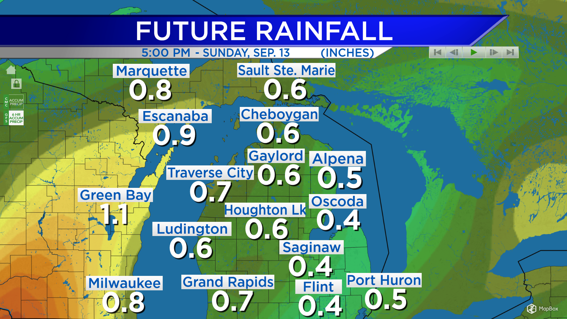
The heaviest rainfall amounts this weekend will be over central and eastern Wisconsin, and southern parts of the Upper Peninsula. For areas shaded in yellow, rainfall amounts are expected to be close to or more than 1 inch. Around Northeast Michigan, rainfall amounts close to a half-inch are expected Saturday afternoon through predawn Sunday.
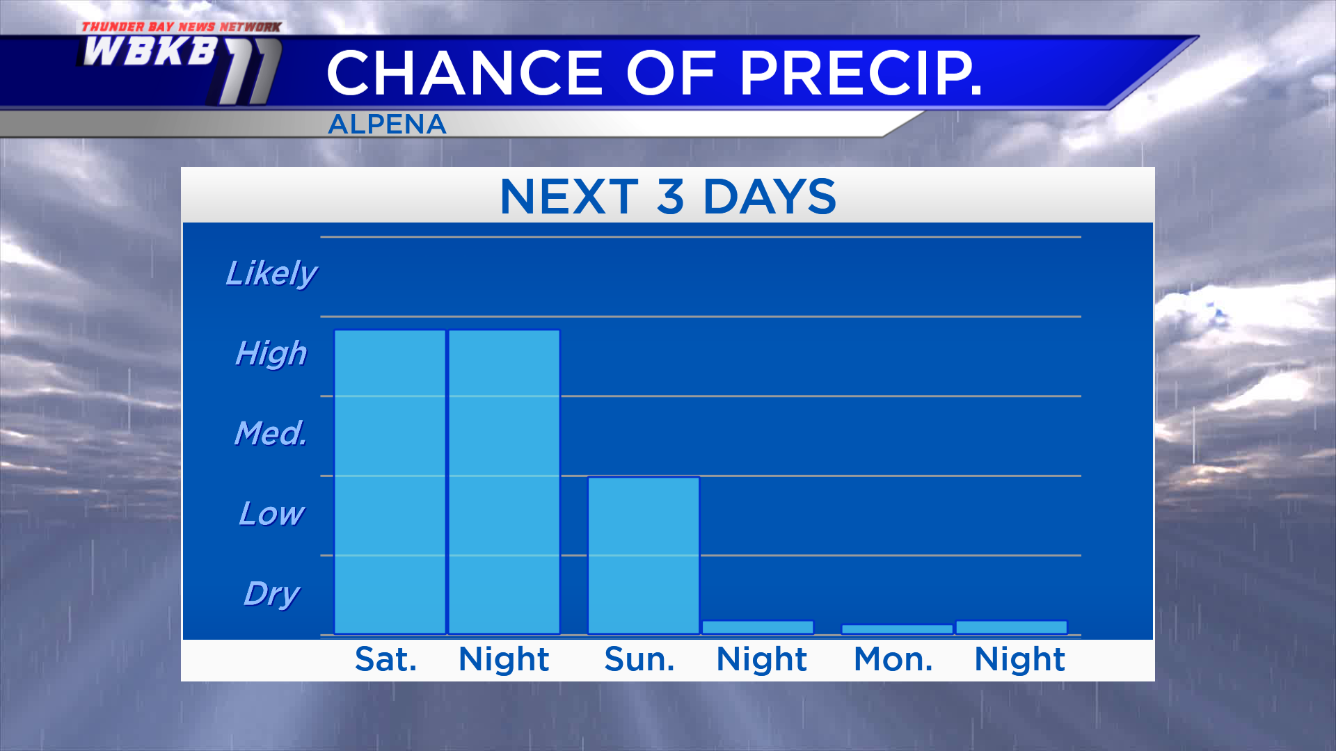
The highest chance of rain over the next few days will certainly be on Saturday. Drier conditions will move in Sunday, giving way to clearing skies. And there will not be a chance of rain on Monday with sunny skies expected.
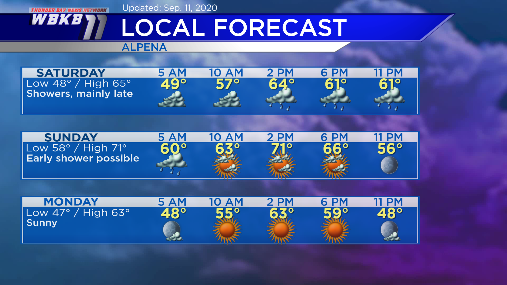
Saturday: Cloudy until the afternoon, then showers will move in and continue into the nighttime. Predawn temperatures will start in the upper 40s. Temperatures will rise to the upper 50s in the late-morning. Afternoon highs will be close to 65 degrees. Early-evening temperatures will be in the lower 60s.
Sunday: Clearing skies and slightly warmer. Predawn temperatures will start in the upper 50s. Late-morning temperatures will be in the middle 60s. Afternoon highs will warm to about 71 degrees. Early-evening temperatures will be in the middle 60s.
Monday: Sunny. Early-morning temperatures will be near 47 degrees. Late-morning temperatures will be in the middle 50s. Afternoon highs will be around 63 degrees. Early-evening temperatures will be in the upper 50s.
For the rest of Northeast Michigan’s weather forecast, watch the latest weather video by clicking the weather tab at the top of the page.


