Showers late tonight; Cooler Tuesday
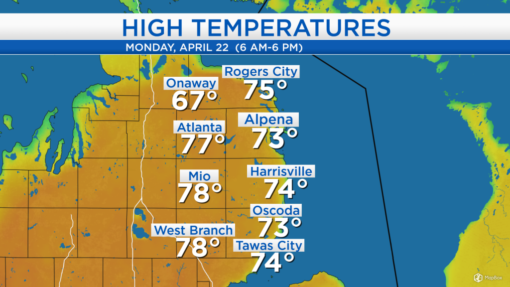
High temperatures today reached the middle 70s for many places with warm air out of the south arriving before a disturbance just to our west. Although these high temperatures are close to 20 degrees warmer than normal, they are not close to any records which are safely in the upper 80s.
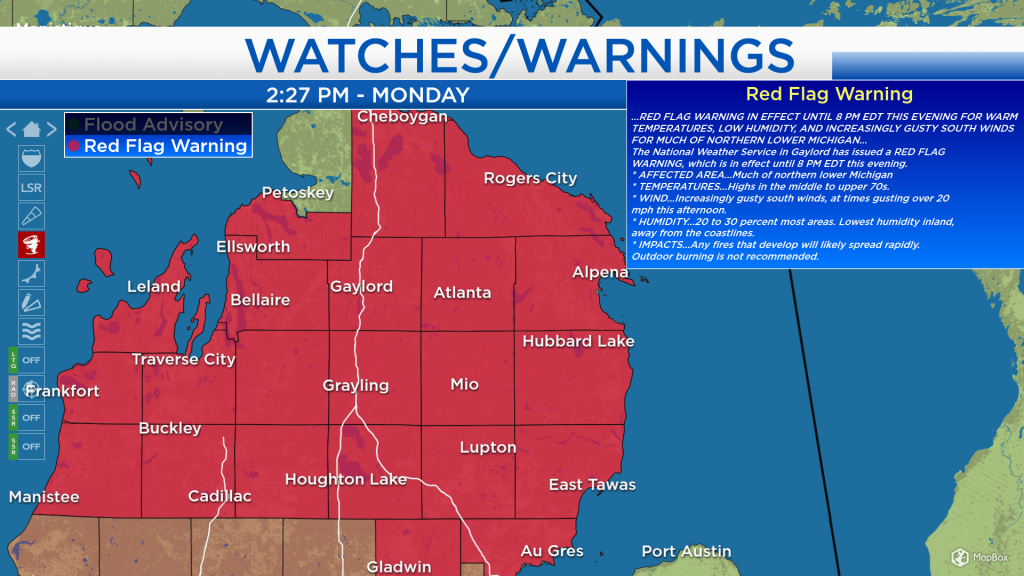
Red Flag Warnings were in effect all day because of warm temperatures, strong breezes and low humidity. These dry and warm conditions caused elevated fire danger across Northern Michigan. Showers arriving tonight should help alleviate the outdoor fire danger in our area.
A boundary separating cooler air from the warmth in our area is producing showers to our north and east, including the Upper Peninsula. A disturbance currently sits to our west, near the Minnesota-Iowa border. This disturbance will bring showers to our area after midnight, and possibly a thunderstorm late tonight or early tomorrow morning.
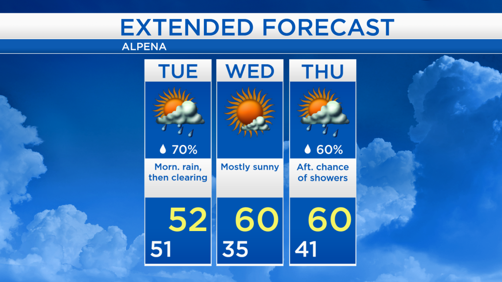
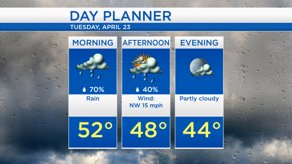
Rain is likely tomorrow morning, then drying out in the afternoon. High temperatures will reach the lower 50s — in the morning — winds out of the northwest will bring cooler temperatures in the afternoon. By tomorrow evening, skies will become partly cloudy and dry.
Rain in the morning, partly cloudy skies late-day and cooler temperatures are in store tomorrow. For Wednesday, although the morning will start with cool temperatures in the 30s, daytime highs should get close to 60 degrees with mostly sunny skies. A few passing showers are possible Thursday afternoon with highs close to 60 degrees. For the rest of Northeast Michigan’s weather forecast, watch the latest weather video by clicking the weather tab at the top of the page.