
Risk of thunderstorms Saturday night-Sunday with a cold front
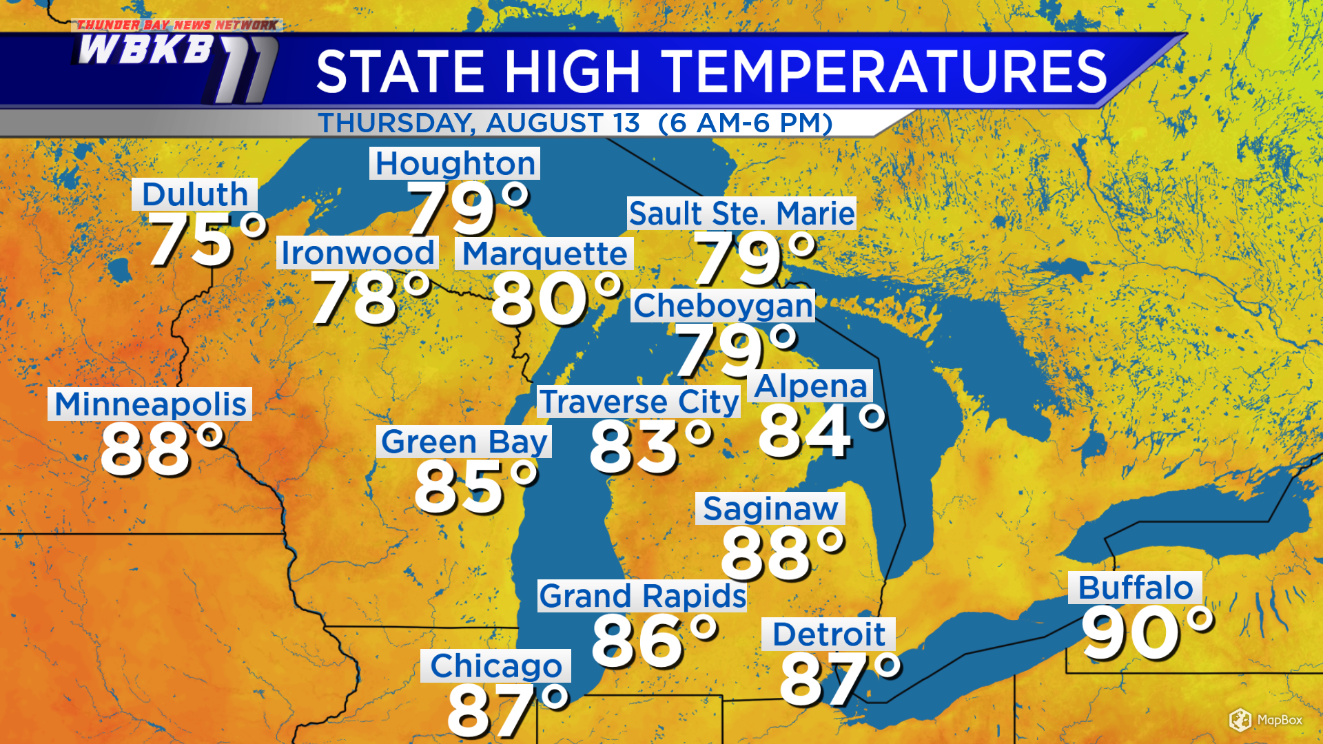
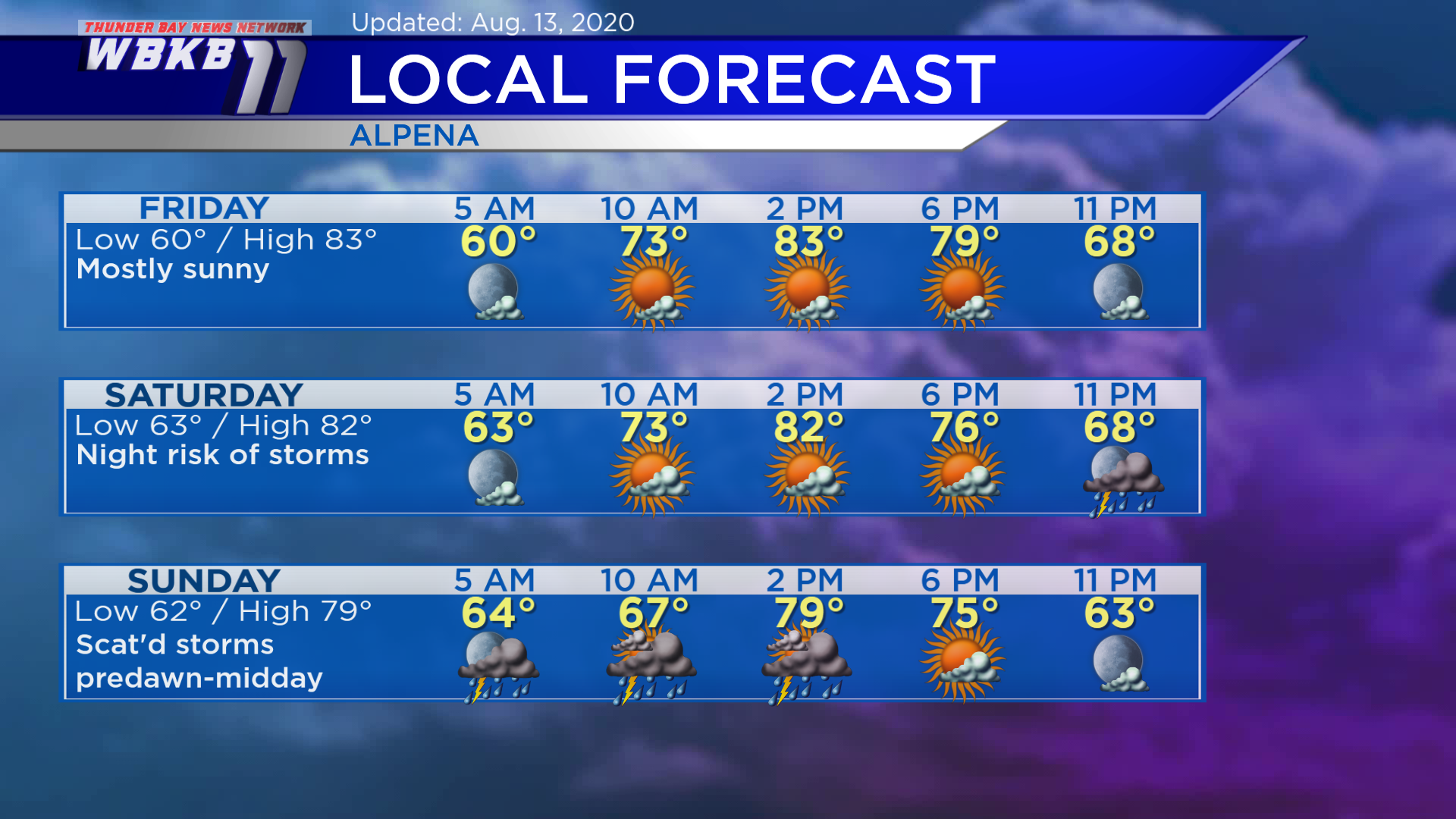
High temperatures today reached 84 degrees in Alpena and 83 degrees in Traverse City. Friday’s highs will be similar, in the middle 80s, but humidity levels will become muggier.
Two areas of showers will merge and become one cold front over the Upper Plains. These current clusters of showers are near the Minnesota-Canada border and near the Montana-Wyoming border. This developing cold front will move eastward and affect our area Saturday night and into Sunday.
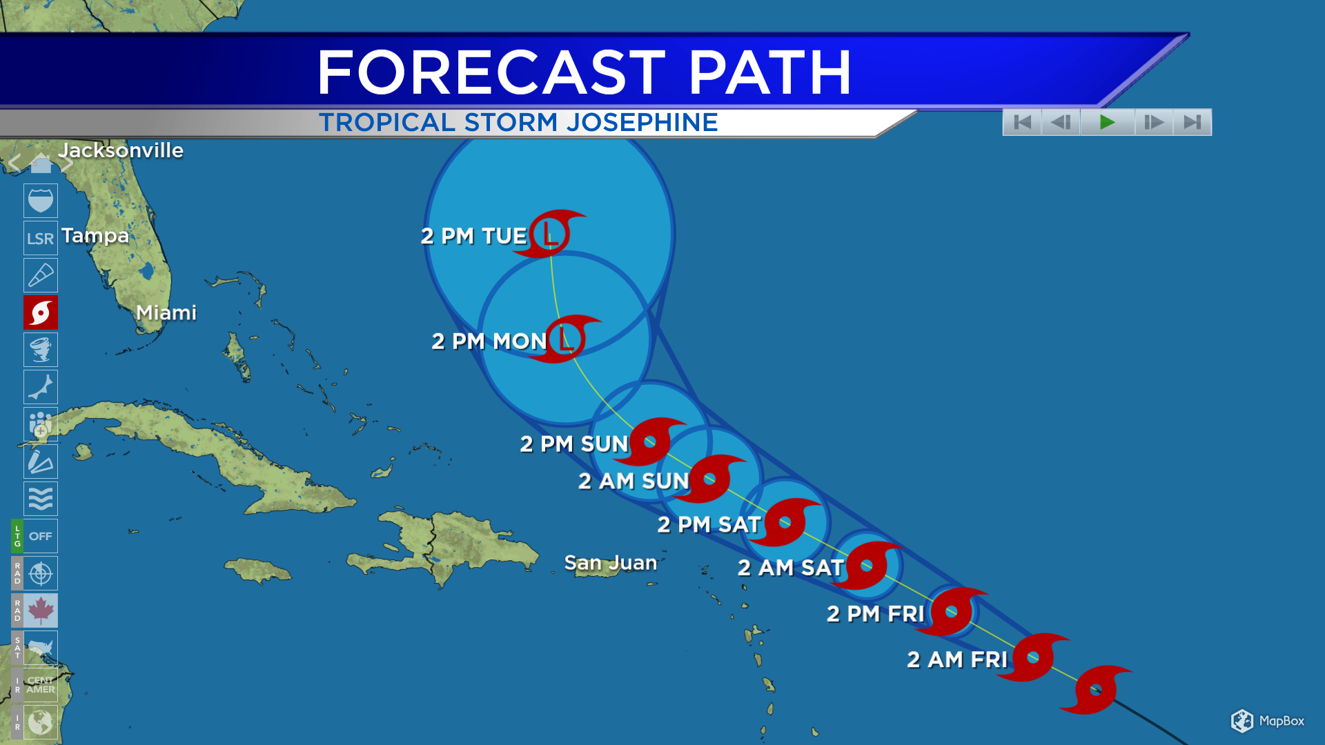
Tropical Storm Josephine has formed in the Atlantic. It will move toward the northwest, and pass well north of Puerto Rico over the weekend, likely maintaining tropical storm strength. At this point, its forecast poses no substantial threat to any landmass.
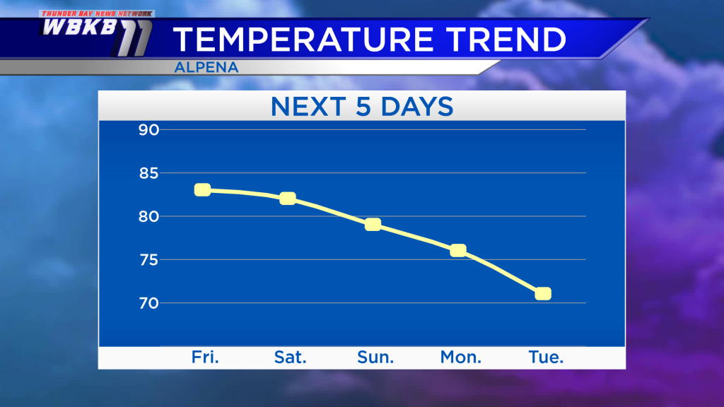
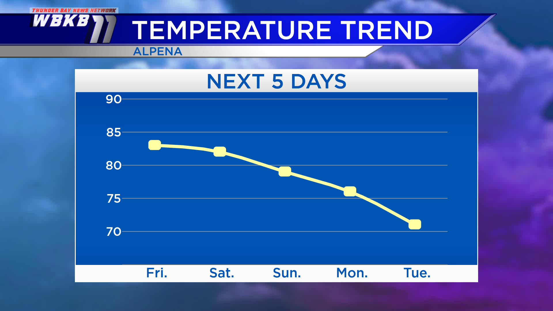
High temperatures Friday will reach about 83 degrees. Highs on Saturday will be in the lower 80s. A cold front will move through Northeast Michigan Sunday and highs will be in the upper 70s. After that, temperatures will become colder with highs in the middle 70s Monday, then lower 70s Tuesday.
Friday: Mostly sunny and more humid. Predawn temperatures will be near degrees. Temperatures will rise to the lower/middle 70s in the late-morning. Afternoon highs will be close to 83 degrees. Early-evening temperatures will be in the upper 70s.
Saturday: Partly cloudy in the morning and afternoon, then a chance of showers and thunderstorms will move in overnight. Early-morning temperatures will be in the lower 60s. Afternoon highs will reach about 82 degrees. Early-evening temperatures will be in the middle 70s.
Sunday: A risk of thunderstorms through midday, some evening clearing expected. Predawn temperatures will be in the lower 60s. Afternoon highs will be close to 79 degrees. Early-evening temperatures will be in the middle 70s.
For the rest of Northeast Michigan’s weather forecast, watch the latest weather video by clicking the weather tab at the top of the page.


