Risk of thunderstorms late Friday; Dry and warm this weekend
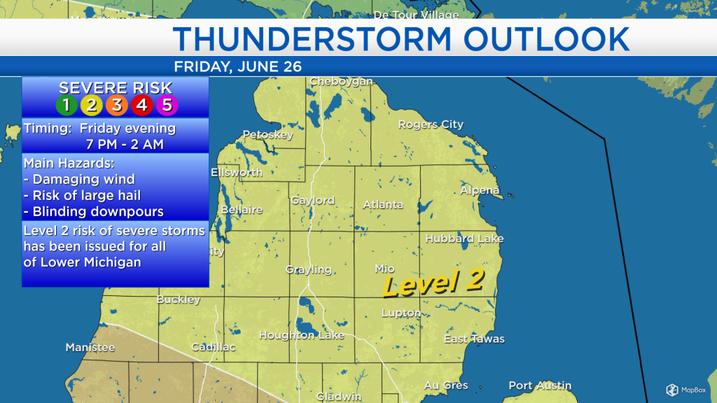
An incoming warm front will increase the humidity on Friday. The cold currently affecting the Upper Plains will follow, and bring a risk of severe thunderstorms to much of Lower Michigan Friday evening. After the cold front, humidity will gradually drop and dry weather will begin this weekend.
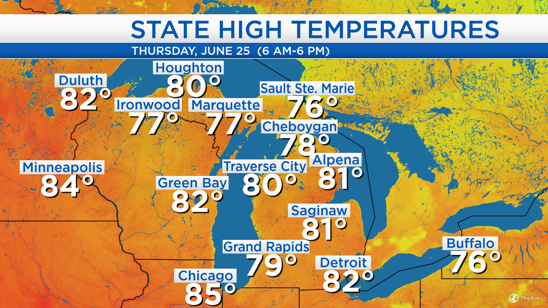
High temperatures today reached 81 degrees in Alpena, 80 degrees in Traverse City and 78 degrees in Cheboygan. Winds will become out of the southwest on Friday which will bring in slightly warmer temperatures. Temperatures Friday afternoon will warm to the middle 80s.
The greatest risk of thunderstorms will move through our area Friday evening. All of Northern Michigan is under a Level 2 risk of severe thunderstorms. Risks include damaging winds, large hail and heavy downpours. The timing when thunderstorms will be most likely is from Friday at 7 p.m. until 2 a.m.

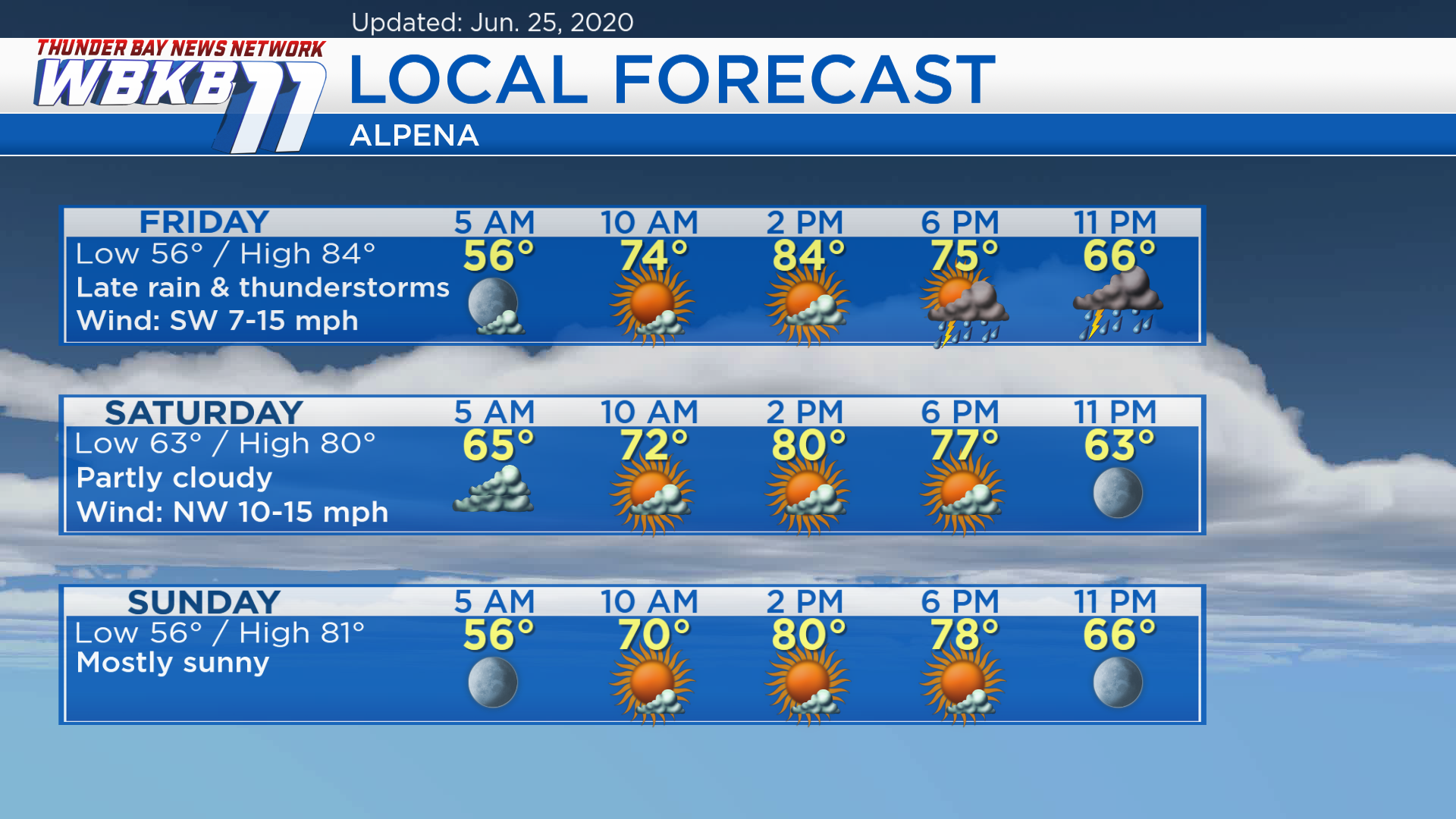
Friday: Mostly sunny skies in the morning, increasing clouds in the afternoon, then evening rain & thunderstorms. Predawn lows will be in the middle 50s. By the late-morning, temperatures will rise to the middle 70s. Afternoon highs will warm to about 84 degrees. Early-evening temperatures will remain mild, in the 70s.
Saturday: Predawn cloud cover will partially clear by midday, giving way to partly cloudy skies from midday into the evening. Predawn low temperatures will be in the lower 60s. Temperatures will reach the lower 70s by the late-morning. Afternoon highs will be near 80 degrees. Temperatures will be in the middle 70s in the early-evening.
Sunday: Mostly sunny, warm but less humid. Predawn temperatures will be in the middle 50s. Afternoon highs will be around 81 degrees. Evening temperatures will gradually cool from the upper 70s to the upper 60s.
For the rest of Northeast Michigan’s weather forecast, watch the latest weather video by clicking the weather tab at the top of the page.