Risk of thunderstorms develops late-day Friday, then unsettled into the weekend
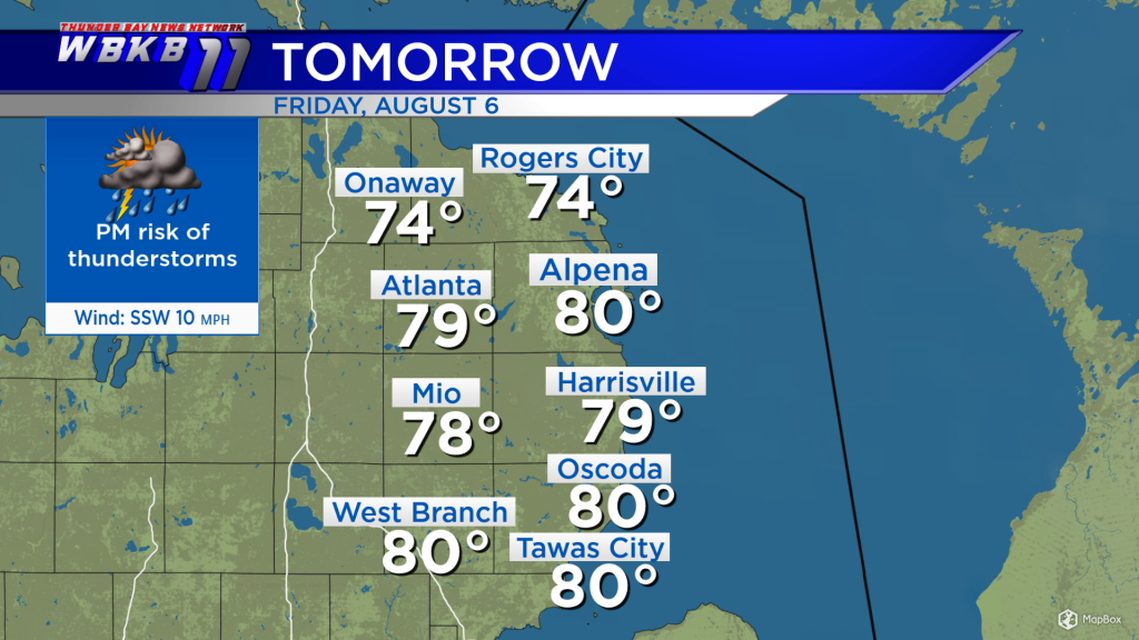
High-level cloud cover is beginning to stream into Northern Michigan, ahead of the next storm system. Rain in Wisconsin and the Upper Peninsula will continue to push eastward, arriving in Northeast Michigan late-day Friday along with a risk of thunderstorms.
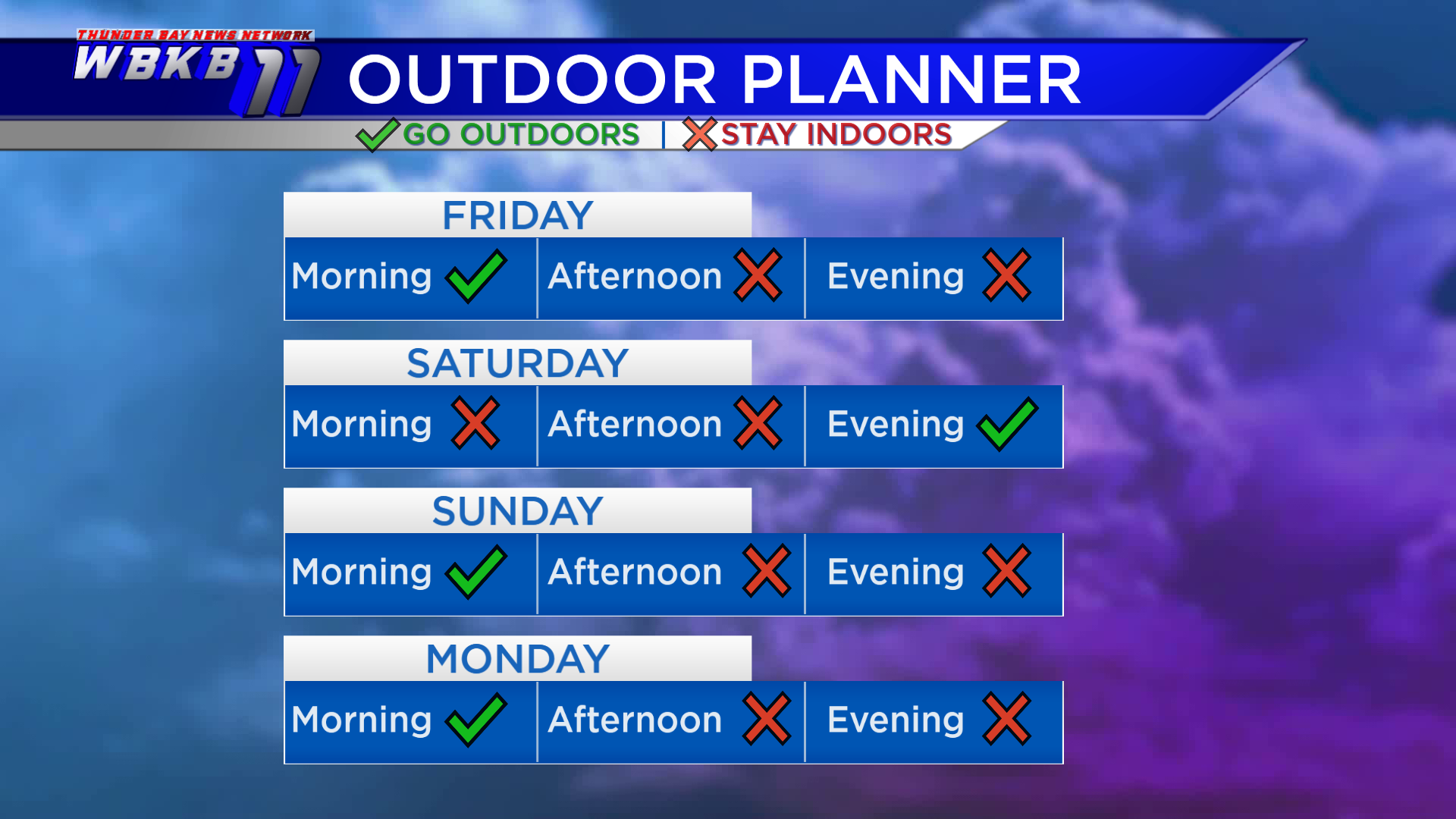
If you’re planning to do anything outdoors Friday, do it in the morning, that’s the driest period of the day. The chance of showers will start to increase Friday afternoon. We’ll have a chance of showers and thunderstorms late Friday. Damp weather continues into Saturday with a risk of thunderstorms throughout Saturday morning and afternoon. We should see things drying out heading through Saturday evening. Sunday will begin without rain in the morning, then a risk of thunderstorms will redevelop in the afternoon and evening. Monday will also have a chance of showers and thunderstorms in the afternoon and evening.
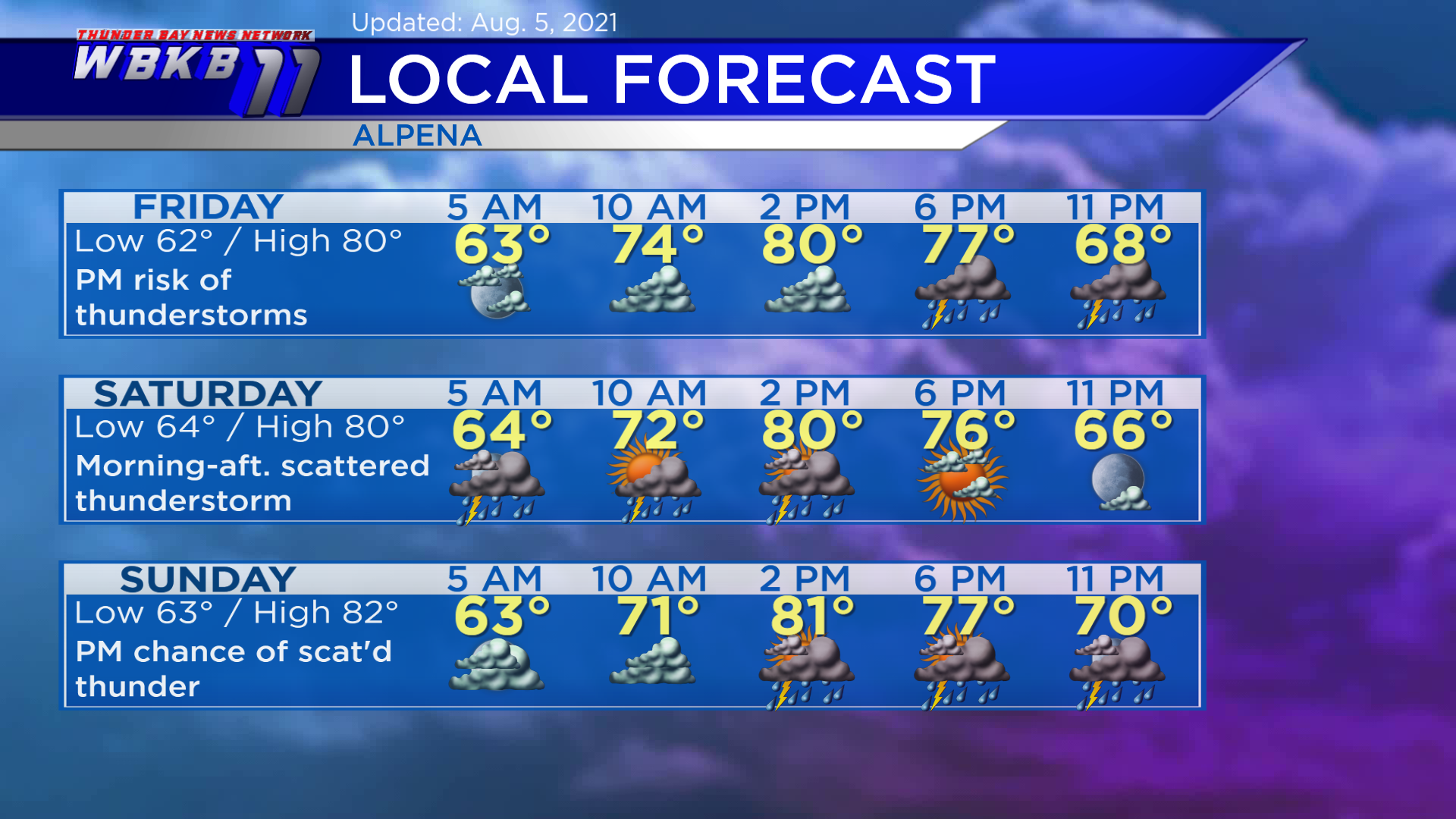
Friday: Risk of thunderstorms increases in the afternoon and evening. Early-morning lows will head down to about 62 degrees. Afternoon highs will reach close to 80 degrees. Evening temperatures will be mainly in the 70s.
Saturday: Scattered thunderstorms in the morning-afternoon. Early-morning temperatures will begin with lows near 64 degrees. Afternoon highs will get up to around 80 degrees. Evening temperatures will cool from the middle 70s to upper 60s.
Sunday: Dry early, then another risk of thunderstorms in the afternoon-evening. Early-morning lows will be close to 63 degrees. afternoon highs will head up to about 82 degrees. Evening temperatures will be in the 70s.
Monday and Tuesday will become even more steamy. For the rest of Northeast Michigan’s weather forecast, watch the latest weather video by clicking the weather tab at the top of the page.


