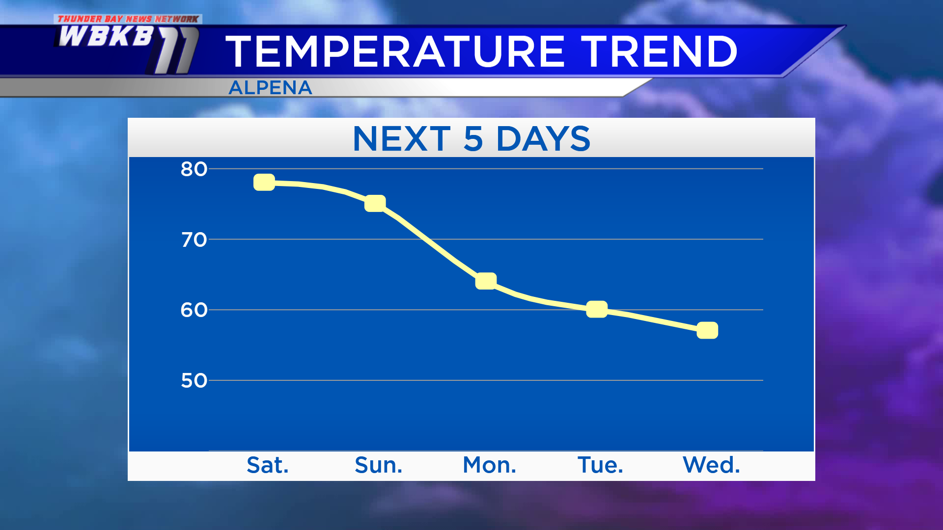
Remains warm Saturday with a small chance of showers; Much colder next week
A cold front providing thunderstorms across the Upper Peninsula tonight will continue moving east. The cold front will weaken and just a few spotty showers are possible in Northeast Michigan Saturday morning-afternoon. Drier conditions will take over Saturday night through Sunday.
High will reach the upper 70s Saturday and middle 70s Sunday. After that winds out of the northwest will bring in significantly colder temperatures. Highs will be only in the middle 60s Monday, near 60 degrees Tuesday, and upper 50s Wednesday.
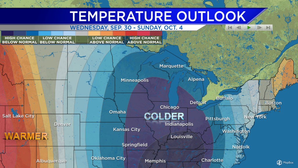
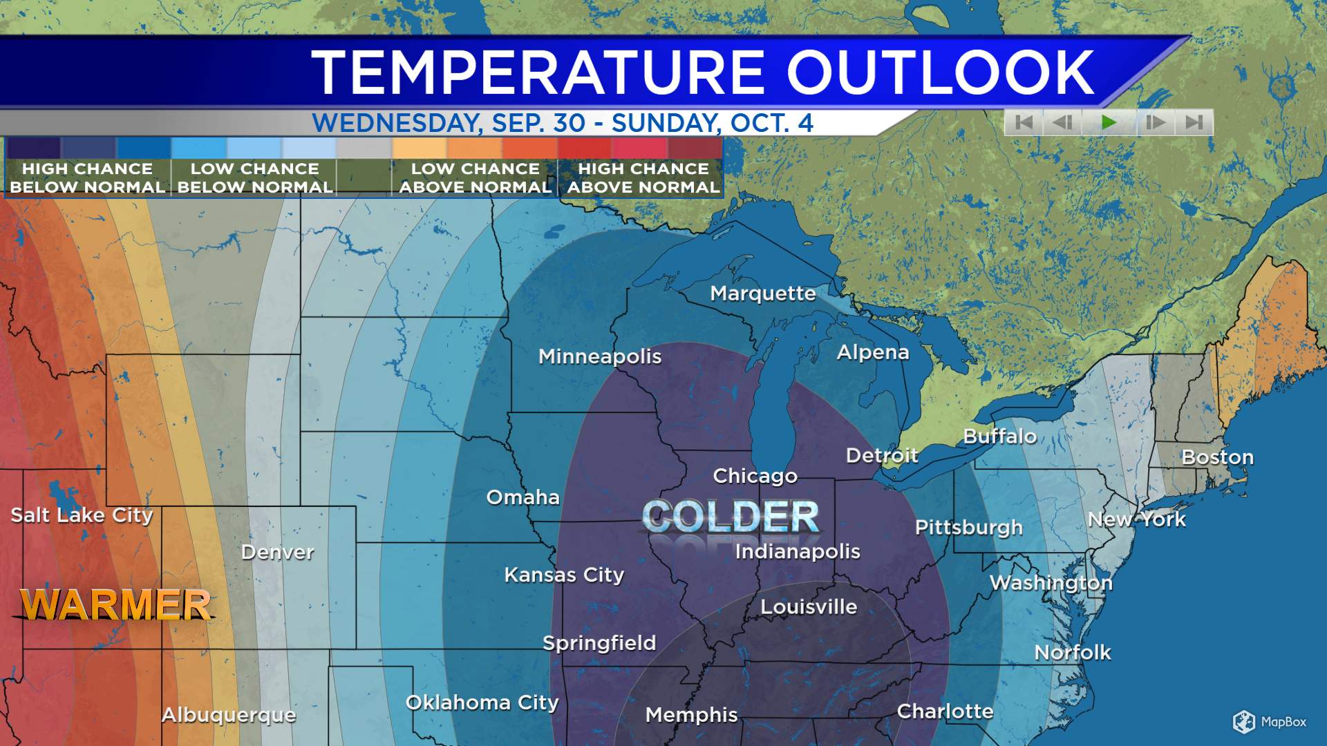
The outlook for September 30-October 4 from the Climate Prediction Center shows a high chance of below-normal temperatures. Following the arrival of colder temperatures early next week, that cold pattern will remain persistent through the end of the week.
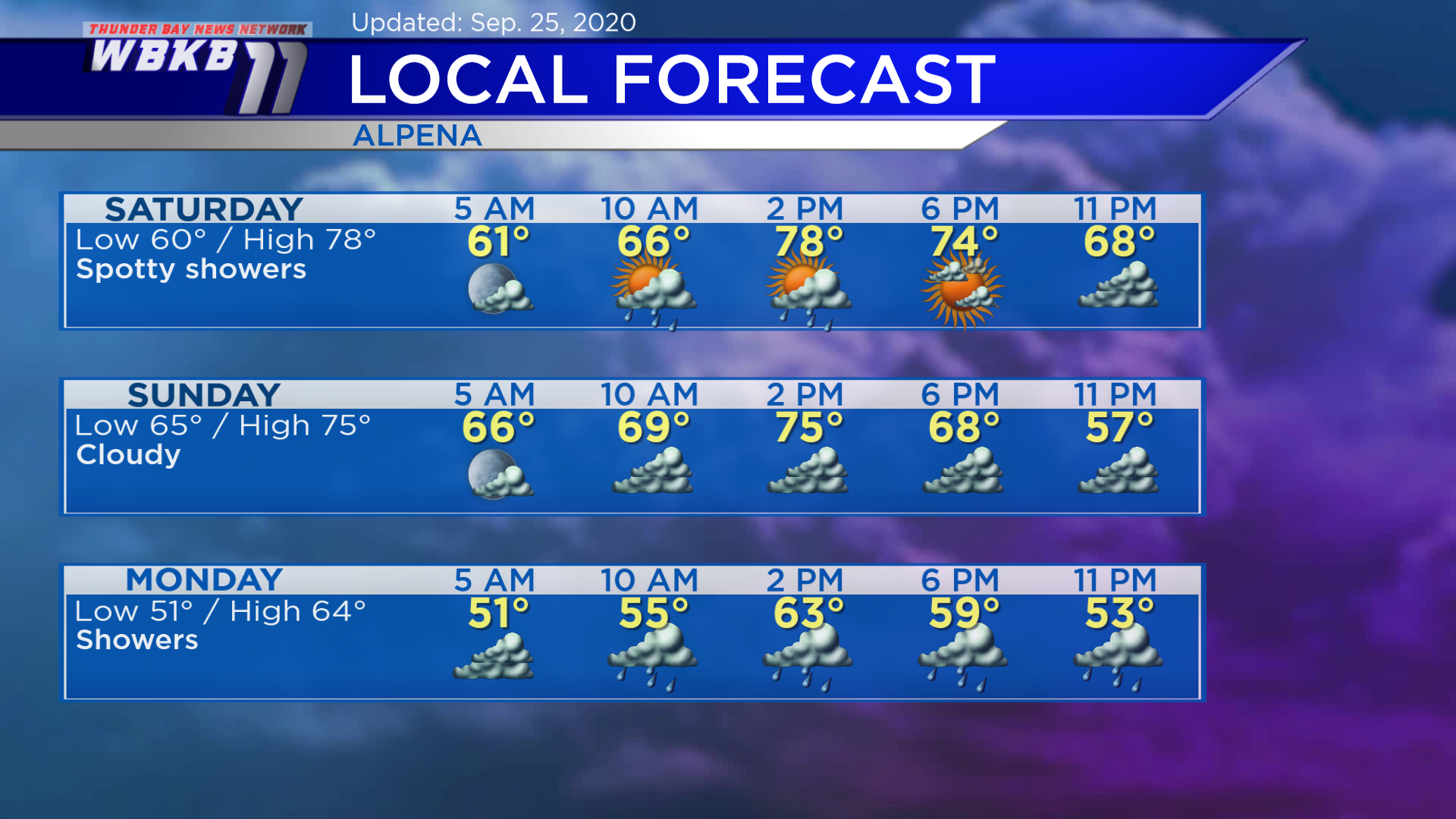
Saturday: Spotty showers are possible during the morning and afternoon. Temperatures will start in the lower 60s predawn. Late-morning temperatures will be in the upper 60s. Afternoon highs will get up to 78 degrees. Early-evening temperatures will remain warm, in the lower 70s.
Sunday: Cloudy but staying dry. Early-morning temperatures will be in the middle 60s. Temperatures will get close to 70 degrees in the late-morning. Afternoon highs will be near 75 degrees. Early-evening temperatures will be in the middle 60s.
Monday: Showers expected. Early-morning temperatures will cool to the lower 50s. Late-morning temperatures will be in the middle/upper 60s. Afternoon highs will be around the middle 60s. Early-evening temperatures will be in the upper 50s.
For the rest of Northeast Michigan’s weather forecast, watch the latest weather video by clicking the weather tab at the top of the page.


