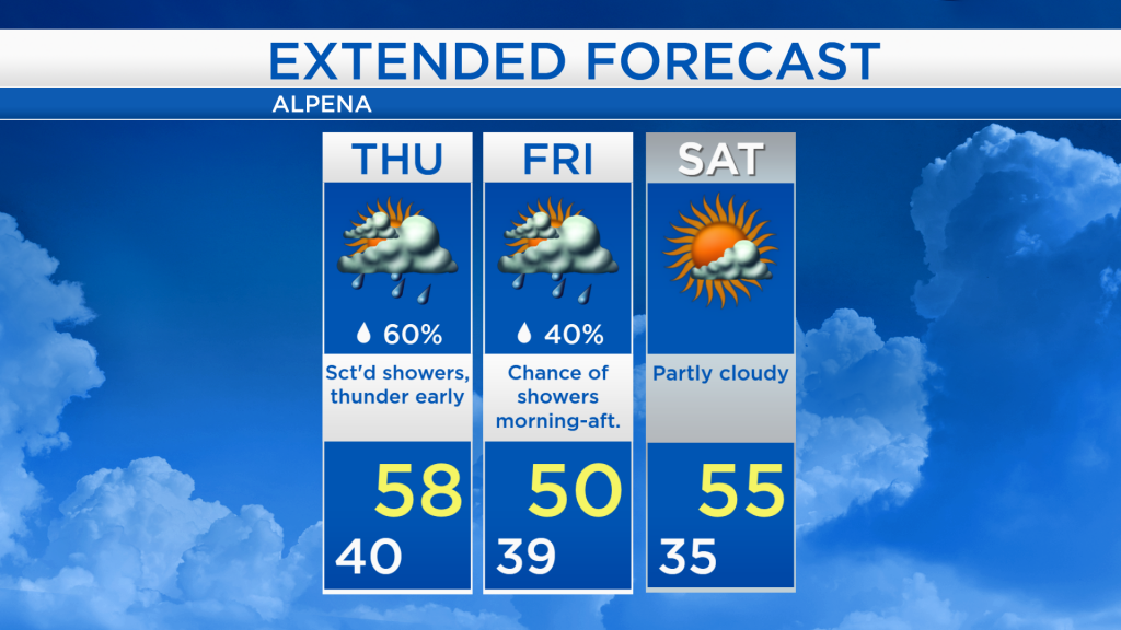
Rain tonight and possible thunderstorms; Still damp tomorrow

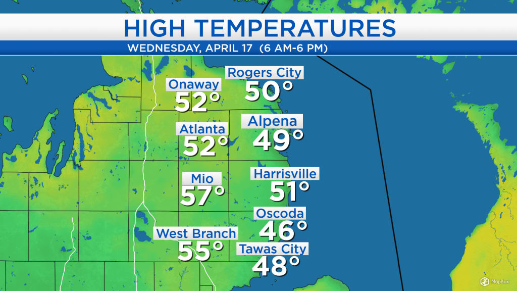
High temperatures today reached the upper 40s at the shoreline, and middle 50s farther inland. Winds out of the east at 10-15 mph kept temperatures a few degrees cooler at the shoreline compared to areas farther from Lake Huron. Although the day started with dry weather during the morning and midday hours, rain entered our area in the late-afternoon.
A storm system near the Minnesota-Iowa border will continue to gradually travel toward the northeast, crossing through Northern Michigan tomorrow. Just ahead of it lies the highest moisture and instability which could cause a few thunderstorms in the predawn hours early tomorrow. Total rainfall amounts will likely end up around a half-inch to 1 inch from this evening through tomorrow. Showers tomorrow should be lighter, but remain possible through the late-afternoon.
Low temperatures tonight will drop close to 40 degrees with rain and a risk of thunderstorms. Winds will shift slightly out of the southeast about 15 mph.
Winds out of the southwest will bring warmer temperatures tomorrow. Already by the morning hours, temperatures are expected to rise into the lower 50s. A high of 58 degrees is forecast tomorrow with scattered showers. The chance of showers decreases tomorrow evening as temperatures gradually cool to the mid-40s.

Scattered showers are expected tomorrow, but should remain light, and afternoon temperatures will reach the upper 50s. There is a lower chance of showers on Friday, then Saturday is looking dry. Cooler temperatures will arrive Friday because of winds out of the north, giving us high temperatures close to 50 degrees. Temperatures will rise to the middle 50s on Saturday and upper 50s on Sunday. For the rest of Northeast Michigan’s weather forecast, watch the latest weather video by clicking the weather tab at the top of the page.