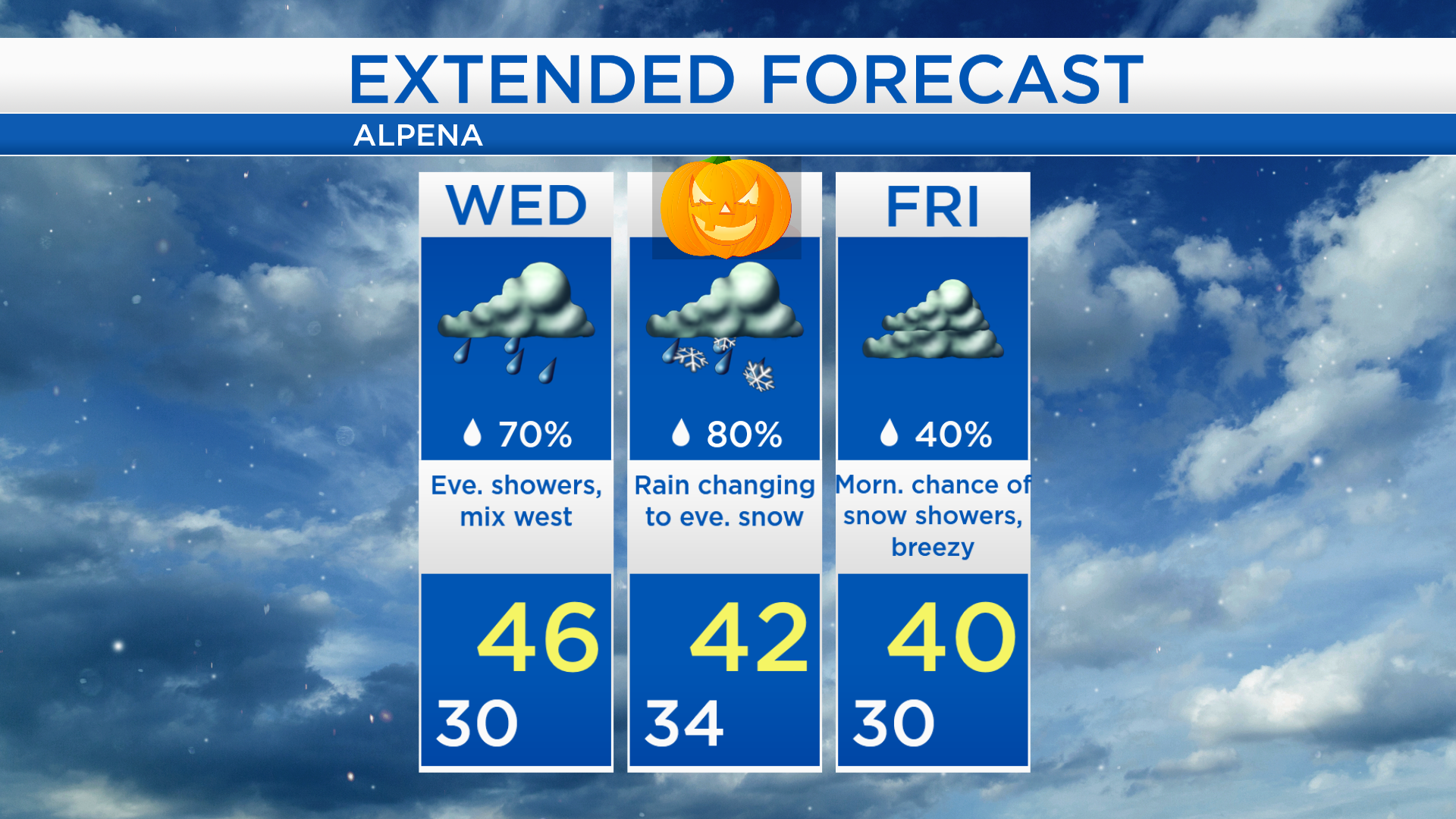
Rain/snow mix late Wednesday; Messy weather Halloween night
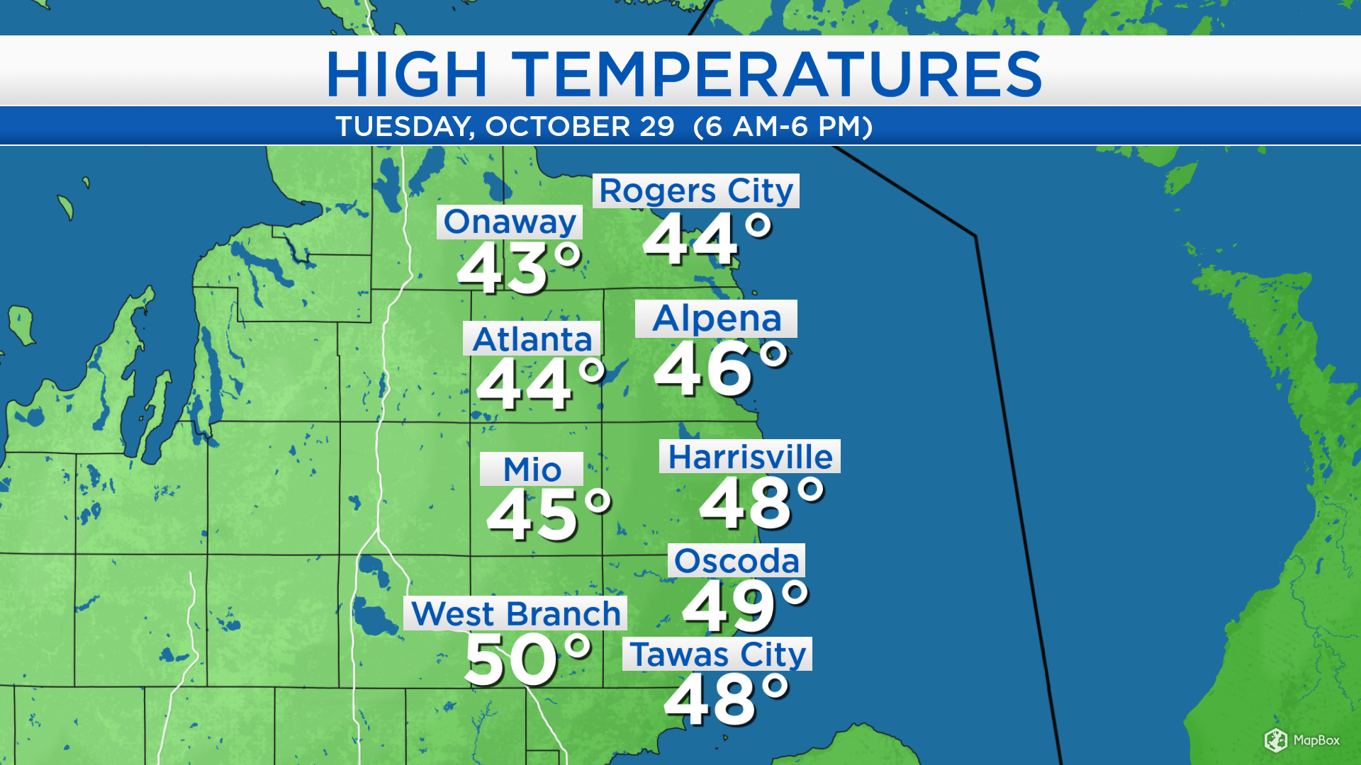
High temperatures today reached the middle to upper 40s across most of Northeast Michigan. Winds tomorrow will be light and variable, so no significant change in the air mass will take place. Winds will become out of the northeast on Thursday, and that wind direction will draw colder air into our area.
The next storm system has two parts that will merge as they both take a path toward the lower Great Lakes. Snow over Colorado will combine with rain moving north from Texas. This system will begin to affect our area late Wednesday and continue through early Friday, with precipitation types changing to snow or mix at night, and rain during the day.
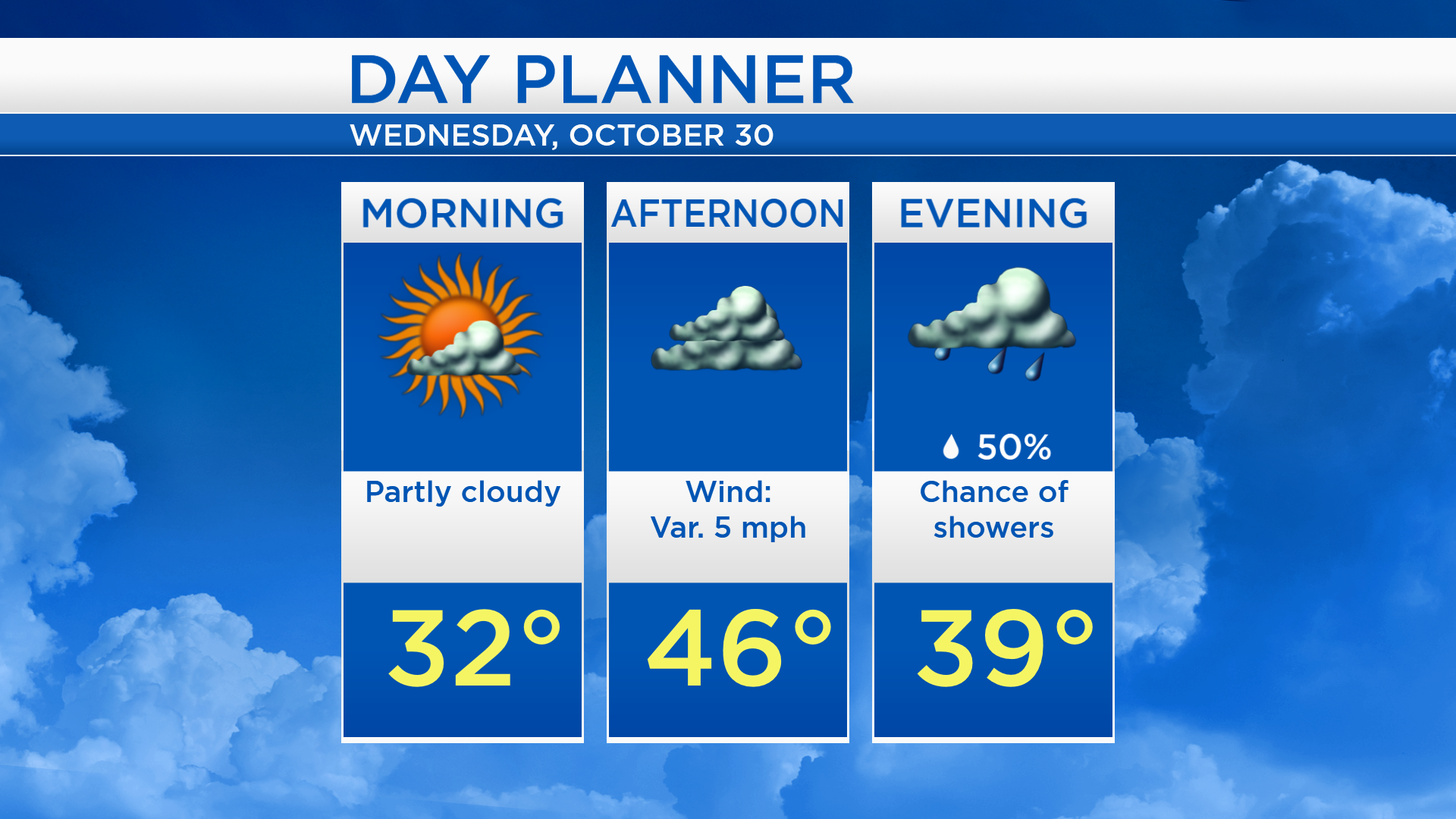
Tomorrow will start with some sunshine and morning temperatures in the lower 30s. Cloud cover will increase and high temperatures will reach about 46 degrees. Showers are possible tomorrow evening, initially starting as rain.
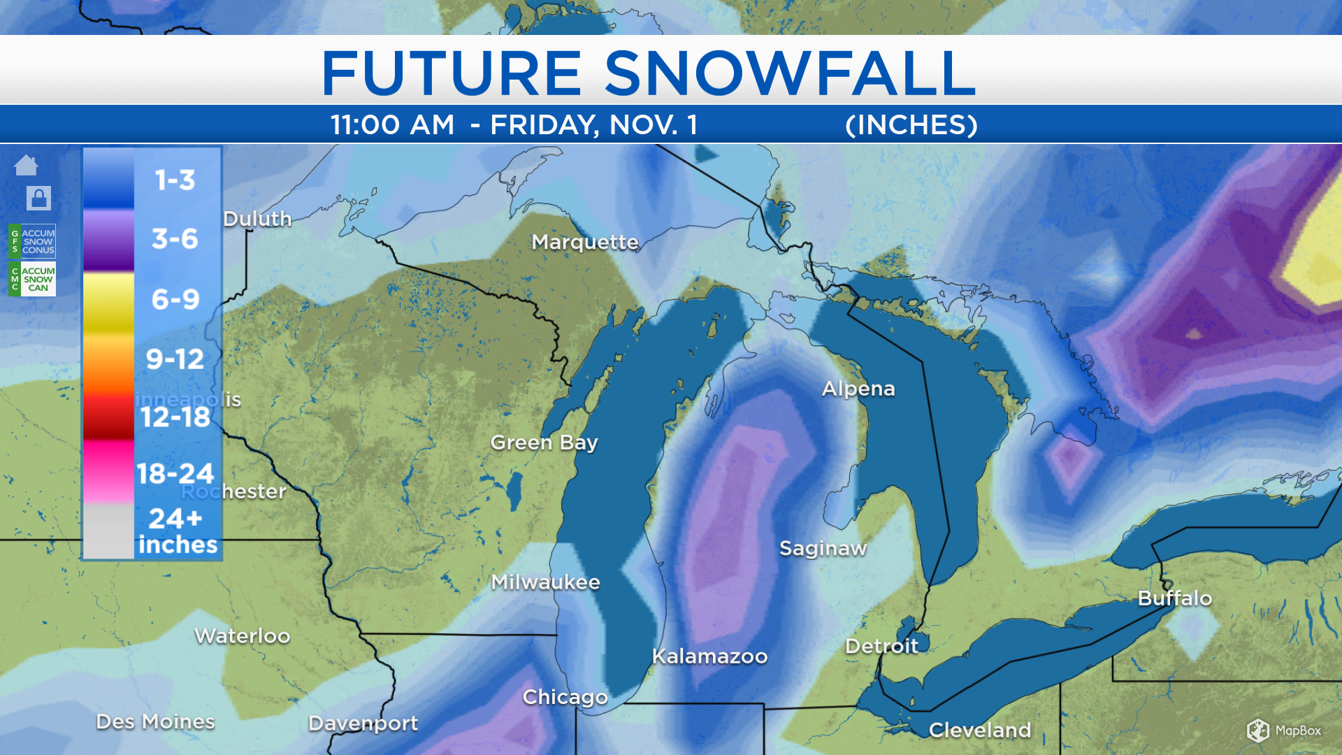
The map below shows one computer model snowfall output through midday Friday. In Northern Michigan, most of the depicted snowfall will take place Thursday night to Friday morning. The purple area indicates 3-6 inches of snow, but the depiction here is not exact.
A preliminary idea for snowfall Thursday night to Friday morning is 1-3 inches near the shorelines of Lake Michigan, Lake Huron, and the Straits of Mackinac; 3-6 inches for interior areas of Northern Michigan. However, these numbers are very subject to change. A few factors will play into how much snowfall any area gets:
-Where does the storm’s center track, so where does the area of most intense precipitation set up?
-How quickly do temperatures drop Thursday evening, and as a result, how quickly does the precipitation change from rain to snow late Thursday?
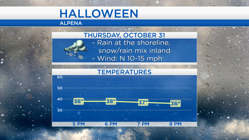
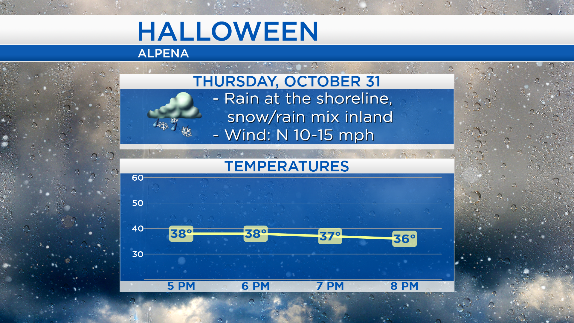
For trick or treating, Thursday late-afternoon and early-evening, expect rain showers at the shoreline and a rain/snow mix further inland. Temperatures will be in the upper 30s around 5 p.m., and cool to the middle 30s around 8 p.m.
Cloud cover will move in tomorrow, then rain showers become increasingly likely tomorrow evening, followed by mixed precipitation late tomorrow night. Rainfall is expected most of Thursday with highs in the lower 40s. Precipitation will change to snow Thursday night, and snow showers are possible Friday morning. For the rest of Northeast Michigan’s weather forecast, watch the latest weather video by clicking the weather tab at the top of the page.