Rain moves in Tuesday late-evening; Warmer Wednesday
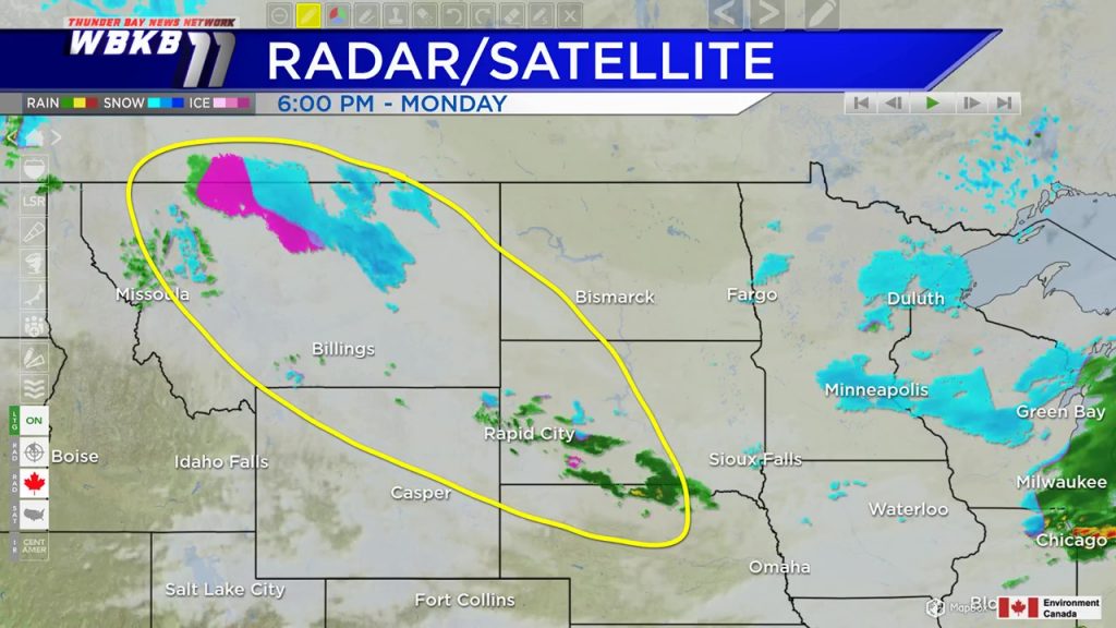
A few light, patchy showers are possible tonight. Tuesday will be dry during the daytime. The next storm system is currently over Montana and South Dakota. It will move east and bring rain to Northeast Michigan Tuesday late-evening and overnight.
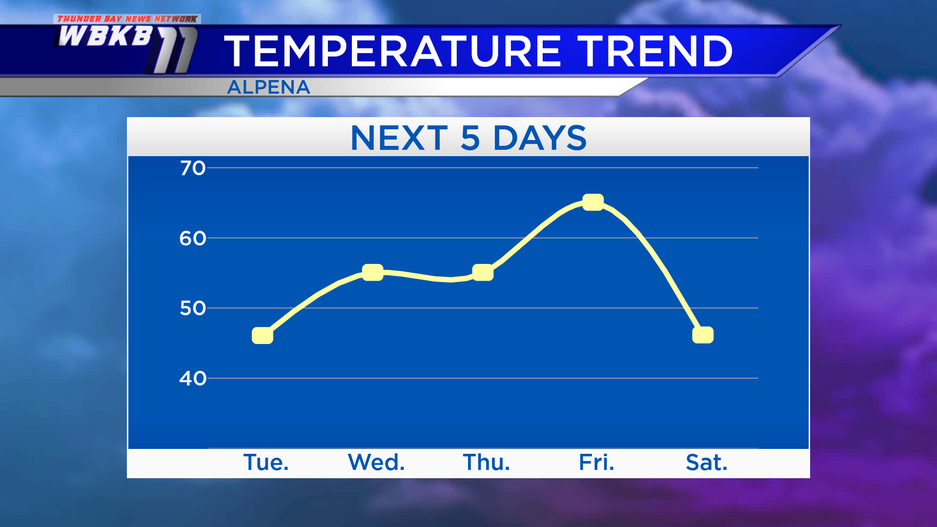
Highs Tuesday afternoon will reach only the middle to upper 40s, it will feel chilly. Warmer temperatures will move in Wednesday, getting up to the middle 50s. Thursday will also have highs climbing to the middle 50s, but that will happen late in the evening. Temperatures will get even warmer Friday with highs in the middle 60s. Then a cold front will come through Friday afternoon, delivering much colder temperatures for the upcoming weekend.
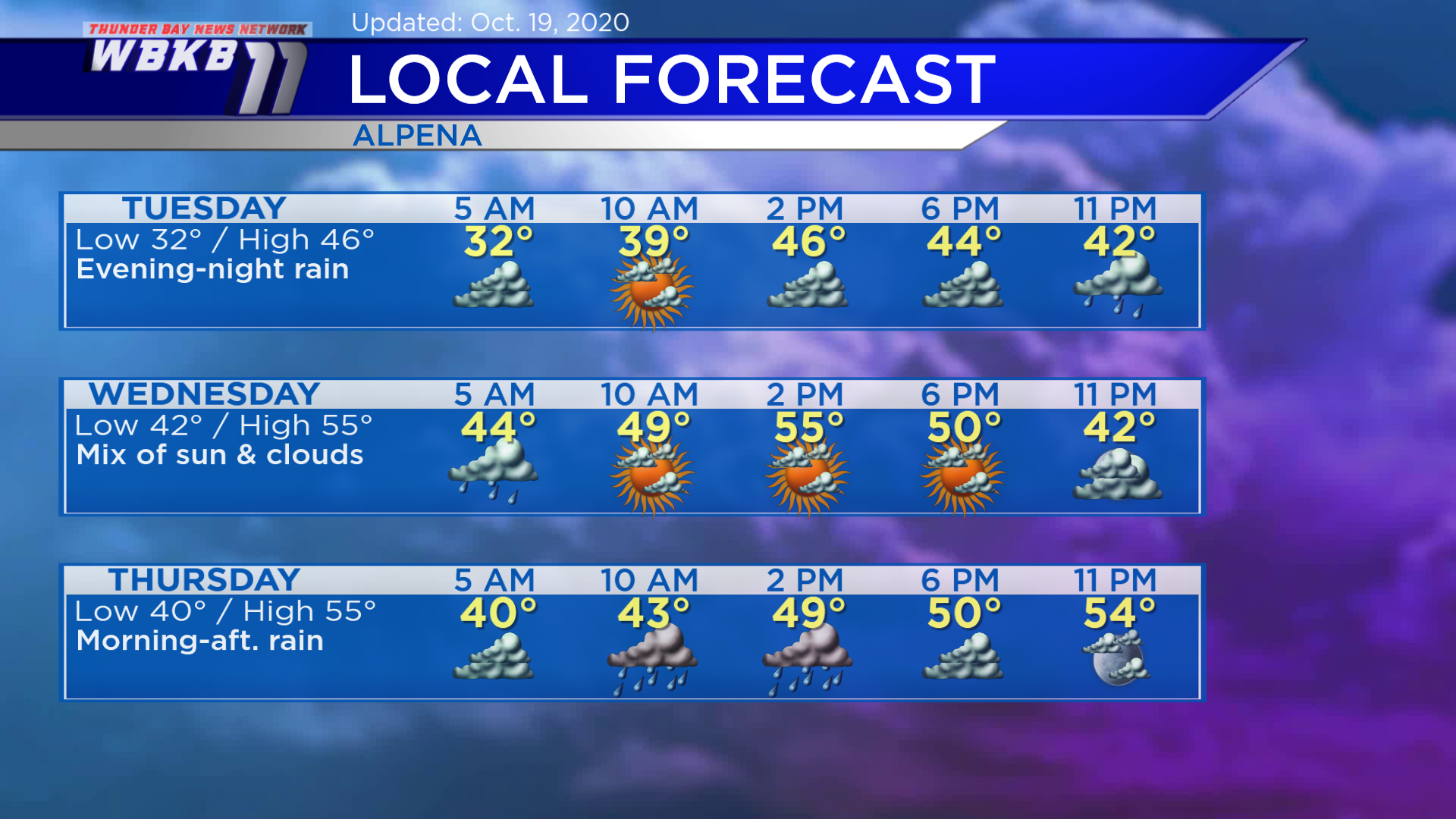
Tuesday: Mostly cloudy in the morning and afternoon. Rain will move in during the late-evening. Early-morning temperatures will start in the lower 30s. Temperatures will rise to around 40 degrees in the late-morning. Highs will be near 46 degrees. Early-evening temperatures will be in the lower/middle 40s.
Wednesday: A few showers will be possible before daybreak, then a mix of sun and clouds. Temperatures will be noticeably warmer. Early-morning lows will be in the lower 40s. Late-morning temperatures will climb to about 50 degrees. Afternoon highs will be near 55 degrees. Early-evening temperatures will be in the upper 40s.
Thursday: Periods of rain in the morning and afternoon as warm front moves through Northern Michigan. Early-morning temperatures will be near 40 degrees. Afternoon temperatures will rise to around 50 degrees. Thursday’s high in the middle 50s will occur in the late-evening.
Looking ahead to Friday, expect rain or thunderstorms midday to afternoon with an incoming cold front. For the rest of Northeast Michigan’s weather forecast, watch the latest weather video by clicking the weather tab at the top of the page.


