Rain and thunderstorms tonight; Much colder Thursday through the weekend
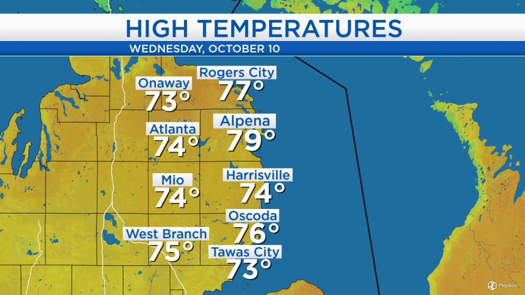
A surge of warm air from the south brought high temperatures that reached the middle and upper 70s in the early-afternoon. Since then, rain has moved in just ahead of a cold front from the west.
A cold front extending from the Upper Peninsula through Illinois and into Arkansas will shift eastward, bringing steady rain across Northeast Michigan through this evening. The rain will start to taper overnight, then colder air will rush in from the west.
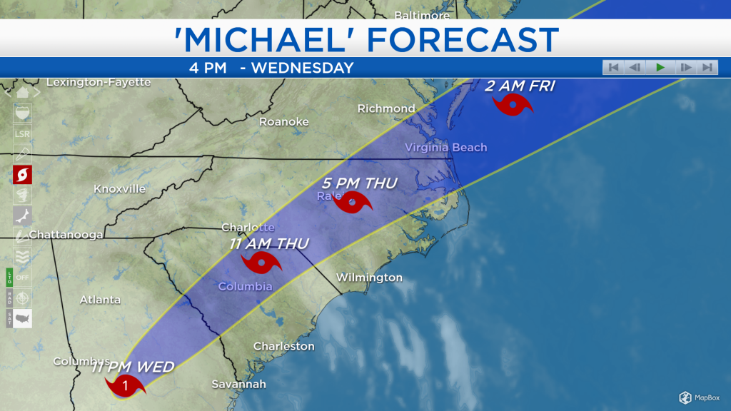
Hurricane Michael has brought destructive winds of 100-150 mph to the Florida Panhandle and storm surge up to 10 feet causing flooding problems. The hurricane reached category 4 strength earlier today with maximum winds of 155 mph, but it is forecast to weaken tonight to a category 1 hurricane. Tomorrow, Michael is forecast to weaken further to a tropical storm as it travels through South Carolina and North Carolina. Tropical storm warnings are in effect for southern and central Georgia, most of South Carolina, and eastern North Carolina.
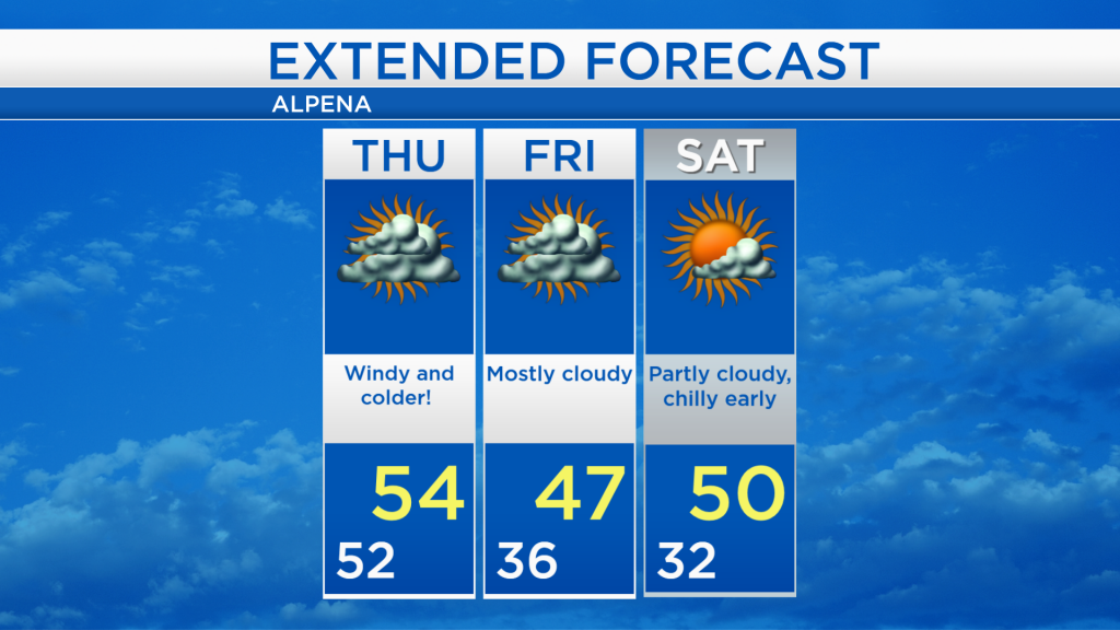
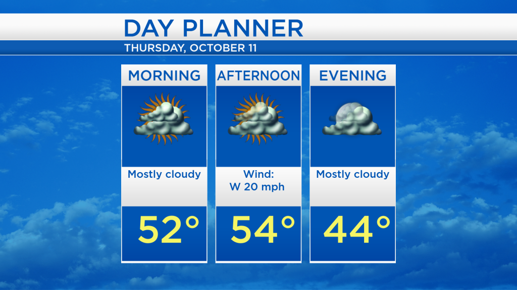
Around Northeast Michigan, rain and a risk of thunderstorms will end overnight. Skies will remain mostly cloudy, and low temperatures will drop to 52 degrees. Afternoon highs will reach only 54 degrees combined with strong winds out of the west about 20 mph.
Windy and mostly cloudy conditions will dominate tomorrow, then temperatures turn even colder on Friday. Early-morning lows will start in the mid-40s, and afternoon temperatures will reach the upper 40s, at least lighter winds are expected Friday. A little more sunshine is forecast for Saturday with high temperatures close to 50 degrees. For the rest of Northeast Michigan’s weather forecast, watch the latest weather video by clicking the weather tab at the top of the page.