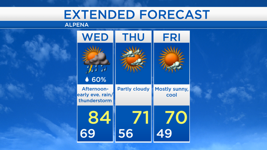
One more warm day Wednesday, then cooler and calmer beginning Thursday
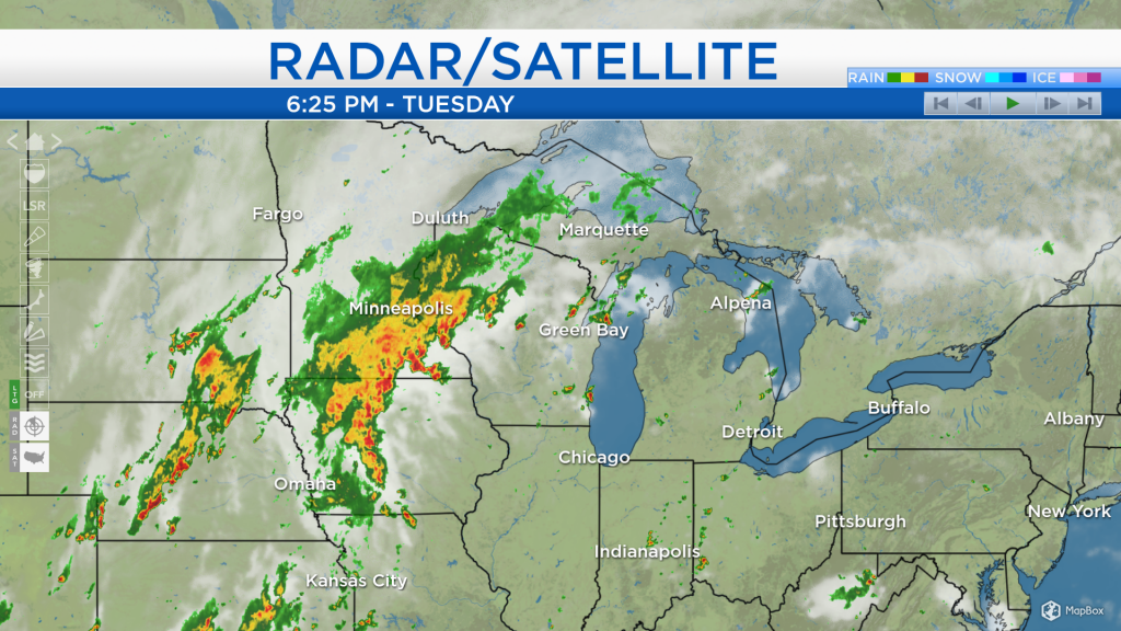
Despite a couple of isolated heavy showers earlier this afternoon, mainly dry weather will last from this evening until tomorrow morning. A widespread swath of rain currently over Iowa and Minnesota, just ahead of a cold front, will move into Northeast Michigan tomorrow afternoon.
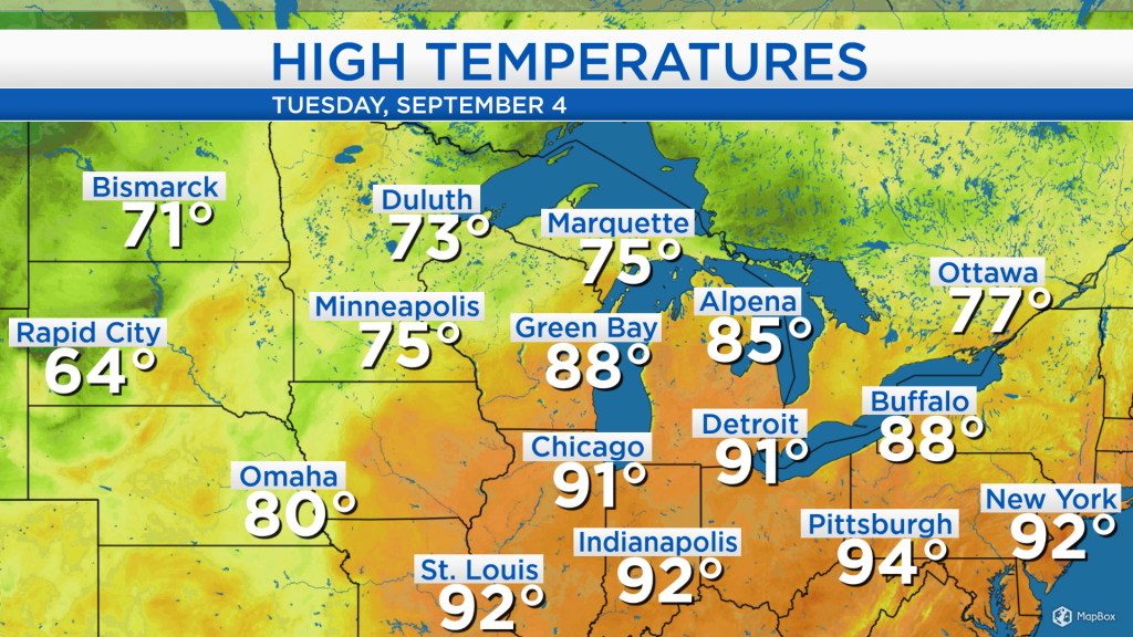
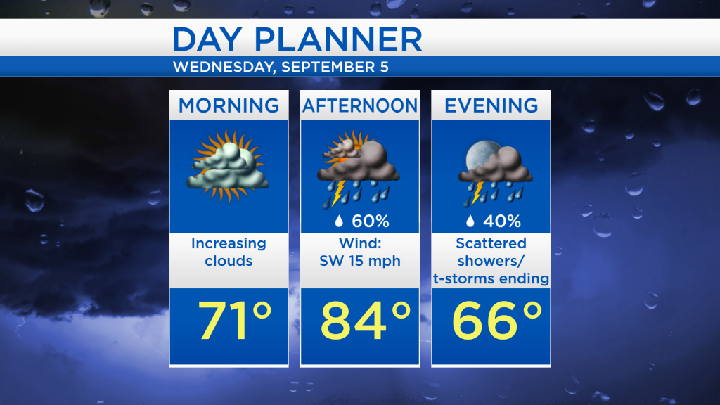
High temperatures today warmed into the mid-80s, and on top of that the humidity was exceptionally high. The warm temperatures and high humidity will last one more day. On the other side of the cold front, temperatures today reached only the lower 70s in much of North Dakota and Minnesota, a sign of some cooler days in our area later this week.
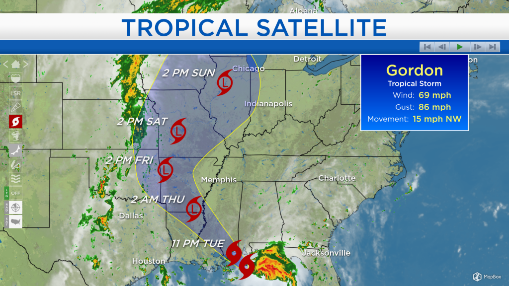
Tropical Storm Gordon, currently just south of the Gulf Coast, continues to move toward the northwest and will make landfall tonight between Mississippi and eastern Louisiana. The impacted areas will see winds of 40-70 mph and rainfall amounts around half a foot. After making landfall, Gordon will weaken to a tropical depression as it progresses north into the Midwest.
Tomorrow will start warm with morning temperatures near 70 degrees. Periods of rain and thunderstorms are expected in the afternoon as high temperatures warm up to the mid-80s, just ahead of the incoming cold front.
After the cold front passes through, early-morning lows will cool to the 50s and upper 40s for the rest of the week, and daytime highs near 70 degrees will feel much more refreshing. For the rest of Northeast Michigan’s weather forecast, watch the latest weather video by clicking the weather tab at the top of the page.