Next soaker moves in Wednesday afternoon
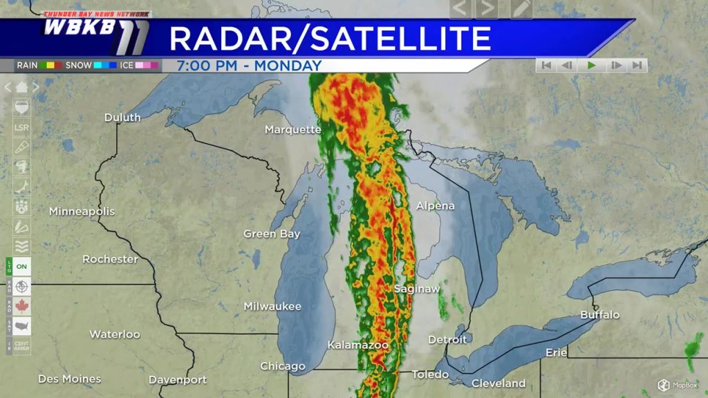
One round of rain has been moving through Northern Michigan this evening. It’s on the way out, and cloud cover will gradually clear overnight. Tuesday will start with morning sunshine, then more clouds will build late-day. The next major storm system to affect our area is just arriving on the west coast — it will move east and bring rain Wednesday.
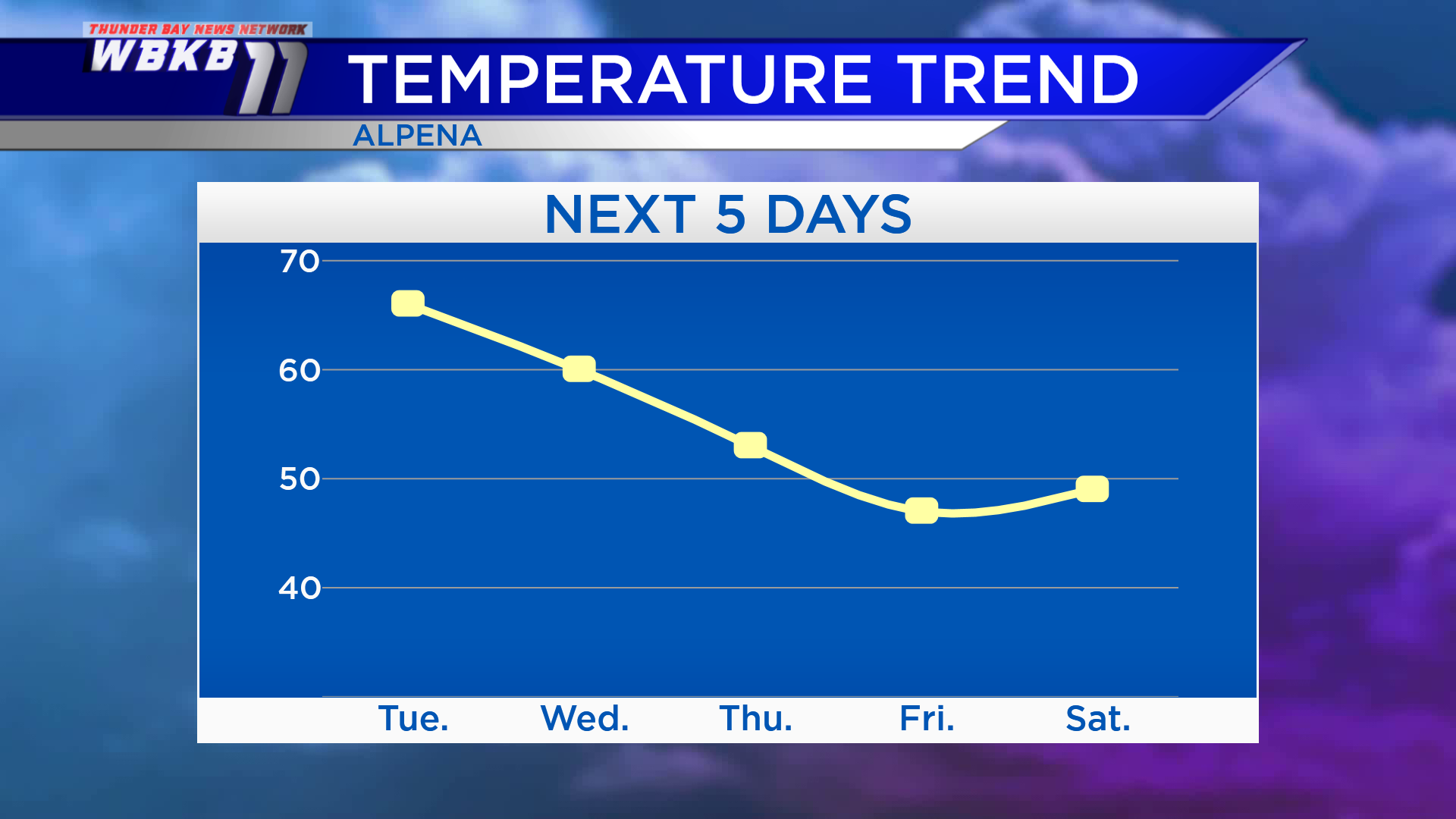
Winds from the southwest will keep warm temperatures around Northeast Michigan. Highs will reach the middle 60s Tuesday afternoon. Highs will be near 60 degrees Wednesday, then a cold front will move through. Highs will be in the lower 50, then even colder Friday and Saturday. Low temperatures are not shown, but the forecast is for upper 20s early Saturday.
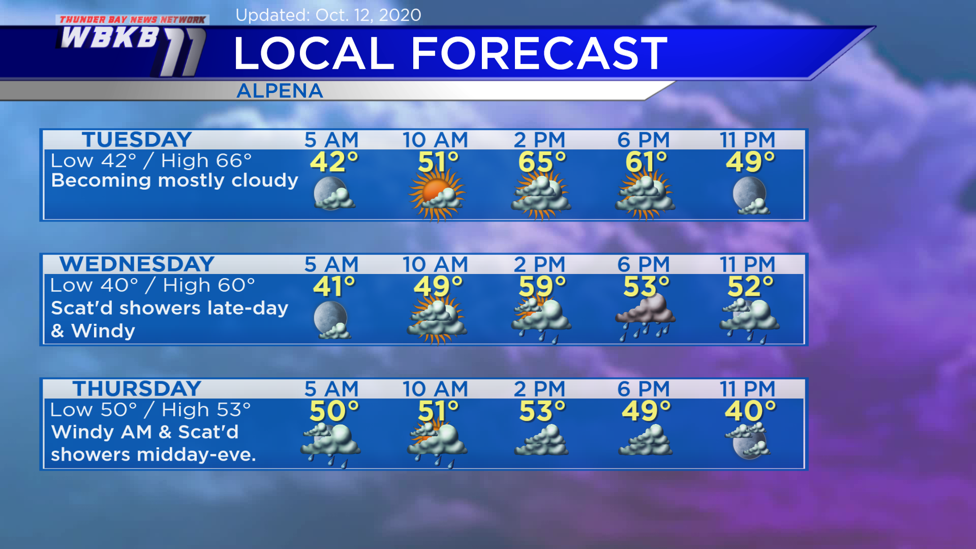
Tuesday: Morning periods of sunshine, then mostly cloudy. Predawn temperatures will be in the lower 40s. Temperatures will rise to the lower 50s in the late-morning. High temperatures will be near 66 degrees Tuesday afternoon. Early-evening temperatures will be around 60 or in the upper 50s.
Wednesday: Increasing clouds, then rain will arrive in the afternoon. Temperatures will start close to 40 degrees predawn. Late-morning temperatures will get close to 50 degrees. Afternoon highs will be around 60 degrees. Evening temperatures will be in the lower 50s.
Thursday: Windy early with a chance of showers, then drier late-day. Temperatures will not budge much. Early-morning temperatures will be near 50 degrees. Midday highs will be in the lower 50s. Evening temperatures will cool to the 40s.
For the rest of Northeast Michigan’s weather forecast, watch the latest weather video by clicking the weather tab at the top of the page.


